Estimated Value: $313,000 - $424,000
--
Bed
--
Bath
3,004
Sq Ft
$126/Sq Ft
Est. Value
About This Home
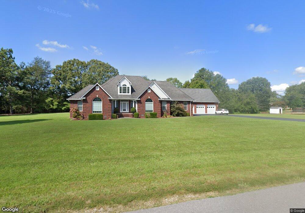
This home is located at 1117 Boggess Dr, Almo, KY 42020 and is currently estimated at $378,585, approximately $126 per square foot. 1117 Boggess Dr is a home located in Calloway County with nearby schools including North Calloway Elementary School, Calloway County Middle School, and Calloway County High School.
Ownership History
Date
Name
Owned For
Owner Type
Purchase Details
Closed on
Dec 19, 2013
Sold by
Bandarra Raymond G and Bandarra Bambi R
Bought by
Schroeder Timothy A and Schroeder Julie A
Current Estimated Value
Purchase Details
Closed on
May 30, 2008
Sold by
Kelso Mike and Kelso Lee Ann
Bought by
Jones Larry E and Jones Austina D
Home Financials for this Owner
Home Financials are based on the most recent Mortgage that was taken out on this home.
Original Mortgage
$231,325
Interest Rate
6.02%
Mortgage Type
New Conventional
Create a Home Valuation Report for This Property
The Home Valuation Report is an in-depth analysis detailing your home's value as well as a comparison with similar homes in the area
Home Values in the Area
Average Home Value in this Area
Purchase History
| Date | Buyer | Sale Price | Title Company |
|---|---|---|---|
| Schroeder Timothy A | $1,500 | None Available | |
| Jones Larry E | $243,500 | None Available | |
| Jones Larry E | $243,500 | None Available |
Source: Public Records
Mortgage History
| Date | Status | Borrower | Loan Amount |
|---|---|---|---|
| Previous Owner | Jones Larry E | $231,325 |
Source: Public Records
Tax History Compared to Growth
Tax History
| Year | Tax Paid | Tax Assessment Tax Assessment Total Assessment is a certain percentage of the fair market value that is determined by local assessors to be the total taxable value of land and additions on the property. | Land | Improvement |
|---|---|---|---|---|
| 2024 | $2,213 | $297,000 | $0 | $0 |
| 2023 | $1,830 | $247,000 | $0 | $0 |
| 2022 | $1,920 | $247,000 | $0 | $0 |
| 2021 | $1,957 | $247,000 | $0 | $0 |
| 2020 | $1,937 | $247,000 | $0 | $0 |
| 2019 | $1,904 | $247,000 | $0 | $0 |
| 2018 | $1,860 | $247,000 | $0 | $0 |
| 2017 | $1,807 | $247,000 | $0 | $0 |
| 2016 | $1,794 | $247,000 | $0 | $0 |
| 2015 | $1,647 | $227,000 | $0 | $0 |
| 2011 | $1,647 | $243,500 | $0 | $0 |
Source: Public Records
Map
Nearby Homes
- 1515 Boggess Dr
- 1536 Almo Rd
- 1783 Radio Rd
- 000 North Dr
- 206 Metcalf Ln
- 202 John Purdom Dr
- 0 U S 641 N
- Lot 17 Jordyn Bailey Rd
- 445 John Purdom Dr
- 0000 Brinn Rd
- 363 Grant Rd
- 2809 W Fork Rd
- 1087 Poor Farm Rd
- 00 Streetland Ln
- Lot# 32 Hunters Glen Unit Hunters Pointe
- 0 N State Route 121 Unit 133802
- Lot# 74 Cornwall Dr Unit Hunters Pointe
- Lot 47 Dock Dr
- Lot 181 Deepwood Dr
- Lot 1 Maplewood Estates Unit Maplewood Estates
- 1192 Boggess Dr
- 1154 Boggess Dr
- 1169 Boggess Dr
- 72 Heath Ln
- 65 Heath Ln
- 56 Heath Ln
- 361 Candlelite Dr
- 1065 Boggess Dr
- 420 Candlelite Dr
- 337 Candlelite Dr
- 374 Candlelite Dr
- 74 Heath Ln
- 1230 Boggess Dr
- 338 Candlelite Dr
- 1249 Boggess Dr
- 1333 Boggess Dr
- 265 Candlelite Dr
- 1375 Boggess Dr
- 294 Candlelite Dr
- 1364 Boggess Dr