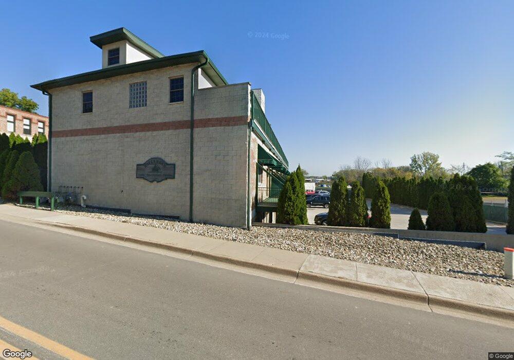
1117 Broad St Unit 2B Saint Joseph, MI 49085
Estimated Value: $284,000 - $330,000
2
Beds
1
Bath
1,000
Sq Ft
$308/Sq Ft
Est. Value
About This Home
This home is located at 1117 Broad St Unit 2B, Saint Joseph, MI 49085 and is currently estimated at $307,929, approximately $307 per square foot. 1117 Broad St Unit 2B is a home located in Berrien County with nearby schools including Upton Middle School, St. Joseph High School, and Benton Harbor Charter School Academy.
Ownership History
Date
Name
Owned For
Owner Type
Purchase Details
Closed on
May 18, 2007
Sold by
Keller A Jerry
Bought by
Keller Rentals Llc
Current Estimated Value
Purchase Details
Closed on
Feb 22, 2007
Sold by
Rice Eva M
Bought by
Keller Rentals Llc
Home Financials for this Owner
Home Financials are based on the most recent Mortgage that was taken out on this home.
Original Mortgage
$184,000
Interest Rate
6.23%
Mortgage Type
Purchase Money Mortgage
Purchase Details
Closed on
Jul 14, 2004
Sold by
Rpm Venture Inc
Bought by
Rice Eva M and Eva M Rice Trust
Create a Home Valuation Report for This Property
The Home Valuation Report is an in-depth analysis detailing your home's value as well as a comparison with similar homes in the area
Home Values in the Area
Average Home Value in this Area
Purchase History
| Date | Buyer | Sale Price | Title Company |
|---|---|---|---|
| Keller Rentals Llc | -- | None Available | |
| Keller A Jerry | -- | None Available | |
| Keller Rentals Llc | $184,000 | Cti | |
| Rice Eva M | $148,350 | -- |
Source: Public Records
Mortgage History
| Date | Status | Borrower | Loan Amount |
|---|---|---|---|
| Previous Owner | Keller Rentals Llc | $184,000 |
Source: Public Records
Tax History Compared to Growth
Tax History
| Year | Tax Paid | Tax Assessment Tax Assessment Total Assessment is a certain percentage of the fair market value that is determined by local assessors to be the total taxable value of land and additions on the property. | Land | Improvement |
|---|---|---|---|---|
| 2025 | $3,806 | $154,500 | $0 | $0 |
| 2024 | $3,692 | $130,400 | $0 | $0 |
| 2023 | $3,541 | $106,200 | $0 | $0 |
| 2022 | $3,380 | $96,700 | $0 | $0 |
| 2021 | $3,358 | $90,900 | $23,300 | $67,600 |
| 2020 | $3,313 | $87,100 | $0 | $0 |
| 2019 | $3,287 | $82,800 | $4,000 | $78,800 |
| 2018 | $3,232 | $82,800 | $0 | $0 |
| 2017 | $2,899 | $80,500 | $0 | $0 |
| 2016 | $2,899 | $79,100 | $0 | $0 |
| 2015 | $2,863 | $80,900 | $0 | $0 |
| 2014 | $2,729 | $78,800 | $0 | $0 |
Source: Public Records
Map
Nearby Homes
- 0 Wayne St Unit 25003159
- 1221 Broad St Unit 3
- 205 Wayne St
- 197 Wayne St
- 1210 Guernsey Ct
- 912 Market St
- 398 Anchors Way Unit 87s
- 398 Anchors Way Unit 82s
- 800 Whitwam Dr Unit Slip 22
- 800 Whitwam Dr Unit Slip 12
- 617 Elm St
- 327 State St Unit 2
- 1008 Wayne St
- 1004 Harrison Ave
- 312 Water St Unit 52
- 312 Water St Unit 31
- 260 Water St Unit 5E
- 1311 Wolcott Ave
- 603 Lions Park Dr
- 144 Mariners Cove
- 1117 Broad St
- 1117 Broad St
- 1117 Broad St Unit T4
- 1117 Broad St
- 1117 Broad St
- 1117 Broad St Unit 6C
- 1117 Broad St
- 1117 Broad St Unit 6A
- 1117 Broad St Unit 5D
- 1117 Broad St Unit 5C
- 1117 Broad St Unit 5B
- 1117 Broad St
- 1117 Broad St Unit 4B
- 1117 Broad St Unit 4A
- 1117 Broad St Unit 3D
- 1117 Broad St Unit 3C
- 1117 Broad St
- 1117 Broad St Unit 3A
- 1117 Broad St Unit 2D
- 1117 Broad St Unit 2C