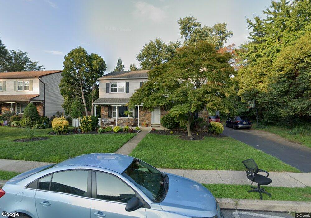
1117 Foss Ave Drexel Hill, PA 19026
Estimated Value: $435,192 - $507,000
4
Beds
3
Baths
1,987
Sq Ft
$235/Sq Ft
Est. Value
About This Home
This home is located at 1117 Foss Ave, Drexel Hill, PA 19026 and is currently estimated at $467,298, approximately $235 per square foot. 1117 Foss Ave is a home located in Delaware County with nearby schools including Hillcrest El School, Drexel Hill Middle School, and Upper Darby High School.
Ownership History
Date
Name
Owned For
Owner Type
Purchase Details
Closed on
May 28, 2010
Sold by
Avella Michael P and Avella Domenique J
Bought by
Liberio Nicholas Anthony and Liberio Debra Ann
Current Estimated Value
Home Financials for this Owner
Home Financials are based on the most recent Mortgage that was taken out on this home.
Original Mortgage
$208,000
Outstanding Balance
$140,356
Interest Rate
5.11%
Mortgage Type
New Conventional
Estimated Equity
$326,942
Purchase Details
Closed on
Apr 22, 2002
Sold by
Khullar Rajesh
Bought by
Avella Michael P and Avella Domenique J
Home Financials for this Owner
Home Financials are based on the most recent Mortgage that was taken out on this home.
Original Mortgage
$162,400
Interest Rate
6.85%
Create a Home Valuation Report for This Property
The Home Valuation Report is an in-depth analysis detailing your home's value as well as a comparison with similar homes in the area
Home Values in the Area
Average Home Value in this Area
Purchase History
| Date | Buyer | Sale Price | Title Company |
|---|---|---|---|
| Liberio Nicholas Anthony | $260,000 | None Available | |
| Holcomb April Marie | $124,900 | None Available | |
| Avella Michael P | $203,000 | T A Title Insurance Company |
Source: Public Records
Mortgage History
| Date | Status | Borrower | Loan Amount |
|---|---|---|---|
| Open | Holcomb April Marie | $208,000 | |
| Closed | Liberio Nicholas Anthony | $208,000 | |
| Previous Owner | Avella Michael P | $162,400 |
Source: Public Records
Tax History Compared to Growth
Tax History
| Year | Tax Paid | Tax Assessment Tax Assessment Total Assessment is a certain percentage of the fair market value that is determined by local assessors to be the total taxable value of land and additions on the property. | Land | Improvement |
|---|---|---|---|---|
| 2025 | $8,568 | $202,600 | $59,110 | $143,490 |
| 2024 | $8,568 | $202,600 | $59,110 | $143,490 |
| 2023 | $8,487 | $202,600 | $59,110 | $143,490 |
| 2022 | $8,259 | $202,600 | $59,110 | $143,490 |
| 2021 | $11,137 | $202,600 | $59,110 | $143,490 |
| 2020 | $10,671 | $164,970 | $55,210 | $109,760 |
| 2019 | $10,484 | $164,970 | $55,210 | $109,760 |
| 2018 | $10,363 | $164,970 | $0 | $0 |
| 2017 | $10,094 | $164,970 | $0 | $0 |
| 2016 | $905 | $164,970 | $0 | $0 |
| 2015 | $905 | $164,970 | $0 | $0 |
| 2014 | $905 | $164,970 | $0 | $0 |
Source: Public Records
Map
Nearby Homes
- 1228 Old Ln
- 1217 Ormond Ave
- 1025 Shadeland Ave
- 1133 Agnew Dr
- 6 N Lexington Ave
- 930 Ormond Ave
- 912 Edmonds Ave
- 904 Harper Ave
- 1048 Morgan Ave
- 844 Mason Ave
- 828 Mason Ave
- 1101 Wilson Dr
- 831 Concord Ave
- 213 N Ormond Ave
- 1102 Childs Ave
- 909 Kenwood Rd
- 760 Foss Ave
- 801 Penn Ave
- 924 Fairfax Rd
- 32 Westwood Park Dr