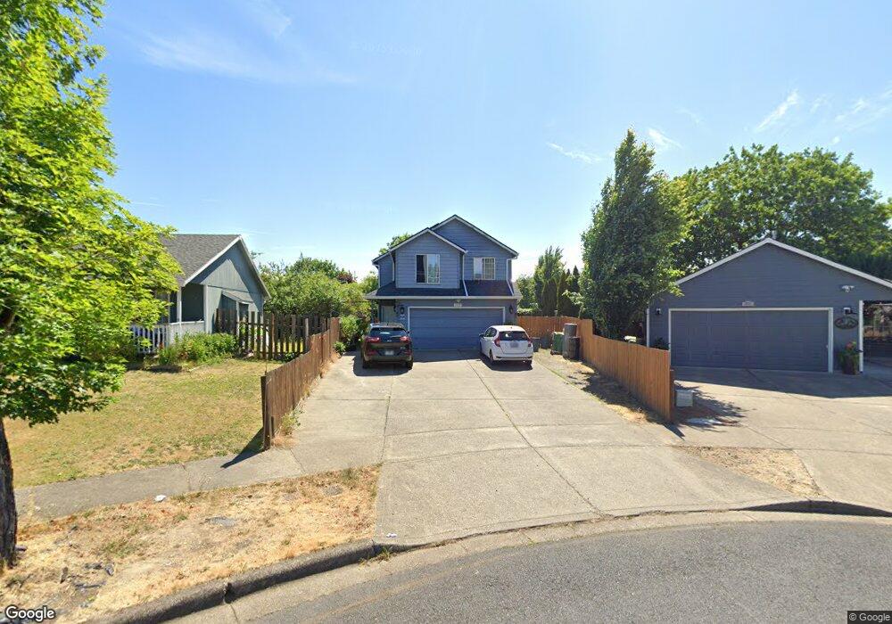
1117 Hampton Ct Forest Grove, OR 97116
Estimated Value: $480,000 - $502,000
4
Beds
3
Baths
1,490
Sq Ft
$328/Sq Ft
Est. Value
About This Home
This home is located at 1117 Hampton Ct, Forest Grove, OR 97116 and is currently estimated at $489,097, approximately $328 per square foot. 1117 Hampton Ct is a home located in Washington County with nearby schools including Joseph Gale Elementary School, Neil Armstrong Middle School, and Tom McCall Upper Elementary School.
Ownership History
Date
Name
Owned For
Owner Type
Purchase Details
Closed on
Nov 1, 2007
Sold by
Cornforth David J and Cornforth Melonie M
Bought by
Garcia Fidel Vega and Ortiz Bertha Nava
Current Estimated Value
Home Financials for this Owner
Home Financials are based on the most recent Mortgage that was taken out on this home.
Original Mortgage
$259,000
Outstanding Balance
$210,738
Interest Rate
6.29%
Mortgage Type
Unknown
Estimated Equity
$278,359
Purchase Details
Closed on
Jul 17, 2002
Sold by
Davis Claud E and Davis Virginia R
Bought by
Cornforth David J and Cornforth Melonie M
Home Financials for this Owner
Home Financials are based on the most recent Mortgage that was taken out on this home.
Original Mortgage
$153,491
Interest Rate
6.69%
Mortgage Type
FHA
Create a Home Valuation Report for This Property
The Home Valuation Report is an in-depth analysis detailing your home's value as well as a comparison with similar homes in the area
Home Values in the Area
Average Home Value in this Area
Purchase History
| Date | Buyer | Sale Price | Title Company |
|---|---|---|---|
| Garcia Fidel Vega | $259,000 | Fidelity Natl Title Co Of Or | |
| Cornforth David J | $155,900 | Fidelity National Title Co |
Source: Public Records
Mortgage History
| Date | Status | Borrower | Loan Amount |
|---|---|---|---|
| Open | Garcia Fidel Vega | $259,000 | |
| Previous Owner | Cornforth David J | $153,491 |
Source: Public Records
Tax History Compared to Growth
Tax History
| Year | Tax Paid | Tax Assessment Tax Assessment Total Assessment is a certain percentage of the fair market value that is determined by local assessors to be the total taxable value of land and additions on the property. | Land | Improvement |
|---|---|---|---|---|
| 2026 | $4,473 | $251,170 | -- | -- |
| 2025 | $4,473 | $243,860 | -- | -- |
| 2024 | $4,315 | $236,760 | -- | -- |
| 2023 | $4,315 | $229,870 | $0 | $0 |
| 2022 | $3,773 | $229,870 | $0 | $0 |
| 2021 | $3,724 | $216,680 | $0 | $0 |
| 2020 | $3,704 | $210,370 | $0 | $0 |
| 2019 | $3,622 | $204,250 | $0 | $0 |
| 2018 | $3,511 | $198,310 | $0 | $0 |
| 2017 | $3,402 | $192,540 | $0 | $0 |
| 2016 | $3,306 | $186,940 | $0 | $0 |
| 2015 | $3,179 | $181,500 | $0 | $0 |
| 2014 | $3,164 | $176,220 | $0 | $0 |
Source: Public Records
Map
Nearby Homes
- 1118 Hampton Ct
- 1119 Hawthorne St
- 0 Crescent Dr
- 2743 15th Place
- 3128 Brittany Dr
- 3213 Maple Place
- 2815 18th Ave
- 1822 Hawthorne St
- 1813 Filbert St
- 2824 19th Ave
- 2902 19th Ave
- 2323 19th Ave
- 3404 19th Ave Unit 103
- 3404 19th Ave Unit 215
- 1520 Main St
- 1938 16th Ave
- 2032 18th Ave
- 2828 22nd Ave Unit 3
- 2828 22nd Ave Unit 5
- 0 Kingwood St
- 1111 Hampton Ct
- 1123 Hampton Ct
- 2726 12th Ave
- 2732 12th Ave
- 2804 12th Ave
- 1105 Hampton Ct
- 2810 12th Ave
- 1210 Emily St
- 1110 Hampton Ct
- 1102 Hampton Ct
- 1126 Hampton Ct
- 2719 12th Ave
- 2816 12th Ave
- 1211 Emily St
- 1218 Emily St
- 1111 Hawthorne St
- 1202 Marvin Ct
- 1103 Hawthorne St
- 2822 12th Ave
- 1127 Hawthorne St