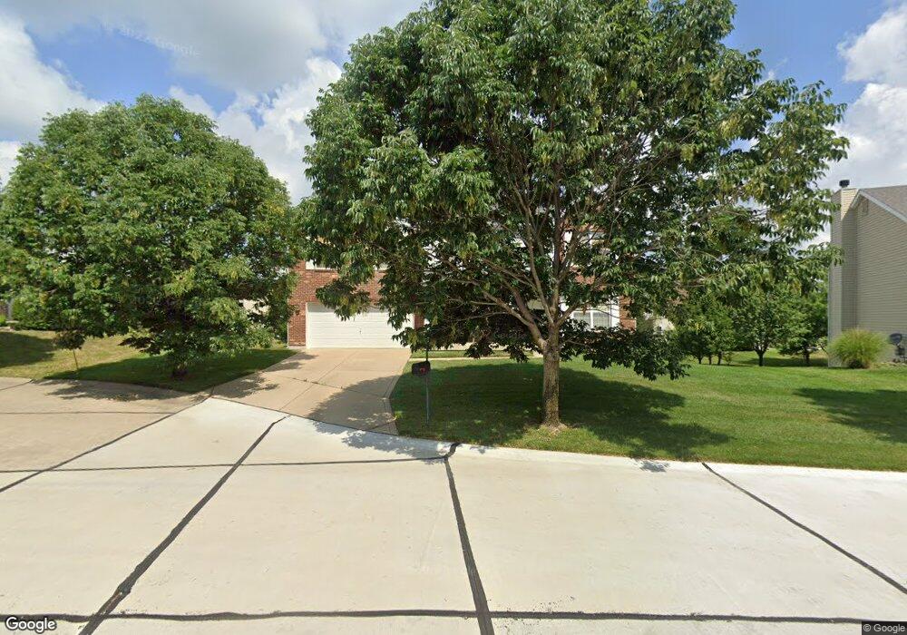
1117 Landing Place Dr Lake Saint Louis, MO 63367
Estimated Value: $512,032 - $569,000
4
Beds
3
Baths
3,178
Sq Ft
$170/Sq Ft
Est. Value
About This Home
This home is located at 1117 Landing Place Dr, Lake Saint Louis, MO 63367 and is currently estimated at $539,508, approximately $169 per square foot. 1117 Landing Place Dr is a home located in St. Charles County with nearby schools including Prairie View Elementary School, Frontier Middle School, and Liberty High School.
Ownership History
Date
Name
Owned For
Owner Type
Purchase Details
Closed on
Jan 6, 2005
Sold by
The Jones Co Homes Llc
Bought by
Mukundi Sammy and Kimata Grace A
Current Estimated Value
Home Financials for this Owner
Home Financials are based on the most recent Mortgage that was taken out on this home.
Original Mortgage
$242,850
Outstanding Balance
$122,043
Interest Rate
5.68%
Mortgage Type
Purchase Money Mortgage
Estimated Equity
$417,465
Create a Home Valuation Report for This Property
The Home Valuation Report is an in-depth analysis detailing your home's value as well as a comparison with similar homes in the area
Home Values in the Area
Average Home Value in this Area
Purchase History
| Date | Buyer | Sale Price | Title Company |
|---|---|---|---|
| Mukundi Sammy | $255,635 | Tia |
Source: Public Records
Mortgage History
| Date | Status | Borrower | Loan Amount |
|---|---|---|---|
| Open | Mukundi Sammy | $242,850 |
Source: Public Records
Tax History Compared to Growth
Tax History
| Year | Tax Paid | Tax Assessment Tax Assessment Total Assessment is a certain percentage of the fair market value that is determined by local assessors to be the total taxable value of land and additions on the property. | Land | Improvement |
|---|---|---|---|---|
| 2025 | $5,196 | $84,897 | -- | -- |
| 2023 | $5,196 | $76,590 | $0 | $0 |
| 2022 | $319 | $61,782 | $0 | $0 |
| 2021 | $4,201 | $61,782 | $0 | $0 |
| 2020 | $4,088 | $57,669 | $0 | $0 |
| 2019 | $3,794 | $57,669 | $0 | $0 |
| 2018 | $3,414 | $49,445 | $0 | $0 |
| 2017 | $3,945 | $49,445 | $0 | $0 |
| 2016 | $3,486 | $48,386 | $0 | $0 |
| 2015 | $3,440 | $48,386 | $0 | $0 |
| 2014 | $2,818 | $42,529 | $0 | $0 |
Source: Public Records
Map
Nearby Homes
- 506 Country Landing Dr
- 618 Country Heights Dr
- 355 Countryshire Dr
- 320 Briarchase Cir
- 1009 Carpathian Dr
- 650 Country Village Dr
- 223 Countryshire Dr
- 823 Waler Dr
- 1800 English Oak Dr
- Pierce Plan at Montage at Hawk Ridge - Montage At Hawk Ridge
- Sierra Plan at Montage at Hawk Ridge - Montage At Hawk Ridge
- Braxton Plan at Montage at Hawk Ridge - Montage At Hawk Ridge
- Davenport Plan at Montage at Hawk Ridge - Montage At Hawk Ridge
- Lancaster Plan at Montage at Hawk Ridge - Montage At Hawk Ridge
- Portsmouth Plan at Montage at Hawk Ridge - Montage At Hawk Ridge
- Rosemont Plan at Montage at Hawk Ridge - Montage At Hawk Ridge
- Chesapeake Plan at Montage at Hawk Ridge - Montage At Hawk Ridge
- Bridgeport Plan at Montage at Hawk Ridge - Montage At Hawk Ridge
- Windsor Plan at Montage at Hawk Ridge - Montage At Hawk Ridge
- Sierra - Universal Design Plan at Montage at Hawk Ridge - Montage At Hawk Ridge
- 1115 Landing Place Dr
- 1119 Landing Place Dr
- 904 Bannon Circle Dr
- 906 Bannon Circle Dr
- 818 Stonewood Bend Dr
- 1114 Landing Place Dr
- 1111 Landing Place Dr
- 527 Country Landing Dr
- 816 Stonewood Bend Dr
- 908 Bannon Circle Dr
- 531 Country Landing Dr
- 523 Country Landing Dr
- 533 Country Landing Dr
- 907 Bannon Cir
- 1109 Landing Place Dr
- 814 Stonewood Bend Dr
- 907 Bannon Circle Ct
- 907 Bannon Circle Dr
- 820 Stonewood Bend Dr
- 910 Bannon Circle Dr