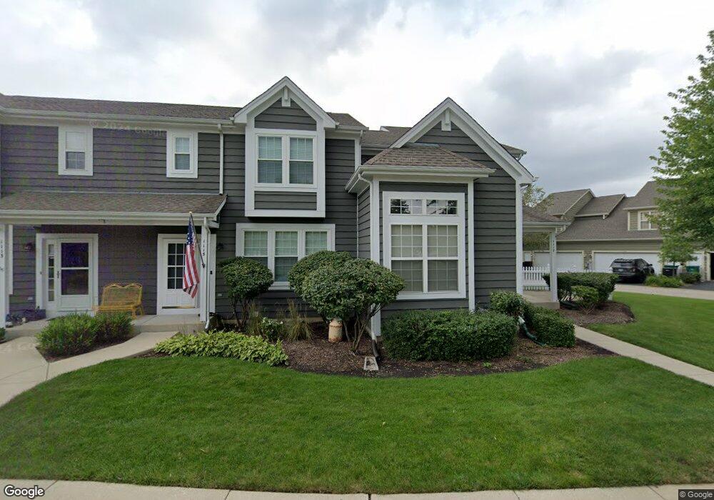
1117 Mckay Cir Unit D Grayslake, IL 60030
Estimated Value: $286,000 - $316,000
2
Beds
3
Baths
1,605
Sq Ft
$186/Sq Ft
Est. Value
About This Home
This home is located at 1117 Mckay Cir Unit D, Grayslake, IL 60030 and is currently estimated at $297,968, approximately $185 per square foot. 1117 Mckay Cir Unit D is a home located in Lake County with nearby schools including Frederick School, Avon Center Elementary School, and Grayslake Middle School.
Ownership History
Date
Name
Owned For
Owner Type
Purchase Details
Closed on
Jul 6, 2021
Sold by
Washington Square Development Llc
Bought by
Camposagrado Leony and Camposagrado Elmer
Current Estimated Value
Home Financials for this Owner
Home Financials are based on the most recent Mortgage that was taken out on this home.
Original Mortgage
$185,250
Outstanding Balance
$168,645
Interest Rate
3.12%
Mortgage Type
New Conventional
Estimated Equity
$129,323
Purchase Details
Closed on
Dec 14, 2000
Sold by
M W Doran Inc
Bought by
Washington Square Development Llc
Home Financials for this Owner
Home Financials are based on the most recent Mortgage that was taken out on this home.
Original Mortgage
$369,000
Interest Rate
8.98%
Create a Home Valuation Report for This Property
The Home Valuation Report is an in-depth analysis detailing your home's value as well as a comparison with similar homes in the area
Home Values in the Area
Average Home Value in this Area
Purchase History
| Date | Buyer | Sale Price | Title Company |
|---|---|---|---|
| Camposagrado Leony | $195,000 | None Listed On Document | |
| Washington Square Development Llc | $123,000 | First American Title |
Source: Public Records
Mortgage History
| Date | Status | Borrower | Loan Amount |
|---|---|---|---|
| Open | Camposagrado Leony | $185,250 | |
| Previous Owner | Washington Square Development Llc | $369,000 |
Source: Public Records
Tax History Compared to Growth
Tax History
| Year | Tax Paid | Tax Assessment Tax Assessment Total Assessment is a certain percentage of the fair market value that is determined by local assessors to be the total taxable value of land and additions on the property. | Land | Improvement |
|---|---|---|---|---|
| 2024 | $7,276 | $84,864 | $8,230 | $76,634 |
| 2023 | $6,190 | $77,885 | $7,553 | $70,332 |
| 2022 | $6,190 | $57,635 | $9,790 | $47,845 |
| 2021 | $6,848 | $55,397 | $9,410 | $45,987 |
| 2020 | $6,871 | $52,708 | $8,953 | $43,755 |
| 2019 | $6,648 | $50,569 | $8,590 | $41,979 |
| 2018 | $7,042 | $53,760 | $6,303 | $47,457 |
| 2017 | $7,021 | $50,569 | $5,929 | $44,640 |
| 2016 | $7,022 | $54,748 | $5,473 | $49,275 |
| 2015 | $7,819 | $50,016 | $5,000 | $45,016 |
| 2014 | $7,786 | $49,787 | $7,064 | $42,723 |
| 2012 | $7,596 | $51,997 | $7,378 | $44,619 |
Source: Public Records
Map
Nearby Homes
- 303 Mainsail Dr
- 33978 N Lake Rd
- 1045 Manchester Cir
- 34871 N Lake Shore Dr
- 7736 Geneva Dr
- 873 Essex Cir
- 34271 N Tangueray Dr
- 827 Easton Ct
- 18587 W Meander Dr
- 707 Crossland Dr
- 33762 N Oak St
- 699 Snow Cap Ct
- 968 Knowles Rd
- 820 Amelia Ct
- 18564 W Main St
- 528 Cliffwood Ln
- 80 N Lake Ave
- 33670 N Lake Shore Dr
- 18254 W Meander Dr
- 7943 Dada Dr
- 1115 Mckay Cir Unit C
- 1113 Mckay Cir Unit B
- 1111 Mckay Cir Unit A
- 1111 Mckay Cir Unit M3A
- 1174 Mount Vernon Dr Unit B
- 1172 Mount Vernon Dr Unit M2A
- 1176 Mount Vernon Dr Unit MC2
- 1160 Mount Vernon Dr
- 1178 Mount Vernon Dr Unit D
- 1182 Mount Vernon Dr Unit E
- 1007 Mckay Cir Unit D
- 1184 Mount Vernon Dr Unit D
- 1184 Mount Vernon Dr Unit 1184
- 1150 Mount Vernon Dr
- 1003 Mckay Cir Unit B
- 1005 Mckay Cir Unit M4C
- 1186 Mount Vernon Dr Unit C
- 997 Mckay Cir Unit D
- 1001 Mckay Cir Unit A
- 1188 Mount Vernon Dr Unit B