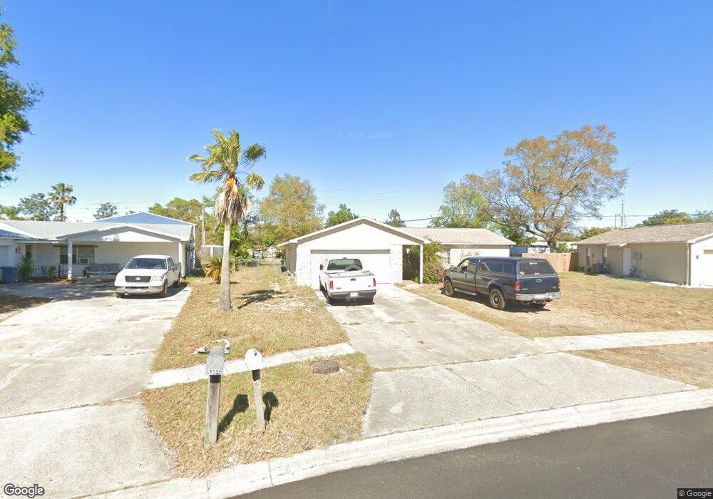
1117 Morgan Rd Port Orange, FL 32129
Willow Run NeighborhoodEstimated Value: $272,112 - $311,000
3
Beds
2
Baths
1,367
Sq Ft
$217/Sq Ft
Est. Value
About This Home
This home is located at 1117 Morgan Rd, Port Orange, FL 32129 and is currently estimated at $296,778, approximately $217 per square foot. 1117 Morgan Rd is a home located in Volusia County with nearby schools including Horizon Elementary School, Atlantic High School, and Silver Sands Middle School.
Ownership History
Date
Name
Owned For
Owner Type
Purchase Details
Closed on
Mar 31, 1998
Sold by
Col Louis R and Col Carol J
Bought by
Breaux Tony W and Breaux Donna L
Current Estimated Value
Home Financials for this Owner
Home Financials are based on the most recent Mortgage that was taken out on this home.
Original Mortgage
$64,800
Outstanding Balance
$12,140
Interest Rate
6.95%
Estimated Equity
$284,638
Purchase Details
Closed on
Apr 15, 1981
Bought by
Breaux Tony W and Breaux Donna L
Create a Home Valuation Report for This Property
The Home Valuation Report is an in-depth analysis detailing your home's value as well as a comparison with similar homes in the area
Home Values in the Area
Average Home Value in this Area
Purchase History
| Date | Buyer | Sale Price | Title Company |
|---|---|---|---|
| Breaux Tony W | $81,000 | -- | |
| Breaux Tony W | $49,500 | -- |
Source: Public Records
Mortgage History
| Date | Status | Borrower | Loan Amount |
|---|---|---|---|
| Open | Breaux Tony W | $64,800 |
Source: Public Records
Tax History Compared to Growth
Tax History
| Year | Tax Paid | Tax Assessment Tax Assessment Total Assessment is a certain percentage of the fair market value that is determined by local assessors to be the total taxable value of land and additions on the property. | Land | Improvement |
|---|---|---|---|---|
| 2025 | $3,683 | $232,953 | $60,372 | $172,581 |
| 2024 | $3,683 | $227,075 | $57,857 | $169,218 |
| 2023 | $3,683 | $227,786 | $57,857 | $169,929 |
| 2022 | $3,342 | $203,029 | $48,801 | $154,228 |
| 2021 | $3,079 | $158,480 | $33,205 | $125,275 |
| 2020 | $2,920 | $151,719 | $32,198 | $119,521 |
| 2019 | $2,787 | $145,798 | $26,161 | $119,637 |
| 2018 | $2,632 | $134,785 | $20,124 | $114,661 |
| 2017 | $2,507 | $127,793 | $19,050 | $108,743 |
| 2016 | $2,337 | $113,678 | $0 | $0 |
| 2015 | $2,217 | $103,522 | $0 | $0 |
| 2014 | $2,031 | $91,317 | $0 | $0 |
Source: Public Records
Map
Nearby Homes
- 1118 Kane Dr
- 1077 Willow Wood Dr
- 1132 Loblolly Ln
- 1086 Donnell Dr
- 1106 Blueberry Dr
- 1075 Horizon View Blvd
- 1300 Harms Way
- 1213 Jeffery Dr
- 1245 Thomas Dr
- 3830 Bourbon St
- 3841 Bourbon St
- 14 Woodlake Dr
- 4041 S Waterbridge Cir
- 1175 Tracy Dr
- 4039 N Waterbridge Cir
- 94 Woodlake Dr
- 4029 N Waterbridge Cir
- 217 Windsor Dr
- 1166 Tracy Dr
- 208 Windsor Dr
- 1115 Morgan Rd
- 1119 Morgan Rd
- 1121 Morgan Rd
- 1113 Morgan Rd
- 1139 Kane Dr
- 1096 Wexford Way
- 1098 Wexford Way
- 1094 Wexford Way
- 1123 Morgan Rd
- 1111 Morgan Rd
- 1136 Kane Dr
- 1092 Wexford Way
- 1137 Kane Dr
- 1114 Morgan Rd
- 1109 Morgan Rd
- 1125 Morgan Rd
- 1099 Kingswood Way
- 1134 Kane Dr
- 1112 Morgan Rd
- 1087 Wild Holly Dr