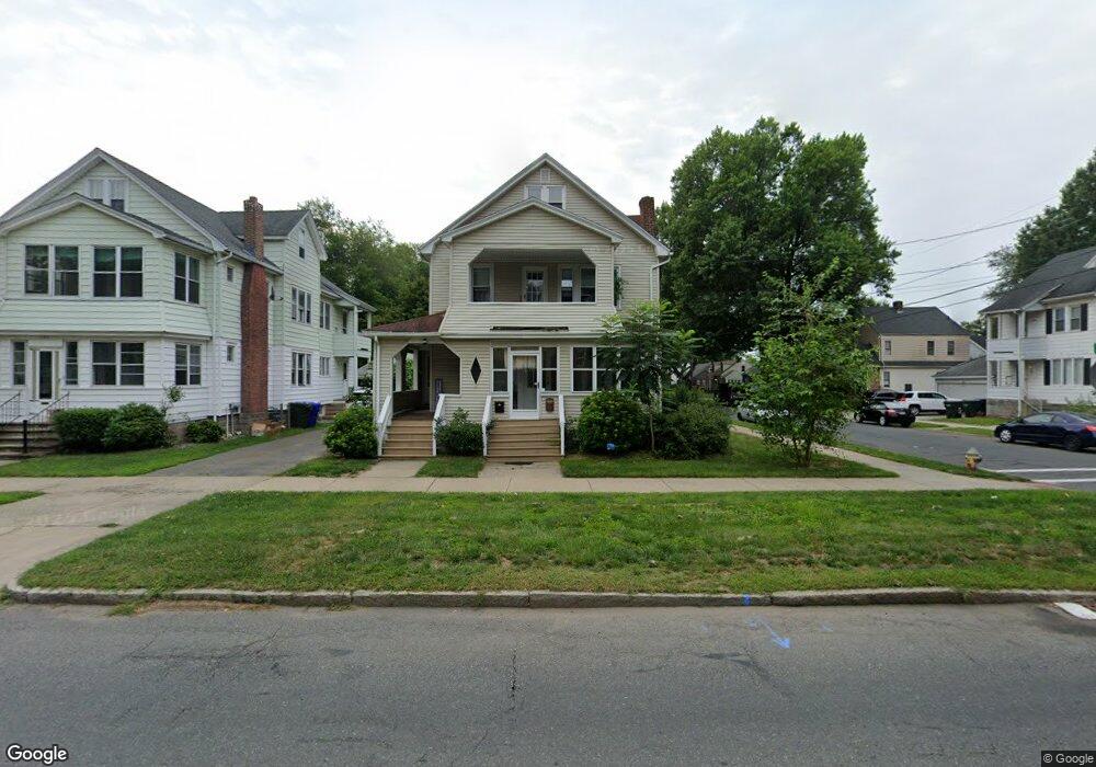
1117 Sumner Ave Unit 1119 Springfield, MA 01118
East Forest Park NeighborhoodEstimated Value: $370,324 - $457,000
6
Beds
2
Baths
2,404
Sq Ft
$178/Sq Ft
Est. Value
About This Home
This home is located at 1117 Sumner Ave Unit 1119, Springfield, MA 01118 and is currently estimated at $428,081, approximately $178 per square foot. 1117 Sumner Ave Unit 1119 is a home located in Hampden County with nearby schools including Frederick Harris Elementary School, M Marcus Kiley Middle, and Springfield High School of Science and Technology.
Ownership History
Date
Name
Owned For
Owner Type
Purchase Details
Closed on
Mar 20, 2019
Sold by
Keough Francis G and Keough Sharon A
Bought by
Keough Sharon A
Current Estimated Value
Purchase Details
Closed on
Oct 1, 2003
Sold by
Keough Francis G
Bought by
Keough Francis G and Keough Sharon A
Home Financials for this Owner
Home Financials are based on the most recent Mortgage that was taken out on this home.
Original Mortgage
$112,000
Interest Rate
6.25%
Mortgage Type
Purchase Money Mortgage
Purchase Details
Closed on
May 28, 1998
Sold by
Bankers First T Ca
Bought by
Keogh Francis G
Home Financials for this Owner
Home Financials are based on the most recent Mortgage that was taken out on this home.
Original Mortgage
$42,140
Interest Rate
7.12%
Mortgage Type
Purchase Money Mortgage
Purchase Details
Closed on
Aug 13, 1997
Sold by
Gardner Samuel and Gardner Edna G
Bought by
Rtc Mtg and Bankers Trust Co Ca
Create a Home Valuation Report for This Property
The Home Valuation Report is an in-depth analysis detailing your home's value as well as a comparison with similar homes in the area
Home Values in the Area
Average Home Value in this Area
Purchase History
| Date | Buyer | Sale Price | Title Company |
|---|---|---|---|
| Keough Sharon A | -- | -- | |
| Keough Francis G | -- | -- | |
| Keogh Francis G | $60,200 | -- | |
| Rtc Mtg | $47,600 | -- |
Source: Public Records
Mortgage History
| Date | Status | Borrower | Loan Amount |
|---|---|---|---|
| Previous Owner | Keough Francis G | $112,000 | |
| Previous Owner | Rtc Mtg | $78,000 | |
| Previous Owner | Rtc Mtg | $42,140 |
Source: Public Records
Tax History
| Year | Tax Paid | Tax Assessment Tax Assessment Total Assessment is a certain percentage of the fair market value that is determined by local assessors to be the total taxable value of land and additions on the property. | Land | Improvement |
|---|---|---|---|---|
| 2025 | $5,174 | $330,000 | $45,200 | $284,800 |
| 2024 | $5,173 | $322,100 | $45,200 | $276,900 |
| 2023 | $5,049 | $296,100 | $43,100 | $253,000 |
| 2022 | $4,216 | $224,000 | $43,100 | $180,900 |
| 2021 | $3,929 | $207,900 | $39,200 | $168,700 |
| 2020 | $3,486 | $178,500 | $39,200 | $139,300 |
| 2019 | $3,296 | $167,500 | $39,200 | $128,300 |
| 2018 | $3,354 | $173,900 | $39,200 | $134,700 |
| 2017 | $3,354 | $170,600 | $39,200 | $131,400 |
| 2016 | $2,941 | $149,600 | $39,200 | $110,400 |
| 2015 | $2,720 | $138,300 | $39,200 | $99,100 |
Source: Public Records
Map
Nearby Homes
- 1088 Sumner Ave
- 13 Bither St
- 79 Roosevelt Ave
- 79 Arvilla St
- 34 Castle St
- 119 Powell Ave
- 134 Eddywood St
- 161 Dorset St
- 77 Dorset St
- 170 Plumtree Rd
- 7 Ashbrook St
- 46 Eckington St
- 88 Brunswick St
- 854-856 Sumner Ave
- 59 Daviston St
- 19 Manor Ct Unit 19
- 125 Manor Ct Unit 125
- 46 Hadley St
- 75 Gillette Cir
- 914-916 Belmont Ave
- 1117 Sumner Ave Unit 1
- 1117-1119 Sumner Ave
- 1119 Sumner Ave Unit 2
- 1123 Sumner Ave Unit 1125
- 11 Vail St
- 1109-1111 Sumner Ave
- 1129 Sumner Ave Unit 1131
- 1109 Sumner Ave Unit 1111
- 17 Vail St
- 1133 Sumner Ave
- 1103 Sumner Ave Unit 1105
- 14 Vail St
- 1101 Sumner Ave
- 1101 Sumner Ave
- 16 Burnside Terrace
- 18 Vail St
- 1139 Sumner Ave
- 1097 Sumner Ave Unit 1099
- 23 Vail St
- 20 Burnside Terrace
Your Personal Tour Guide
Ask me questions while you tour the home.