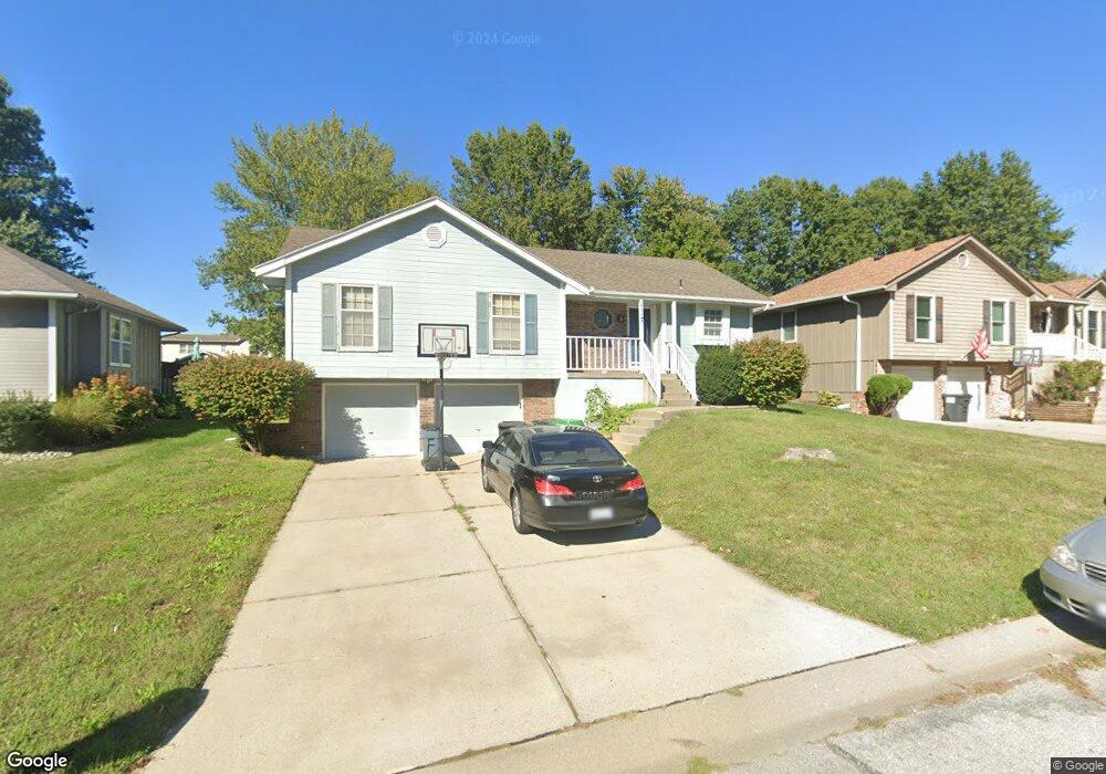
1117 SW Brook Ct Blue Springs, MO 64015
Estimated Value: $286,019 - $303,000
3
Beds
2
Baths
1,330
Sq Ft
$221/Sq Ft
Est. Value
About This Home
This home is located at 1117 SW Brook Ct, Blue Springs, MO 64015 and is currently estimated at $294,255, approximately $221 per square foot. 1117 SW Brook Ct is a home located in Jackson County with nearby schools including Cordill-Mason Elementary School, Moreland Ridge Middle School, and Blue Springs South High School.
Ownership History
Date
Name
Owned For
Owner Type
Purchase Details
Closed on
Jul 28, 2004
Sold by
Davidson Wayne E and Davidson Theresa A
Bought by
Tierney Brandt and Tierney Brittany
Current Estimated Value
Home Financials for this Owner
Home Financials are based on the most recent Mortgage that was taken out on this home.
Original Mortgage
$137,000
Outstanding Balance
$76,869
Interest Rate
8.15%
Mortgage Type
Purchase Money Mortgage
Estimated Equity
$217,386
Purchase Details
Closed on
Feb 19, 1996
Sold by
Scarbo Fredrick Robert and Scarbo Kerri A
Bought by
Davidson Wayne E and Davidson Theresa A
Home Financials for this Owner
Home Financials are based on the most recent Mortgage that was taken out on this home.
Original Mortgage
$81,700
Interest Rate
7.09%
Mortgage Type
Purchase Money Mortgage
Create a Home Valuation Report for This Property
The Home Valuation Report is an in-depth analysis detailing your home's value as well as a comparison with similar homes in the area
Home Values in the Area
Average Home Value in this Area
Purchase History
| Date | Buyer | Sale Price | Title Company |
|---|---|---|---|
| Tierney Brandt | -- | Security Land Title Company | |
| Davidson Wayne E | -- | Old Republic Title Company |
Source: Public Records
Mortgage History
| Date | Status | Borrower | Loan Amount |
|---|---|---|---|
| Open | Tierney Brandt | $137,000 | |
| Previous Owner | Davidson Wayne E | $81,700 |
Source: Public Records
Tax History Compared to Growth
Tax History
| Year | Tax Paid | Tax Assessment Tax Assessment Total Assessment is a certain percentage of the fair market value that is determined by local assessors to be the total taxable value of land and additions on the property. | Land | Improvement |
|---|---|---|---|---|
| 2025 | $3,067 | $40,204 | $7,026 | $33,178 |
| 2024 | $3,005 | $38,384 | $4,619 | $33,765 |
| 2023 | $3,005 | $38,384 | $5,767 | $32,617 |
| 2022 | $2,705 | $30,400 | $4,684 | $25,716 |
| 2021 | $2,548 | $30,400 | $4,684 | $25,716 |
| 2020 | $2,526 | $28,938 | $4,684 | $24,254 |
| 2019 | $2,454 | $28,938 | $4,684 | $24,254 |
| 2018 | $2,338 | $26,678 | $3,719 | $22,959 |
| 2017 | $2,338 | $26,678 | $3,719 | $22,959 |
| 2016 | $2,320 | $26,562 | $3,819 | $22,743 |
| 2014 | $2,139 | $24,262 | $3,822 | $20,440 |
Source: Public Records
Map
Nearby Homes
- 4000 SW 9th St
- 3908 SW 9th St
- 3608 SW 10th Street Ct
- 1205 SW Southgate Dr
- 4405 SW 8th Street Terrace
- 3605 SW Meyer Blvd
- 4712 SW 6th Terrace
- 4716 SW 6th Terrace
- 3205 SW 8th St
- 2253 SW Wall St
- 305 SW Nelson Dr
- 500 SW Chelmsford Dr
- 505 SW Newport Dr
- 509 SW Newport Dr
- 3400 SW 22nd St
- 205 SW Nelson Dr
- 217 SW Chelmsford Dr
- 220 SW Chelmsford Dr
- 108 SE Harvard Dr
- The Magnolia Plan at Eagles Ridge - Garden Collection
- 1113 SW Brook Ct
- 1121 SW Brook Ct
- 1109 SW Brook Ct
- 1125 SW Brook Ct
- 1116 SW Brook Ct
- 1120 SW Brook Ct
- 1112 SW Brook Ct
- 1112 SW Breckenridge Ct
- 1116 SW Breckenridge Ct
- 1120 SW Breckenridge Ct
- 1129 SW Brook Ct
- 1124 SW Brook Ct
- 1105 SW Brook Ct
- 1108 SW Breckenridge Ct
- 1124 SW Breckenridge Ct
- 1108 SW Brook Ct
- 1128 SW Brook Ct
- 1128 SW Breckenridge Ct
- 1104 SW Breckenridge Ct
- 1101 SW Brook Ct