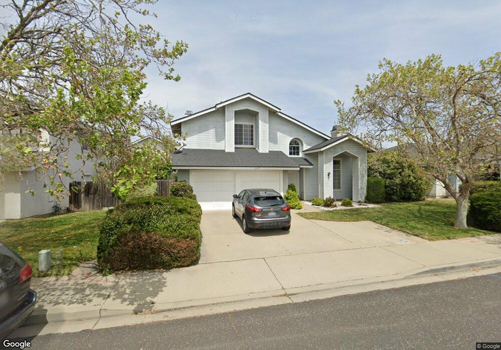
1117 W Barton Ave Lompoc, CA 93436
Estimated Value: $582,000 - $622,000
3
Beds
3
Baths
1,612
Sq Ft
$374/Sq Ft
Est. Value
About This Home
This home is located at 1117 W Barton Ave, Lompoc, CA 93436 and is currently estimated at $602,181, approximately $373 per square foot. 1117 W Barton Ave is a home located in Santa Barbara County with nearby schools including La Canada Elementary School, Lompoc Valley Middle School, and Lompoc High School.
Ownership History
Date
Name
Owned For
Owner Type
Purchase Details
Closed on
May 7, 2022
Sold by
Leonard And Barbara Kaplan Family Trust
Bought by
Kaplan Lee
Current Estimated Value
Purchase Details
Closed on
Oct 25, 2021
Sold by
Joan Kaplan Barbara
Bought by
Leonard And Barbara Kaplan Family Trust and Fam Barbara
Purchase Details
Closed on
Aug 30, 2011
Sold by
Winkler Barbara
Bought by
Kaplan Barbara and Kaplan Leonard
Purchase Details
Closed on
Dec 6, 2010
Sold by
Winkler Barbara
Bought by
Kaplan Barbara and Kaplan Leonard
Purchase Details
Closed on
Nov 3, 2010
Sold by
Kaplan Barbara Winkler and Kaplan Leonard
Bought by
Kaplan Barbara and Kaplan Leonard
Create a Home Valuation Report for This Property
The Home Valuation Report is an in-depth analysis detailing your home's value as well as a comparison with similar homes in the area
Home Values in the Area
Average Home Value in this Area
Purchase History
| Date | Buyer | Sale Price | Title Company |
|---|---|---|---|
| Kaplan Lee | -- | Mullen & Henzell Llp | |
| Leonard And Barbara Kaplan Family Trust | -- | -- | |
| Kaplan Barbara | -- | None Available | |
| Kaplan Barbara | -- | None Available | |
| Kaplan Barbara | -- | None Available |
Source: Public Records
Tax History
| Year | Tax Paid | Tax Assessment Tax Assessment Total Assessment is a certain percentage of the fair market value that is determined by local assessors to be the total taxable value of land and additions on the property. | Land | Improvement |
|---|---|---|---|---|
| 2025 | $6,285 | $578,358 | $180,405 | $397,953 |
| 2023 | $6,285 | $555,900 | $173,400 | $382,500 |
| 2022 | $2,425 | $211,283 | $70,714 | $140,569 |
| 2021 | $2,451 | $207,141 | $69,328 | $137,813 |
| 2020 | $2,425 | $205,018 | $68,618 | $136,400 |
| 2019 | $2,385 | $200,999 | $67,273 | $133,726 |
| 2018 | $2,348 | $197,058 | $65,954 | $131,104 |
| 2017 | $2,305 | $193,195 | $64,661 | $128,534 |
| 2016 | $2,264 | $189,408 | $63,394 | $126,014 |
| 2014 | $2,215 | $182,910 | $61,219 | $121,691 |
Source: Public Records
Map
Nearby Homes
- 1212 Timothy Ct
- 1213 Iris Ct
- 1344 Village Meadows Dr
- 908 Northpoint Place
- 933 Bellflower Ln
- 1012 W Anthony Way
- 1416 Glen Ellen Ln
- 2000 Green Ridge Cir
- 321 W North Ave Unit 133
- 1103 Point Sal Loop
- 1407 N H St
- 2205 Point Sal Loop
- 100 California 1
- 516 N U St
- 600 N Y St
- 526 N L St
- 420 N W St
- 510 N I St
- 321 N Z St
- 230 N R St
- 1121 W Barton Ave
- 1113 W Barton Ave
- 1213 Timothy Ct
- 1125 W Barton Ave
- 1109 W Barton Ave
- 1216 Timothy Ct
- 1116 W Barton Ave
- 1120 W Barton Ave
- 1217 Timothy Ct
- 1129 W Barton Ave
- 1112 W Barton Ave Unit 2
- 1124 W Barton Ave Unit 2
- 1105 W Barton Ave
- 1108 W Barton Ave
- 1220 Timothy Ct
- 1221 Timothy Ct
- 1381 Village Meadows Dr
- 1128 W Barton Ave
- 1128 Jason Dr Unit 2
- 1132 Jason Dr
Your Personal Tour Guide
Ask me questions while you tour the home.