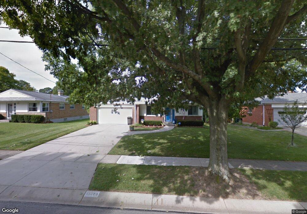
11173 MacAr Dr Cincinnati, OH 45241
Estimated Value: $252,098 - $280,000
3
Beds
1
Bath
1,106
Sq Ft
$239/Sq Ft
Est. Value
About This Home
This home is located at 11173 MacAr Dr, Cincinnati, OH 45241 and is currently estimated at $264,275, approximately $238 per square foot. 11173 MacAr Dr is a home located in Hamilton County with nearby schools including Sharonville Elementary School, Princeton Community Middle School, and Princeton High School.
Ownership History
Date
Name
Owned For
Owner Type
Purchase Details
Closed on
Jun 18, 2021
Sold by
Robertson Christopher M and Rita M Robinson Trust
Bought by
Lafrance Debra B
Current Estimated Value
Purchase Details
Closed on
Jun 17, 2021
Sold by
Raymond Robertson Donald
Bought by
Rita M Robertson Trust
Purchase Details
Closed on
Aug 26, 2015
Sold by
Keating Thomas T
Bought by
Robertson Rita M and Rita M Robertson Trust
Purchase Details
Closed on
May 15, 2003
Sold by
Nelson Steven A
Bought by
Robertson Donald R and Donald R Robertson Trust
Create a Home Valuation Report for This Property
The Home Valuation Report is an in-depth analysis detailing your home's value as well as a comparison with similar homes in the area
Home Values in the Area
Average Home Value in this Area
Purchase History
| Date | Buyer | Sale Price | Title Company |
|---|---|---|---|
| Lafrance Debra B | $195,000 | None Available | |
| Rita M Robertson Trust | -- | -- | |
| Robertson Rita M | -- | Attorney | |
| Keating Thomas T | -- | Attorney | |
| Robertson Donald R | $100,000 | -- |
Source: Public Records
Tax History
| Year | Tax Paid | Tax Assessment Tax Assessment Total Assessment is a certain percentage of the fair market value that is determined by local assessors to be the total taxable value of land and additions on the property. | Land | Improvement |
|---|---|---|---|---|
| 2025 | $3,331 | $68,251 | $18,421 | $49,830 |
| 2023 | $2,881 | $68,251 | $18,421 | $49,830 |
| 2022 | $2,342 | $44,671 | $12,334 | $32,337 |
| 2021 | $1,755 | $44,671 | $12,334 | $32,337 |
| 2020 | $1,788 | $44,671 | $12,334 | $32,337 |
| 2019 | $1,626 | $38,843 | $10,724 | $28,119 |
| 2018 | $1,525 | $38,843 | $10,724 | $28,119 |
| 2017 | $1,422 | $38,843 | $10,724 | $28,119 |
| 2016 | $1,931 | $40,258 | $10,189 | $30,069 |
| 2015 | $1,518 | $40,258 | $10,189 | $30,069 |
| 2014 | $1,524 | $40,258 | $10,189 | $30,069 |
| 2013 | $1,588 | $42,375 | $10,724 | $31,651 |
Source: Public Records
Map
Nearby Homes
- 4036 Haverstraw Dr
- 4051 Falling Creek Ct
- 4138 Radcliff Ln
- 3380 Spurrier Ln
- 11108 Huntwicke Place
- 4365 Classic Dr
- 4071 E Kemper Rd
- 10480 Wintergreen Ct
- 3703 Moorhill Dr
- 3816 Glendale Milford Rd
- 3706 Glendale Milford Rd
- 4254 Fox Hollow Dr
- 3875 Hauck Rd
- 10301 Giverny Blvd
- 10561 Plainfield Rd
- 37 Carpenters Run
- 4204 Magnolia Aly
- 5078 Arabella Cir
- 5074 Arabella Cir
- 5070 Arabella Cir
- 11179 MacAr Dr
- 11169 MacAr Dr
- 11183 MacAr Dr
- 11163 MacAr Dr
- 11174 MacAr Dr
- 11170 MacAr Dr
- 11178 MacAr Dr
- 11159 MacAr Dr
- 11166 MacAr Dr
- 11182 MacAr Dr
- 3801 Cornell Rd
- 11189 MacAr Dr
- 3819 Cornell Rd
- 11162 MacAr Dr
- 3793 Cornell Rd
- 11153 MacAr Dr
- 3797 Cornell Rd
- 11158 MacAr Dr
- 11190 MacAr Dr
- 3783 Cornell Rd