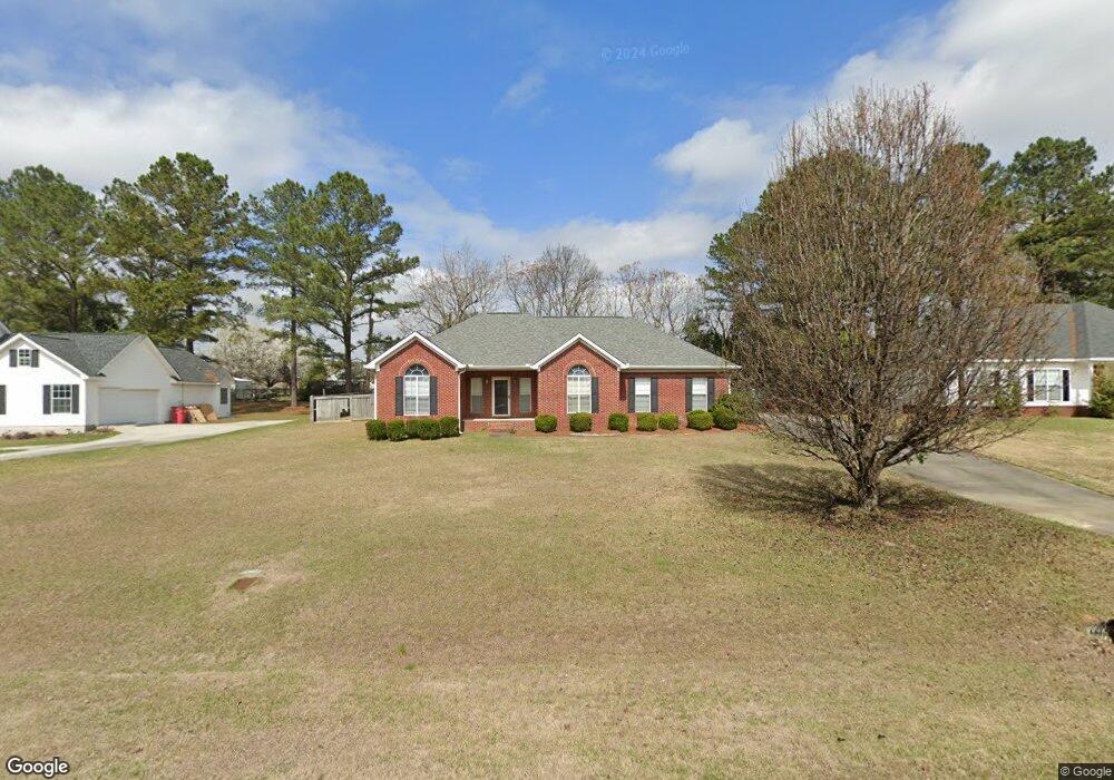
1118 Alma Dr Macon, GA 31216
Estimated Value: $223,000 - $277,000
3
Beds
2
Baths
1,613
Sq Ft
$153/Sq Ft
Est. Value
About This Home
This home is located at 1118 Alma Dr, Macon, GA 31216 and is currently estimated at $245,997, approximately $152 per square foot. 1118 Alma Dr is a home located in Bibb County with nearby schools including Porter Elementary School, Rutland Middle School, and Rutland High School.
Ownership History
Date
Name
Owned For
Owner Type
Purchase Details
Closed on
Oct 28, 2005
Sold by
Jones Nona E
Bought by
Rowland E J
Current Estimated Value
Home Financials for this Owner
Home Financials are based on the most recent Mortgage that was taken out on this home.
Original Mortgage
$100,000
Outstanding Balance
$53,197
Interest Rate
5.76%
Mortgage Type
New Conventional
Estimated Equity
$192,800
Purchase Details
Closed on
Jul 31, 2002
Create a Home Valuation Report for This Property
The Home Valuation Report is an in-depth analysis detailing your home's value as well as a comparison with similar homes in the area
Home Values in the Area
Average Home Value in this Area
Purchase History
| Date | Buyer | Sale Price | Title Company |
|---|---|---|---|
| Rowland E J | $145,000 | None Available | |
| -- | $136,200 | -- |
Source: Public Records
Mortgage History
| Date | Status | Borrower | Loan Amount |
|---|---|---|---|
| Open | Rowland E J | $100,000 |
Source: Public Records
Tax History Compared to Growth
Tax History
| Year | Tax Paid | Tax Assessment Tax Assessment Total Assessment is a certain percentage of the fair market value that is determined by local assessors to be the total taxable value of land and additions on the property. | Land | Improvement |
|---|---|---|---|---|
| 2025 | $1,631 | $73,384 | $11,200 | $62,184 |
| 2024 | $1,686 | $73,384 | $11,200 | $62,184 |
| 2023 | $1,229 | $73,384 | $11,200 | $62,184 |
| 2022 | $2,219 | $71,090 | $11,336 | $59,754 |
| 2021 | $2,110 | $62,536 | $9,360 | $53,176 |
| 2020 | $1,923 | $56,534 | $8,840 | $47,694 |
| 2019 | $1,748 | $51,656 | $7,800 | $43,856 |
| 2018 | $2,857 | $51,656 | $7,800 | $43,856 |
| 2017 | $1,673 | $51,656 | $7,800 | $43,856 |
| 2016 | $1,545 | $51,656 | $7,800 | $43,856 |
| 2015 | $2,187 | $51,656 | $7,800 | $43,856 |
| 2014 | $1,999 | $47,746 | $7,800 | $39,946 |
Source: Public Records
Map
Nearby Homes