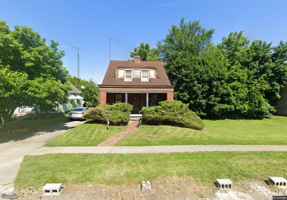
1118 Broer Ave Toledo, OH 43607
Scott Park NeighborhoodEstimated Value: $103,000 - $117,000
3
Beds
1
Bath
1,242
Sq Ft
$89/Sq Ft
Est. Value
About This Home
This home is located at 1118 Broer Ave, Toledo, OH 43607 and is currently estimated at $110,827, approximately $89 per square foot. 1118 Broer Ave is a home located in Lucas County with nearby schools including Keyser Elementary School, Rogers High School, and Victory Academy of Toledo.
Ownership History
Date
Name
Owned For
Owner Type
Purchase Details
Closed on
Apr 17, 1998
Sold by
Kobil Gerald M and Kobil Mary Sue
Bought by
Googins Stephen R and Googins Sheila E
Current Estimated Value
Home Financials for this Owner
Home Financials are based on the most recent Mortgage that was taken out on this home.
Original Mortgage
$45,900
Interest Rate
7.26%
Create a Home Valuation Report for This Property
The Home Valuation Report is an in-depth analysis detailing your home's value as well as a comparison with similar homes in the area
Home Values in the Area
Average Home Value in this Area
Purchase History
| Date | Buyer | Sale Price | Title Company |
|---|---|---|---|
| Googins Stephen R | $17,000 | Perrysburg Title Agency Inc | |
| Googins Stephen R | $17,000 | Perrysburg Title Agency Inc | |
| Googins Stephen R | $17,000 | Perrysburg Title Agency Inc |
Source: Public Records
Mortgage History
| Date | Status | Borrower | Loan Amount |
|---|---|---|---|
| Closed | Googins Stephen R | $45,900 |
Source: Public Records
Tax History Compared to Growth
Tax History
| Year | Tax Paid | Tax Assessment Tax Assessment Total Assessment is a certain percentage of the fair market value that is determined by local assessors to be the total taxable value of land and additions on the property. | Land | Improvement |
|---|---|---|---|---|
| 2024 | $762 | $24,080 | $6,265 | $17,815 |
| 2023 | $1,461 | $22,155 | $3,255 | $18,900 |
| 2022 | $1,451 | $22,155 | $3,255 | $18,900 |
| 2021 | $1,500 | $22,155 | $3,255 | $18,900 |
| 2020 | $1,619 | $21,210 | $3,080 | $18,130 |
| 2019 | $1,569 | $21,210 | $3,080 | $18,130 |
| 2018 | $1,588 | $21,210 | $3,080 | $18,130 |
| 2017 | $1,597 | $20,720 | $3,010 | $17,710 |
| 2016 | $2,480 | $59,200 | $8,600 | $50,600 |
| 2015 | $1,603 | $59,200 | $8,600 | $50,600 |
| 2014 | $1,303 | $20,720 | $3,010 | $17,710 |
| 2013 | $1,303 | $20,720 | $3,010 | $17,710 |
Source: Public Records
Map
Nearby Homes
- 1117 Broer Ave
- 914 Turner Ave
- 1408 Roosevelt Ave
- 1125 Secor Rd
- 1743 Kensington Rd
- 2666 Montebello Rd
- 1752 Pilgrim Rd
- 1809 Pilgrim Rd
- 1702 Alvin St
- 2013 Bretton Place
- 1730 Alvin St
- 615 Cuthbert Rd
- 514 Conrad Ave
- 1735 Perth St
- 1814 Alvin St
- 1901 Alvin St
- 2547 Greenbriar Rd
- 1911 Alvin St
- 1917 Alvin St
- 2019 Kensington Rd
- 1122 Broer Ave
- 1114 Broer Ave
- 1126 Broer Ave
- 1110 Broer Ave
- 1130 Broer Ave
- 1115 Turner Ave
- 1121 Turner Ave
- 1102 Broer Ave
- 1109 Turner Ave
- 1125 Turner Ave
- 1129 Turner Ave
- 1101 Turner Ave
- 1111 Broer Ave
- 1121 Broer Ave
- 1109 Broer Ave
- 1125 Broer Ave
- 1105 Broer Ave
- 1201 Broer Ave
- 1028 Broer Ave
- 1101 Broer Ave