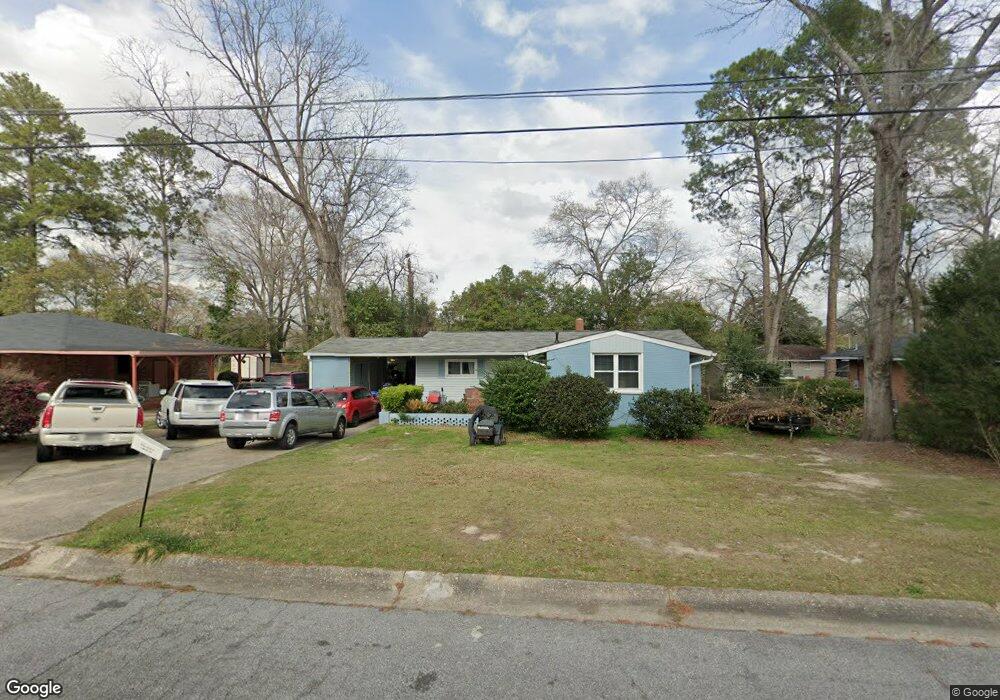
1118 Dunbar Ave Columbus, GA 31906
Lindsey Creek Park-Boxwood Estates NeighborhoodEstimated Value: $148,000 - $198,959
4
Beds
2
Baths
2,075
Sq Ft
$83/Sq Ft
Est. Value
About This Home
This home is located at 1118 Dunbar Ave, Columbus, GA 31906 and is currently estimated at $172,490, approximately $83 per square foot. 1118 Dunbar Ave is a home located in Muscogee County with nearby schools including Rigdon Road Elementary School, Richards Middle School, and Carver High School.
Ownership History
Date
Name
Owned For
Owner Type
Purchase Details
Closed on
Dec 11, 2023
Sold by
Wheeler Daginal D
Bought by
Wheeler Daginal D and Foster Judy A
Current Estimated Value
Purchase Details
Closed on
Sep 16, 2013
Sold by
Bell Johnnie
Bought by
Bell Johnnie and Bell Helen L
Create a Home Valuation Report for This Property
The Home Valuation Report is an in-depth analysis detailing your home's value as well as a comparison with similar homes in the area
Home Values in the Area
Average Home Value in this Area
Purchase History
| Date | Buyer | Sale Price | Title Company |
|---|---|---|---|
| Wheeler Daginal D | -- | None Listed On Document | |
| Bell Johnnie | -- | -- |
Source: Public Records
Tax History Compared to Growth
Tax History
| Year | Tax Paid | Tax Assessment Tax Assessment Total Assessment is a certain percentage of the fair market value that is determined by local assessors to be the total taxable value of land and additions on the property. | Land | Improvement |
|---|---|---|---|---|
| 2025 | $2,361 | $60,312 | $7,896 | $52,416 |
| 2024 | $2,361 | $60,312 | $7,896 | $52,416 |
| 2023 | $2,119 | $53,804 | $7,896 | $45,908 |
| 2022 | $0 | $43,204 | $7,896 | $35,308 |
| 2021 | $0 | $42,004 | $7,896 | $34,108 |
| 2020 | $0 | $42,004 | $7,896 | $34,108 |
| 2019 | $660 | $42,004 | $7,896 | $34,108 |
| 2018 | $660 | $42,004 | $7,896 | $34,108 |
| 2017 | $664 | $42,004 | $7,896 | $34,108 |
| 2016 | $667 | $39,774 | $5,120 | $34,654 |
| 2015 | $669 | $39,774 | $5,120 | $34,654 |
| 2014 | $671 | $39,774 | $5,120 | $34,654 |
| 2013 | -- | $34,617 | $5,120 | $29,497 |
Source: Public Records
Map
Nearby Homes
- 1061 Dunbar Ave
- 3122 Glenwood Dr
- 1312 Glenwood Rd
- 1047 Fisk Ave
- 1301 Rigdon Rd
- 937 Diggs Ave
- 3319 Decatur St
- 2902 Hood St
- 3570 Stratford Dr
- 2925 Colorado St
- 2726 Marion St
- 2937 Thomas St
- 2916 Gardenia St
- 2911 Thomas St
- 1310 S Dixon Dr
- 2911 Gardenia St
- 2835 Thomas St
- 3415 Terminal St
- 2833 Thomas St
- 2829 Thomas St
- 1124 Dunbar Ave
- 1110 Dunbar Ave
- 1125 W Lindsay Dr
- 0 Dunbar Ave
- 1131 W Lindsay Dr
- 1117 W Lindsay Dr
- 3204 Melrose Dr
- 1117 Dunbar Ave Unit ID1043803P
- 1117 Dunbar Ave
- 1104 Dunbar Ave
- 1123 Dunbar Ave
- 1109 Dunbar Ave
- 3214 Melrose Dr
- 1109 W Lindsay Dr
- 3116 Melrose Dr
- 1107 Dunbar Ave
- 1092 Dunbar Ave
- 1103 W Lindsay Dr
- 1104 Bolton Ave
- 1112 Bolton Ave