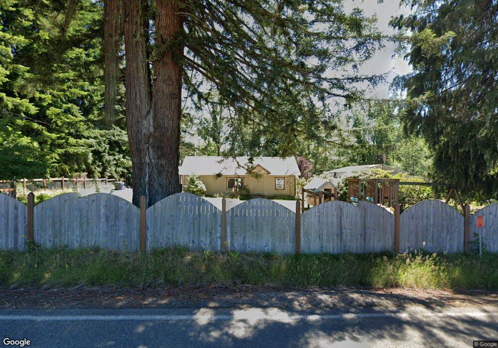
1118 Middle Fork Rd Onalaska, WA 98570
Estimated Value: $407,390 - $705,000
3
Beds
1
Bath
1,401
Sq Ft
$393/Sq Ft
Est. Value
About This Home
This home is located at 1118 Middle Fork Rd, Onalaska, WA 98570 and is currently estimated at $551,098, approximately $393 per square foot. 1118 Middle Fork Rd is a home located in Lewis County with nearby schools including Onalaska Elementary School and Onalaska High School.
Ownership History
Date
Name
Owned For
Owner Type
Purchase Details
Closed on
Apr 30, 2010
Sold by
Auman Karen
Bought by
Auman Neal
Current Estimated Value
Purchase Details
Closed on
Oct 6, 2005
Sold by
Auman Neal R and Auman Beverly J
Bought by
Auman Neal T and Auman Karen M
Home Financials for this Owner
Home Financials are based on the most recent Mortgage that was taken out on this home.
Original Mortgage
$103,208
Outstanding Balance
$54,112
Interest Rate
5.63%
Mortgage Type
Purchase Money Mortgage
Estimated Equity
$496,986
Create a Home Valuation Report for This Property
The Home Valuation Report is an in-depth analysis detailing your home's value as well as a comparison with similar homes in the area
Purchase History
| Date | Buyer | Sale Price | Title Company |
|---|---|---|---|
| Auman Neal | -- | None Available | |
| Auman Neal T | -- | None Available | |
| Auman Neal T | -- | None Available |
Source: Public Records
Mortgage History
| Date | Status | Borrower | Loan Amount |
|---|---|---|---|
| Open | Auman Neal T | $103,208 | |
| Closed | Auman Neal T | $103,208 |
Source: Public Records
Tax History
| Year | Tax Paid | Tax Assessment Tax Assessment Total Assessment is a certain percentage of the fair market value that is determined by local assessors to be the total taxable value of land and additions on the property. | Land | Improvement |
|---|---|---|---|---|
| 2025 | $2,778 | $382,600 | $83,300 | $299,300 |
| 2024 | $2,778 | $390,700 | $93,900 | $296,800 |
| 2023 | $2,779 | $375,600 | $69,200 | $306,400 |
| 2022 | $2,371 | $274,900 | $54,800 | $220,100 |
| 2021 | $2,156 | $274,900 | $54,800 | $220,100 |
| 2020 | $2,164 | $242,500 | $45,700 | $196,800 |
| 2019 | $1,945 | $229,100 | $45,700 | $183,400 |
| 2018 | $1,311 | $201,500 | $40,100 | $161,400 |
| 2017 | $1,205 | $132,400 | $36,600 | $95,800 |
| 2016 | $1,149 | $122,000 | $34,900 | $87,100 |
| 2015 | $1,188 | $112,400 | $33,200 | $79,200 |
| 2013 | $1,188 | $113,900 | $33,200 | $80,700 |
Source: Public Records
Map
Nearby Homes
- 188 Birchfield Pkwy
- 253 Kruger Rd Unit B
- 0 Sunburst Ln Unit NWM2293308
- 119 Redwood Ln
- 123 Redwood Ln
- 49 Sunburst Ln
- 0 State Highway 508 Unit NWM2150571
- 110 Sequoia Ln
- 108 Sequoia Ln
- 18 Sunburst Ln
- 209 Alpha Way
- 4311 State 508
- 196 Jensen Rd
- 132 Quiet Acres Dr
- 126 Burchett Rd
- 0 Gish Rd Unit Lot 1 NWM2364104
- 0 Gish Rd Unit Lot 2 NWM2364107
- 2 XX Oppelt Rd
- 3 xx Oppelt Rd
- 10 xx Oppelt Rd
- 1126 Middle Fork Rd
- 119 Cedar Heights Dr
- 1096 Middle Fork Rd
- 1090 Middle Fork Rd
- 1151 Middle Fork Rd
- 131 Cedar Heights Dr
- 1152 Middle Fork Rd
- 140 Cedar Heights Dr
- 105 Wood Duck Ln
- 143 Cedar Heights Dr
- 149 Cedar Heights Dr
- 1069 Middle Fork Rd
- 1068 Middle Fork Rd
- 1061 Middle Fork Rd
- 1201 Middle Fork Rd
- 1217 Middle Fork Rd
- 1218 Middle Fork Rd
- 1015 Middle Fork Rd
- 1008 Middle Fork Rd
- 1223 Middle Fork Rd
Your Personal Tour Guide
Ask me questions while you tour the home.