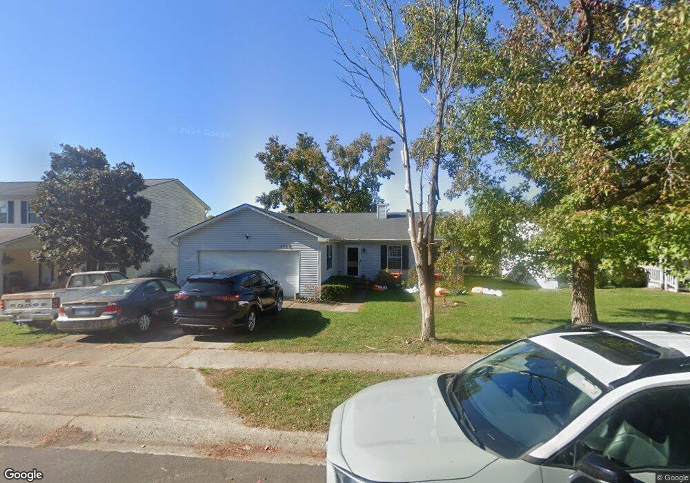
1118 Southpoint Dr Georgetown, KY 40324
Mount Vernon NeighborhoodEstimated Value: $234,850 - $267,000
3
Beds
2
Baths
1,380
Sq Ft
$181/Sq Ft
Est. Value
About This Home
This home is located at 1118 Southpoint Dr, Georgetown, KY 40324 and is currently estimated at $249,213, approximately $180 per square foot. 1118 Southpoint Dr is a home located in Scott County with nearby schools including Southern Elementary School, Creekside Elementary School, and Georgetown Middle School.
Ownership History
Date
Name
Owned For
Owner Type
Purchase Details
Closed on
Aug 28, 2009
Sold by
Fraley William R and Fraley Jennifer L
Bought by
Patton Tyrone M and Patton Britney S
Current Estimated Value
Home Financials for this Owner
Home Financials are based on the most recent Mortgage that was taken out on this home.
Original Mortgage
$125,600
Outstanding Balance
$81,807
Interest Rate
5.11%
Mortgage Type
VA
Estimated Equity
$167,406
Create a Home Valuation Report for This Property
The Home Valuation Report is an in-depth analysis detailing your home's value as well as a comparison with similar homes in the area
Home Values in the Area
Average Home Value in this Area
Purchase History
| Date | Buyer | Sale Price | Title Company |
|---|---|---|---|
| Patton Tyrone M | $123,000 | None Available |
Source: Public Records
Mortgage History
| Date | Status | Borrower | Loan Amount |
|---|---|---|---|
| Open | Patton Tyrone M | $125,600 |
Source: Public Records
Tax History Compared to Growth
Tax History
| Year | Tax Paid | Tax Assessment Tax Assessment Total Assessment is a certain percentage of the fair market value that is determined by local assessors to be the total taxable value of land and additions on the property. | Land | Improvement |
|---|---|---|---|---|
| 2024 | $1,742 | $193,700 | $0 | $0 |
| 2023 | $1,694 | $186,800 | $35,000 | $151,800 |
| 2022 | $1,411 | $165,900 | $30,000 | $135,900 |
| 2021 | $1,444 | $153,300 | $30,000 | $123,300 |
| 2020 | $1,247 | $145,100 | $30,000 | $115,100 |
| 2019 | $1,211 | $138,700 | $0 | $0 |
| 2018 | $1,154 | $133,000 | $0 | $0 |
| 2017 | $1,135 | $130,210 | $0 | $0 |
| 2016 | $1,010 | $125,380 | $0 | $0 |
| 2015 | $984 | $123,000 | $0 | $0 |
| 2014 | $1,020 | $123,000 | $0 | $0 |
| 2011 | $76 | $123,000 | $0 | $0 |
Source: Public Records
Map
Nearby Homes
- 1115 Southpoint Dr
- 230 E Showalter Dr
- 1363 Bridges Creek Ct
- 224 E Showalter Dr
- 1338 Liberty Dr Unit A and B
- 139 E Showalter Dr
- 145 Placid Dr
- 127 E Chopin Way
- 155 Bill Perkins Ln
- 107 Oconner Ct
- 102 Browning Dr
- 148 Bill Perkins Ln
- 188 Ruth Miller Dr
- 1020 Parkside Dr
- 145 Ruth Miller Dr
- 143 Ruth Miller Dr
- 158 Ruth Miller Dr
- 140 Ruth Miller Dr
- 174 Ruth Miller Dr
- 117 Sun Drop Ln
- 1120 Southpoint Dr
- 1108 Southpoint Dr
- 1337 Dorchester Dr
- 1335 Dorchester Dr
- 1122 Southpoint Dr
- 1339 Dorchester Dr
- 1117 Southpoint Dr Unit 1
- 1119 Southpoint Dr
- 1103 Southpoint Dr
- 1341 Dorchester Dr
- 1105 Southpoint Dr
- 1113 Southpoint Dr
- 1333 Dorchester Dr
- 1107 Southpoint Dr
- 1126 Southpoint Dr Unit 1
- 1125 Southpoint Dr
- 1338 Dorchester Dr
- 1336 Dorchester Dr
- 1340 Dorchester Dr
- 1329 Dorchester Dr