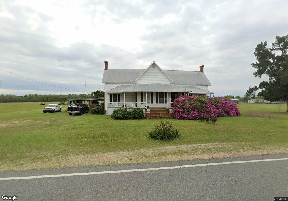
11183 Zoar Rd Hazlehurst, GA 31539
Estimated Value: $121,657 - $191,000
--
Bed
1
Bath
3,044
Sq Ft
$51/Sq Ft
Est. Value
About This Home
This home is located at 11183 Zoar Rd, Hazlehurst, GA 31539 and is currently estimated at $156,329, approximately $51 per square foot. 11183 Zoar Rd is a home located in Appling County.
Ownership History
Date
Name
Owned For
Owner Type
Purchase Details
Closed on
May 20, 2015
Sold by
Overstreet Annette P
Bought by
Sweat Melissa O
Current Estimated Value
Purchase Details
Closed on
Dec 8, 2014
Sold by
Paulk Mary Jeanine
Bought by
Overstreet Annette P
Purchase Details
Closed on
Dec 13, 2011
Sold by
Paulk Mary J
Bought by
Sweat Melissa C
Purchase Details
Closed on
Sep 12, 2007
Sold by
Paulk Mary J
Bought by
Paulk Mary J
Purchase Details
Closed on
Nov 8, 1961
Bought by
Mary Paulk L and Mary Jane
Create a Home Valuation Report for This Property
The Home Valuation Report is an in-depth analysis detailing your home's value as well as a comparison with similar homes in the area
Home Values in the Area
Average Home Value in this Area
Purchase History
| Date | Buyer | Sale Price | Title Company |
|---|---|---|---|
| Sweat Melissa O | -- | -- | |
| Overstreet Annette P | -- | -- | |
| Overstreet Annette P | -- | -- | |
| Sweat Melissa C | -- | -- | |
| Paulk Mary J | -- | -- | |
| Mary Paulk L | -- | -- |
Source: Public Records
Tax History Compared to Growth
Tax History
| Year | Tax Paid | Tax Assessment Tax Assessment Total Assessment is a certain percentage of the fair market value that is determined by local assessors to be the total taxable value of land and additions on the property. | Land | Improvement |
|---|---|---|---|---|
| 2024 | $919 | $37,440 | $2,280 | $35,160 |
| 2023 | $919 | $40,571 | $2,291 | $38,280 |
| 2022 | $601 | $23,300 | $1,925 | $21,375 |
| 2021 | $602 | $23,300 | $1,925 | $21,375 |
| 2020 | $523 | $19,508 | $1,925 | $17,583 |
| 2019 | $533 | $19,508 | $1,925 | $17,583 |
| 2018 | $543 | $19,508 | $1,925 | $17,583 |
| 2017 | $543 | $19,508 | $1,925 | $17,583 |
| 2016 | $543 | $19,508 | $1,925 | $17,583 |
| 2015 | $441 | $15,814 | $1,925 | $13,890 |
| 2014 | $1,352 | $58,514 | $44,624 | $13,890 |
| 2013 | -- | $58,513 | $44,623 | $13,890 |
Source: Public Records
Map
Nearby Homes
- 0 Herrington Rd
- 00 Herrington Rd
- 469 Dyal Rd
- 0 T M Mims Rd
- 60 Fred Hutchinson Rd
- 908 Bethel Freewill Rd
- T M Mims Rd
- 00 Henry Mims Rd
- 2612 Buck Head Rd
- 4043 Lake Mayers Rd
- 548 Walker Ln
- 0 Henry-Mimbs Rd Unit 10544748
- TBD Golden Isle W
- 0 Golden Isle W
- 43 Graham Methodist Church Rd
- 152 Stream Rd
- 0 Elizabeth Church Rd Unit 10583146
- 68 Rentz Woods Rd
- LOT 6 Carl Cravey Rd
- LOT 5 Carl Cravey Rd