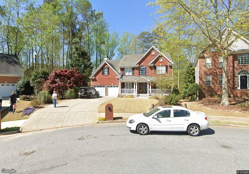
11185 Kimball Crest Dr Alpharetta, GA 30022
Estimated Value: $714,000 - $847,000
4
Beds
3
Baths
2,928
Sq Ft
$266/Sq Ft
Est. Value
About This Home
This home is located at 11185 Kimball Crest Dr, Alpharetta, GA 30022 and is currently estimated at $779,158, approximately $266 per square foot. 11185 Kimball Crest Dr is a home located in Fulton County with nearby schools including New Prospect Elementary School, Webb Bridge Middle School, and Alpharetta High School.
Ownership History
Date
Name
Owned For
Owner Type
Purchase Details
Closed on
Mar 30, 2004
Sold by
Payne Ginger Ellen
Bought by
Moss Allan R and Moss Tabitha
Current Estimated Value
Home Financials for this Owner
Home Financials are based on the most recent Mortgage that was taken out on this home.
Original Mortgage
$252,000
Outstanding Balance
$117,595
Interest Rate
5.54%
Mortgage Type
New Conventional
Estimated Equity
$661,563
Purchase Details
Closed on
Sep 27, 1999
Sold by
Rick Olson Homes
Bought by
Payne Ginger E
Purchase Details
Closed on
Feb 11, 1999
Sold by
Crown Dev Llc
Bought by
Rick Olson Homes Inc
Home Financials for this Owner
Home Financials are based on the most recent Mortgage that was taken out on this home.
Original Mortgage
$353,900
Interest Rate
6.79%
Mortgage Type
New Conventional
Create a Home Valuation Report for This Property
The Home Valuation Report is an in-depth analysis detailing your home's value as well as a comparison with similar homes in the area
Home Values in the Area
Average Home Value in this Area
Purchase History
| Date | Buyer | Sale Price | Title Company |
|---|---|---|---|
| Moss Allan R | $315,000 | -- | |
| Payne Ginger E | -- | -- | |
| Rick Olson Homes Inc | $95,000 | -- |
Source: Public Records
Mortgage History
| Date | Status | Borrower | Loan Amount |
|---|---|---|---|
| Open | Moss Allan R | $252,000 | |
| Previous Owner | Rick Olson Homes Inc | $353,900 |
Source: Public Records
Tax History Compared to Growth
Tax History
| Year | Tax Paid | Tax Assessment Tax Assessment Total Assessment is a certain percentage of the fair market value that is determined by local assessors to be the total taxable value of land and additions on the property. | Land | Improvement |
|---|---|---|---|---|
| 2025 | $673 | $302,280 | $57,000 | $245,280 |
| 2023 | $4,648 | $164,680 | $37,080 | $127,600 |
| 2022 | $3,459 | $164,680 | $37,080 | $127,600 |
| 2021 | $4,060 | $193,320 | $31,080 | $162,240 |
| 2020 | $4,083 | $164,680 | $37,080 | $127,600 |
| 2019 | $622 | $161,760 | $36,440 | $125,320 |
| 2018 | $3,477 | $141,040 | $31,400 | $109,640 |
| 2017 | $3,410 | $132,280 | $28,080 | $104,200 |
| 2016 | $3,393 | $132,280 | $28,080 | $104,200 |
| 2015 | $3,083 | $130,720 | $28,080 | $102,640 |
| 2014 | $2,789 | $103,720 | $13,960 | $89,760 |
Source: Public Records
Map
Nearby Homes
- 10900 Wittenridge Dr Unit I3
- 10900 Wittenridge Dr Unit H8
- 10900 Wittenridge Dr Unit L6
- 10900 Wittenridge Dr Unit C7
- 10845 Carrissa Trail
- 3396 Carverton Ln
- 610 Varina Way
- 825 Highland Bend Cove
- 125 Sandridge Ct
- 465 Kirkstall Trail
- 870 Longstone Landing
- 3430 Waters Mill Dr
- 345 Kincardine Way Unit IIIA
- 10880 Windham Way
- 3335 Waters Mill Dr
- 105 Kimball Bridge Cove
- 725 High Hampton Run
- 3962 Erin Dr
- 11175 Kimball Crest Dr
- 11100 Kimball Crest Dr
- 10981 Waters Rd
- 10985 Waters Rd
- 11165 Kimball Crest Dr
- 11090 Kimball Crest Dr
- 10989 Waters Rd
- 11080 Kimball Crest Dr
- 3425 Rialto Place
- 3430 Rialto Place
- 11070 Kimball Crest Dr
- 10969 Waters Rd
- 3435 Rialto Place
- 11155 Kimball Crest Dr
- 0 Rialto Place Unit 7223546
- 0 Rialto Place Unit 8694250
- 0 Rialto Place Unit 7483942
- 0 Rialto Place Unit 7150898
- 10993 Waters Rd
- 3470 Curitiba Ct