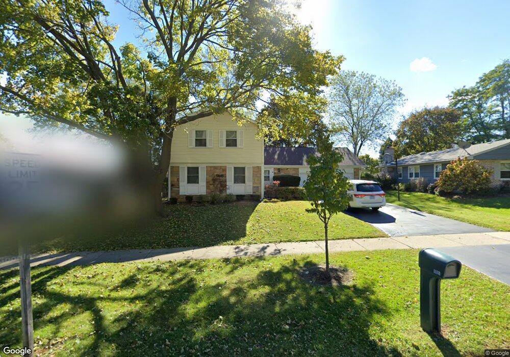
1119 Bernard Dr Buffalo Grove, IL 60089
South Buffalo Grove NeighborhoodEstimated Value: $482,000 - $517,000
4
Beds
3
Baths
2,086
Sq Ft
$237/Sq Ft
Est. Value
About This Home
This home is located at 1119 Bernard Dr, Buffalo Grove, IL 60089 and is currently estimated at $494,376, approximately $236 per square foot. 1119 Bernard Dr is a home located in Cook County with nearby schools including Henry W Longfellow Elementary School, Cooper Middle School, and Buffalo Grove High School.
Ownership History
Date
Name
Owned For
Owner Type
Purchase Details
Closed on
Jun 10, 2002
Sold by
Skyles William V and Skyles Lisa
Bought by
Blumenthal Michael and Greene Jennifer R
Current Estimated Value
Purchase Details
Closed on
Mar 27, 1998
Sold by
Cunningham David L and Cunningham Cecile L
Bought by
Skyles William V and Skyles Lisa M
Home Financials for this Owner
Home Financials are based on the most recent Mortgage that was taken out on this home.
Original Mortgage
$203,000
Interest Rate
7.09%
Mortgage Type
VA
Create a Home Valuation Report for This Property
The Home Valuation Report is an in-depth analysis detailing your home's value as well as a comparison with similar homes in the area
Home Values in the Area
Average Home Value in this Area
Purchase History
| Date | Buyer | Sale Price | Title Company |
|---|---|---|---|
| Blumenthal Michael | $290,000 | Lawyers Title Insurance Corp | |
| Skyles William V | $200,000 | -- |
Source: Public Records
Mortgage History
| Date | Status | Borrower | Loan Amount |
|---|---|---|---|
| Previous Owner | Skyles William V | $203,000 | |
| Closed | Blumenthal Michael | $0 |
Source: Public Records
Tax History Compared to Growth
Tax History
| Year | Tax Paid | Tax Assessment Tax Assessment Total Assessment is a certain percentage of the fair market value that is determined by local assessors to be the total taxable value of land and additions on the property. | Land | Improvement |
|---|---|---|---|---|
| 2024 | $10,141 | $35,000 | $7,875 | $27,125 |
| 2023 | $9,724 | $35,000 | $7,875 | $27,125 |
| 2022 | $9,724 | $35,000 | $7,875 | $27,125 |
| 2021 | $9,115 | $29,130 | $5,031 | $24,099 |
| 2020 | $8,949 | $29,130 | $5,031 | $24,099 |
| 2019 | $8,937 | $32,295 | $5,031 | $27,264 |
| 2018 | $8,736 | $28,802 | $4,375 | $24,427 |
| 2017 | $8,595 | $28,802 | $4,375 | $24,427 |
| 2016 | $8,262 | $28,802 | $4,375 | $24,427 |
| 2015 | $8,757 | $28,401 | $3,718 | $24,683 |
| 2014 | $8,630 | $28,401 | $3,718 | $24,683 |
| 2013 | $7,960 | $28,401 | $3,718 | $24,683 |
Source: Public Records
Map
Nearby Homes
- 921 Bernard Dr
- 705 Grove Dr Unit 101
- 859 Beechwood Rd
- 715 W Whiting Ln
- 571 Estate Dr
- 720 Weidner Rd Unit 302
- 535 Estate Dr
- 751 W Happfield Dr Unit 30
- 812 W Whiting Ln
- 715 W Happfield Dr
- 811 W Nichols Rd
- 820 Weidner Rd Unit 4013
- 820 Weidner Rd Unit 409
- 665 Thornwood Dr
- 18 E Heritage Ct
- 310 Rosewood Ave
- 1112 Auburn Ln
- 1115 Miller Ln Unit 104
- 3227 N Heritage Ln
- 972 Thornton Ln Unit 102
- 1129 Bernard Dr
- 1107 Bernard Dr
- 1097 Bernard Dr
- 1143 Bernard Dr
- 1116 Bernard Dr
- 1106 Bernard Dr
- 1087 Bernard Dr
- 1144 Bernard Dr
- 1096 Bernard Dr
- 10 Regent Ct W
- 1085 Bernard Dr
- 1086 Bernard Dr
- 12 Regent Ct W
- 8 Regent Ct W
- 1309 Rose Ct E
- 14 Regent Ct W
- 1311 Rose Ct E
- 404 Regent Dr
- 384 Regent Dr
- 1313 Rose Ct E