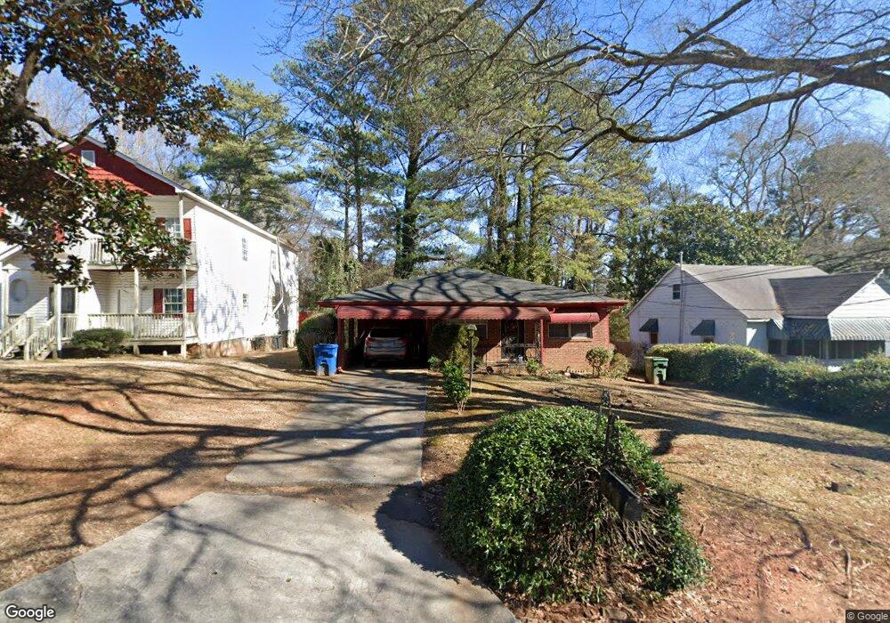
1119 Cato St NW Atlanta, GA 30318
Grove Park NeighborhoodEstimated Value: $143,000 - $223,000
3
Beds
2
Baths
964
Sq Ft
$187/Sq Ft
Est. Value
About This Home
This home is located at 1119 Cato St NW, Atlanta, GA 30318 and is currently estimated at $180,390, approximately $187 per square foot. 1119 Cato St NW is a home located in Fulton County with nearby schools including Boyd Elementary School, John Lewis Invictus Academy, and Frederick Douglass High School.
Ownership History
Date
Name
Owned For
Owner Type
Purchase Details
Closed on
Dec 28, 2000
Sold by
Bivens James A and Bivens Helen J
Bought by
Withers Larry and Withers Robertina L
Current Estimated Value
Home Financials for this Owner
Home Financials are based on the most recent Mortgage that was taken out on this home.
Original Mortgage
$66,300
Outstanding Balance
$27,088
Interest Rate
7.44%
Mortgage Type
New Conventional
Estimated Equity
$153,302
Purchase Details
Closed on
Jan 27, 1999
Sold by
Brown Loraine
Bought by
Belvins James A and Belvins Helen J
Home Financials for this Owner
Home Financials are based on the most recent Mortgage that was taken out on this home.
Original Mortgage
$25,000
Interest Rate
6.73%
Mortgage Type
New Conventional
Purchase Details
Closed on
Jun 22, 1998
Sold by
Burston Joseph
Bought by
Brown Loraine
Create a Home Valuation Report for This Property
The Home Valuation Report is an in-depth analysis detailing your home's value as well as a comparison with similar homes in the area
Home Values in the Area
Average Home Value in this Area
Purchase History
| Date | Buyer | Sale Price | Title Company |
|---|---|---|---|
| Withers Larry | $65,000 | -- | |
| Belvins James A | $30,000 | -- | |
| Brown Loraine | -- | -- |
Source: Public Records
Mortgage History
| Date | Status | Borrower | Loan Amount |
|---|---|---|---|
| Open | Withers Larry | $66,300 | |
| Previous Owner | Belvins James A | $25,000 |
Source: Public Records
Tax History Compared to Growth
Tax History
| Year | Tax Paid | Tax Assessment Tax Assessment Total Assessment is a certain percentage of the fair market value that is determined by local assessors to be the total taxable value of land and additions on the property. | Land | Improvement |
|---|---|---|---|---|
| 2025 | $58 | $71,920 | $40,240 | $31,680 |
| 2023 | $3,295 | $79,600 | $57,840 | $21,760 |
| 2022 | $156 | $79,600 | $57,840 | $21,760 |
| 2021 | $179 | $80,640 | $62,240 | $18,400 |
| 2020 | $62 | $53,280 | $31,160 | $22,120 |
| 2019 | $351 | $27,480 | $9,360 | $18,120 |
| 2018 | $25 | $12,760 | $3,880 | $8,880 |
| 2017 | $15 | $10,080 | $4,600 | $5,480 |
| 2016 | $15 | $10,080 | $4,600 | $5,480 |
| 2015 | $356 | $10,080 | $4,600 | $5,480 |
| 2014 | $16 | $12,440 | $8,840 | $3,600 |
Source: Public Records
Map
Nearby Homes
- 1075 Cato St NW
- 2015 Lois Place NW
- 1050 Cato St NW
- 1985 Lois Place NW
- 1131 Cato St NW
- 965 Cato St NW
- 1981 Lois Place NW
- 1987 Ruth St NW
- 75 Johnson Rd NW
- 1974 Lois Place NW
- 37 Johnson Rd NW
- 30 Johnson Rd NW
- 25 Johnson Rd NW
- 15 Johnson Rd NW
- 1039 Margaret Place NW
- 0 Cato St NW Unit 7588989
- 923 N Eugenia Place NW
- 38 Mildred NW
- 1115 Cato St NW
- 1123 Cato St NW
- 1127 Cato St NW
- 1081 Cato St NW
- 2060 Ruth St NW
- 2055 Lois Place NW
- 2055 Lois Place NW Unit A&B
- 2054 Ruth St NW
- 1071 Cato St NW
- 1110 Cato St NW Unit 1
- 1110 Cato St NW Unit 2
- 1110 Cato St NW
- 1124 Cato St NW
- 1080 Cato St NW
- 2052 Ruth St NW
- 1126 Cato St NW
- 2045 Lois Place NW
- 1084 Cato St NW Unit 10
- 1084 Cato St NW
- 1131 Gun Club Rd NW