Estimated Value: $69,000 - $137,000
Studio
2
Baths
1,385
Sq Ft
$68/Sq Ft
Est. Value
About This Home
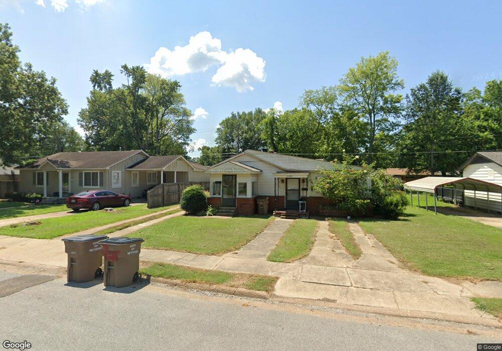
This home is located at 1119 Forrest Ave E, Wynne, AR 72396 and is currently estimated at $94,009, approximately $67 per square foot. 1119 Forrest Ave E is a home located in Cross County with nearby schools including Wynne Primary School, Wynne Intermediate School, and Wynne Junior High School.
Ownership History
Date
Name
Owned For
Owner Type
Purchase Details
Closed on
Dec 1, 2020
Sold by
Ungerank Bridgette H and Ungerank Gregory A
Bought by
Ungerank Rentals Llc
Current Estimated Value
Purchase Details
Closed on
Oct 21, 2014
Sold by
Brawner Onalee
Bought by
Ungerank Gregory A and Ungerank Bridgette H
Home Financials for this Owner
Home Financials are based on the most recent Mortgage that was taken out on this home.
Original Mortgage
$42,000
Interest Rate
4.23%
Mortgage Type
New Conventional
Create a Home Valuation Report for This Property
The Home Valuation Report is an in-depth analysis detailing your home's value as well as a comparison with similar homes in the area
Purchase History
| Date | Buyer | Sale Price | Title Company |
|---|---|---|---|
| Ungerank Rentals Llc | -- | Cowling Title | |
| Ungerank Gregory A | $40,000 | -- |
Source: Public Records
Mortgage History
| Date | Status | Borrower | Loan Amount |
|---|---|---|---|
| Previous Owner | Ungerank Gregory A | $42,000 |
Source: Public Records
Tax History
| Year | Tax Paid | Tax Assessment Tax Assessment Total Assessment is a certain percentage of the fair market value that is determined by local assessors to be the total taxable value of land and additions on the property. | Land | Improvement |
|---|---|---|---|---|
| 2025 | $692 | $20,710 | $2,960 | $17,750 |
| 2024 | $631 | $12,740 | $2,580 | $10,160 |
| 2023 | $631 | $12,740 | $2,580 | $10,160 |
| 2022 | $631 | $12,740 | $2,580 | $10,160 |
| 2021 | $631 | $12,740 | $2,580 | $10,160 |
| 2020 | $625 | $12,740 | $2,580 | $10,160 |
| 2019 | $568 | $11,470 | $2,340 | $9,130 |
| 2018 | $568 | $11,470 | $2,340 | $9,130 |
| 2017 | $568 | $11,470 | $2,340 | $9,130 |
| 2016 | $568 | $11,470 | $2,340 | $9,130 |
| 2015 | $568 | $11,470 | $2,340 | $9,130 |
| 2014 | $568 | $10,670 | $2,130 | $8,540 |
Source: Public Records
Map
Nearby Homes
- 1204 Forrest Ave E
- 226 Nathan Dr E
- 594 Malone St N
- 108 Nathan Dr E
- 1106 Marion Dr
- 109 Nathan Dr E
- 568 Killough Rd N
- 916 Forrest Ave E
- 909 Killough Rd N
- 1420 Hamilton Ave E
- 1404 Airpark Rd
- 1406 Airpark Rd
- 109 Eldridge Ct
- 1011 Hilltop Dr
- 802 Poplar Ave E
- 1201 Peterson Dr
- 1308 Killough Rd N
- 1621 Dodd Dr
- 39 Morningside Dr
- 8 Acres Arkansas 1
- 1123 Forrest Ave E
- 1115 Forrest Ave E
- 1127 Forrest Ave E
- 1111 Forrest Ave E
- 1110 Poplar Ave E
- 309 Nathan Dr E
- 1108 Poplar Ave E
- 1116 Forrest Ave E
- 1120 Forrest Ave E
- 1112 Poplar Ave E
- 1112 Forrest Ave E
- 1107 Forrest Ave E
- 1106 Poplar Ave E
- 305 Nathan Dr E
- 1205 Forrest Ave E
- 1108 Forrest Ave E
- 1103 Forrest Ave E
- 1204 Poplar Ave E
- 219 Nathan Dr E
- 301 Nathan Dr E
Your Personal Tour Guide
Ask me questions while you tour the home.