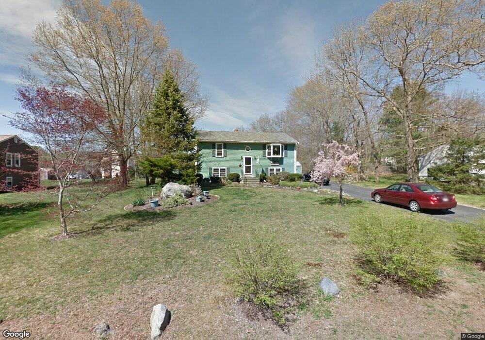
1119 Glebe St Taunton, MA 02780
Westville NeighborhoodEstimated Value: $520,000 - $546,000
3
Beds
2
Baths
1,668
Sq Ft
$317/Sq Ft
Est. Value
About This Home
This home is located at 1119 Glebe St, Taunton, MA 02780 and is currently estimated at $529,041, approximately $317 per square foot. 1119 Glebe St is a home located in Bristol County with nearby schools including Edmund Hatch Bennett School, Benjamin Friedman Middle School, and Taunton High School.
Ownership History
Date
Name
Owned For
Owner Type
Purchase Details
Closed on
Jul 27, 2021
Sold by
Bosh Michael A and Bosh Joan M
Bought by
Bosh Family 2021 Irt
Current Estimated Value
Purchase Details
Closed on
Aug 31, 1983
Bought by
Bosh Michael A and Bosh Joan M
Create a Home Valuation Report for This Property
The Home Valuation Report is an in-depth analysis detailing your home's value as well as a comparison with similar homes in the area
Home Values in the Area
Average Home Value in this Area
Purchase History
| Date | Buyer | Sale Price | Title Company |
|---|---|---|---|
| Bosh Family 2021 Irt | -- | None Available | |
| Bosh Michael A | -- | -- |
Source: Public Records
Mortgage History
| Date | Status | Borrower | Loan Amount |
|---|---|---|---|
| Previous Owner | Bosh Michael A | $90,000 | |
| Previous Owner | Bosh Michael A | $95,600 | |
| Previous Owner | Bosh Michael A | $20,000 | |
| Previous Owner | Bosh Michael A | $85,000 |
Source: Public Records
Tax History Compared to Growth
Tax History
| Year | Tax Paid | Tax Assessment Tax Assessment Total Assessment is a certain percentage of the fair market value that is determined by local assessors to be the total taxable value of land and additions on the property. | Land | Improvement |
|---|---|---|---|---|
| 2025 | $5,039 | $460,600 | $139,900 | $320,700 |
| 2024 | $4,609 | $411,900 | $139,900 | $272,000 |
| 2023 | $4,531 | $376,000 | $133,500 | $242,500 |
| 2022 | $4,506 | $341,900 | $121,900 | $220,000 |
| 2021 | $4,253 | $299,500 | $110,800 | $188,700 |
| 2020 | $4,167 | $280,400 | $110,800 | $169,600 |
| 2019 | $4,343 | $275,600 | $110,800 | $164,800 |
| 2018 | $4,029 | $264,600 | $111,900 | $152,700 |
| 2017 | $3,898 | $248,100 | $106,100 | $142,000 |
| 2016 | $3,724 | $237,500 | $103,000 | $134,500 |
| 2015 | $3,457 | $230,300 | $97,300 | $133,000 |
| 2014 | $3,338 | $228,500 | $97,300 | $131,200 |
Source: Public Records
Map
Nearby Homes
- 70 Forest Hill Dr
- 0 Kimberly Rd
- 852 Burt St
- 165 Andrea Ln
- 1079 Burt St
- 0 Tremont St Unit 73249875
- 14 Tremont St
- 701 Winthrop St Unit 313
- 0 Range Ave Unit 72771509
- 0 Range Ave Unit 72771508
- 48 Round Farm Rd
- 52 Round Farm Rd
- 1 Round Farm Rd
- 2 Round Farm Rd
- 75 Alanita Dr
- 2045 Winthrop St
- Lot 6 Tremont St
- 2136 Winthrop St
- 10 1/2 Worcester St
- 29 & 43 Francis St
- 1105 Glebe St
- 1131 Glebe St
- 31 James h Luther Dr
- 1095 Glebe St
- 1120 Glebe St
- 1104 Glebe St
- 43 James h Luther Dr
- 1147 Glebe St
- 1085 Glebe St
- 32 James h Luther Dr
- 24 Morgan Dr
- 1084 Glebe St
- 1075 Glebe St
- 55 James h Luther Dr
- 1159 Glebe St
- 473 Burt St
- 1074 Glebe St
- 50 James h Luther Dr
- 240 Glebe St
- 493 Burt St