Estimated Value: $530,000 - $599,000
4
Beds
4
Baths
2,843
Sq Ft
$200/Sq Ft
Est. Value
About This Home
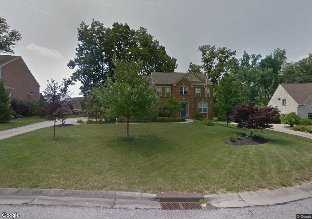
This home is located at 1119 Grindstone Ct, Union, KY 41091 and is currently estimated at $569,313, approximately $200 per square foot. 1119 Grindstone Ct is a home located in Boone County with nearby schools including Shirley Mann Elementary School, Gray Middle School, and Larry A. Ryle High School.
Ownership History
Date
Name
Owned For
Owner Type
Purchase Details
Closed on
Jan 7, 2019
Sold by
Merchant Douglas C and Merchant Rita F
Bought by
Danner William E and Danner Theresa A
Current Estimated Value
Home Financials for this Owner
Home Financials are based on the most recent Mortgage that was taken out on this home.
Original Mortgage
$301,750
Outstanding Balance
$265,328
Interest Rate
4.8%
Mortgage Type
New Conventional
Estimated Equity
$303,985
Purchase Details
Closed on
Aug 13, 2001
Sold by
Fischer Single Family Ho
Bought by
Merchant Douglas C and Merchant Rita F
Home Financials for this Owner
Home Financials are based on the most recent Mortgage that was taken out on this home.
Original Mortgage
$275,000
Interest Rate
7.1%
Mortgage Type
New Conventional
Purchase Details
Closed on
Sep 1, 2000
Sold by
Fischer Single Family Ho
Bought by
Planeaux Bruce W and Planeaux Frieda R
Create a Home Valuation Report for This Property
The Home Valuation Report is an in-depth analysis detailing your home's value as well as a comparison with similar homes in the area
Home Values in the Area
Average Home Value in this Area
Purchase History
| Date | Buyer | Sale Price | Title Company |
|---|---|---|---|
| Danner William E | $355,000 | None Available | |
| Merchant Douglas C | $293,451 | -- | |
| Planeaux Bruce W | $311,190 | -- |
Source: Public Records
Mortgage History
| Date | Status | Borrower | Loan Amount |
|---|---|---|---|
| Open | Danner William E | $301,750 | |
| Previous Owner | Merchant Douglas C | $275,000 |
Source: Public Records
Tax History
| Year | Tax Paid | Tax Assessment Tax Assessment Total Assessment is a certain percentage of the fair market value that is determined by local assessors to be the total taxable value of land and additions on the property. | Land | Improvement |
|---|---|---|---|---|
| 2025 | $5,066 | $446,600 | $75,000 | $371,600 |
| 2024 | $3,975 | $355,000 | $38,000 | $317,000 |
| 2023 | $4,040 | $355,000 | $38,000 | $317,000 |
| 2022 | $3,986 | $355,000 | $38,000 | $317,000 |
| 2021 | $4,069 | $355,000 | $38,000 | $317,000 |
| 2020 | $4,064 | $355,000 | $38,000 | $317,000 |
| 2019 | $4,112 | $355,000 | $38,000 | $317,000 |
| 2018 | $3,783 | $325,000 | $38,000 | $287,000 |
| 2017 | $3,708 | $325,000 | $38,000 | $287,000 |
| 2015 | $3,663 | $325,000 | $38,000 | $287,000 |
| 2013 | -- | $325,000 | $38,000 | $287,000 |
Source: Public Records
Map
Nearby Homes
- 1095 Bold Forbes Ct
- 1049 Swale Ct
- 928 Dustwhirl Dr
- 1316 Oxley Ct
- 1096 Whirlaway Dr
- 1152 Monarchos Ridge
- 14086 Bridlegate Dr
- 1217 Citation Dr
- 1068 Charley Ct
- 10759 Crown Pointe Dr
- 909 Riva Ridge Ln
- 631 Coaltown Ct
- 10869 Arcaro Ln
- 10771 Crown Pointe Dr
- 13008 Barbaro Dr
- 6813 Green Isle Ln
- 11960 Cloverbrook Dr
- 10730 Stone St
- 10826 Omaha Trace
- 701 Keeneland Green Dr
- 1117 Grindstone Ct
- 1123 Grindstone Ct
- 10604 Pegasus Ct
- 10604 Pegasus Ct Unit 944
- 1118 Grindstone Ct
- 1124 Grindstone Ct
- 1122 Grindstone Ct
- 1113 Grindstone Ct
- 1114 Grindstone Ct
- 10601 Pegasus Ct
- 1109 Grindstone Ct
- 10400 Giacomo Ct
- 10405 Giacomo Ct
- 10612 Pegasus Ct
- 1097 Bold Forbes Ct
- 10609 Pegasus Ct
- 1106 Grindstone Ct
- 11064 War Admiral Dr
- 1105 Grindstone Ct
- 11026 War Admiral Dr
Your Personal Tour Guide
Ask me questions while you tour the home.