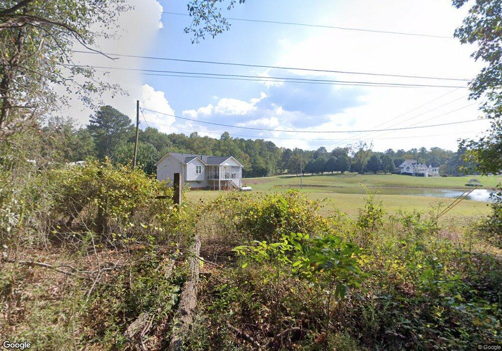
1119 Laurel Rd Carrollton, GA 30117
Estimated Value: $276,699 - $359,000
3
Beds
2
Baths
1,226
Sq Ft
$263/Sq Ft
Est. Value
About This Home
This home is located at 1119 Laurel Rd, Carrollton, GA 30117 and is currently estimated at $322,925, approximately $263 per square foot. 1119 Laurel Rd is a home located in Carroll County with nearby schools including Central Elementary School, Central Middle School, and Central High School.
Ownership History
Date
Name
Owned For
Owner Type
Purchase Details
Closed on
Feb 28, 2023
Sold by
Mcbrayer Henry T
Bought by
Mcbrayer Family Partnership Lp
Current Estimated Value
Purchase Details
Closed on
May 29, 1998
Sold by
Mcbrayer George R
Bought by
Mcbrayer Henry T
Purchase Details
Closed on
Mar 20, 1998
Sold by
Mcbrayer George
Bought by
Mcbrayer Henry T
Purchase Details
Closed on
Nov 17, 1979
Bought by
Mcbrayer George R
Create a Home Valuation Report for This Property
The Home Valuation Report is an in-depth analysis detailing your home's value as well as a comparison with similar homes in the area
Home Values in the Area
Average Home Value in this Area
Purchase History
| Date | Buyer | Sale Price | Title Company |
|---|---|---|---|
| Mcbrayer Family Partnership Lp | -- | -- | |
| Mcbrayer Henry T | -- | -- | |
| Mcbrayer Henry T | -- | -- | |
| Mcbrayer George R | -- | -- |
Source: Public Records
Tax History Compared to Growth
Tax History
| Year | Tax Paid | Tax Assessment Tax Assessment Total Assessment is a certain percentage of the fair market value that is determined by local assessors to be the total taxable value of land and additions on the property. | Land | Improvement |
|---|---|---|---|---|
| 2024 | $2,335 | $103,239 | $27,084 | $76,155 |
| 2023 | $2,336 | $91,432 | $21,667 | $69,765 |
| 2022 | $1,766 | $70,409 | $14,445 | $55,964 |
| 2021 | $1,527 | $59,568 | $11,556 | $48,012 |
| 2020 | $1,386 | $54,011 | $10,505 | $43,506 |
| 2019 | $1,300 | $50,237 | $10,505 | $39,732 |
| 2018 | $1,120 | $42,652 | $8,543 | $34,109 |
| 2017 | $1,123 | $42,652 | $8,543 | $34,109 |
| 2016 | $1,124 | $42,652 | $8,543 | $34,109 |
| 2015 | $1,089 | $38,949 | $11,969 | $26,980 |
| 2014 | $1,094 | $38,949 | $11,969 | $26,980 |
Source: Public Records
Map
Nearby Homes
- 2214 Hays Mill Rd
- 915 Oak Grove Rd
- 533 Buffalo Creek Rd
- 0 Buffalo Creek Rd Unit 10624169
- 2492 Oak Grove Church Rd
- 105 Woodbine Dr
- 345 Piney Grove Rd
- 315 Laurel Rd
- 1250 Hays Mill Rd
- 0 Bonner Rd Unit 10635754
- 400 Stripling Chapel Rd
- 195 Gold Dust Trail
- 121 Carson Place
- 399 Old Camp Church Rd
- 135 Gray Rd
- 221 Valley Ridge Dr
- 1531 Tyus Carrollton Rd
- 0 Ringer Rd Unit 10595950
- 2265 Hays Mill Rd
- 1070 Laurel Rd
- 2278 Hays Mill Rd
- 1098 Laurel Rd
- 1098 Laurel Rd
- 1098 Laurel Rd
- 1098 Laurel Rd
- 1098 Laurel Rd
- 2339 Hays Mill Rd
- 0 Laurel Rd Unit 7131914
- 1058 Laurel Rd
- 1009 Oak Grove Rd
- 2345 Hays Mill Rd
- 2207 Hays Mill Rd
- 979 Oak Grove Rd
- 945 Oak Grove Rd
- 2187 Hays Mill Rd
- 1030 Laurel Rd
- 85 Dogwood Ln
- 2405 Hays Mill Rd