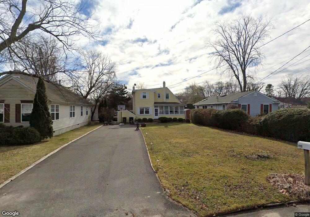
1119 Manito Rd Manasquan, NJ 08736
Estimated Value: $721,000 - $807,000
3
Beds
2
Baths
1,240
Sq Ft
$617/Sq Ft
Est. Value
About This Home
This home is located at 1119 Manito Rd, Manasquan, NJ 08736 and is currently estimated at $765,060, approximately $616 per square foot. 1119 Manito Rd is a home located in Monmouth County with nearby schools including Wall High School and The Brookside School.
Ownership History
Date
Name
Owned For
Owner Type
Purchase Details
Closed on
Aug 7, 2012
Sold by
Hahn Jamie E and Hahn James F
Bought by
Hahn James F and Hahn Monica T
Current Estimated Value
Home Financials for this Owner
Home Financials are based on the most recent Mortgage that was taken out on this home.
Original Mortgage
$139,000
Outstanding Balance
$96,021
Interest Rate
3.61%
Mortgage Type
New Conventional
Estimated Equity
$669,039
Purchase Details
Closed on
Mar 19, 2001
Sold by
Grossman Andrew
Bought by
Hahn Jamie
Home Financials for this Owner
Home Financials are based on the most recent Mortgage that was taken out on this home.
Original Mortgage
$144,000
Interest Rate
6.93%
Purchase Details
Closed on
Nov 25, 1998
Sold by
Longstreet Robin
Bought by
Grossman Andrew
Home Financials for this Owner
Home Financials are based on the most recent Mortgage that was taken out on this home.
Original Mortgage
$118,000
Interest Rate
6.8%
Create a Home Valuation Report for This Property
The Home Valuation Report is an in-depth analysis detailing your home's value as well as a comparison with similar homes in the area
Home Values in the Area
Average Home Value in this Area
Purchase History
| Date | Buyer | Sale Price | Title Company |
|---|---|---|---|
| Hahn James F | -- | None Available | |
| Hahn Jamie | $170,000 | -- | |
| Grossman Andrew | $124,000 | -- |
Source: Public Records
Mortgage History
| Date | Status | Borrower | Loan Amount |
|---|---|---|---|
| Open | Hahn James F | $139,000 | |
| Closed | Hahn Jamie | $144,000 | |
| Previous Owner | Grossman Andrew | $118,000 |
Source: Public Records
Tax History Compared to Growth
Tax History
| Year | Tax Paid | Tax Assessment Tax Assessment Total Assessment is a certain percentage of the fair market value that is determined by local assessors to be the total taxable value of land and additions on the property. | Land | Improvement |
|---|---|---|---|---|
| 2025 | $7,225 | $342,400 | $225,000 | $117,400 |
| 2024 | $7,009 | $342,400 | $225,000 | $117,400 |
| 2023 | $7,009 | $342,400 | $225,000 | $117,400 |
| 2022 | $6,838 | $342,400 | $225,000 | $117,400 |
| 2021 | $6,838 | $342,400 | $225,000 | $117,400 |
| 2020 | $6,756 | $342,400 | $225,000 | $117,400 |
| 2019 | $6,673 | $342,400 | $225,000 | $117,400 |
| 2018 | $6,615 | $342,400 | $225,000 | $117,400 |
| 2017 | $6,485 | $342,400 | $225,000 | $117,400 |
| 2016 | $6,348 | $342,400 | $225,000 | $117,400 |
| 2015 | $5,425 | $183,900 | $108,900 | $75,000 |
| 2014 | $4,995 | $173,200 | $105,000 | $68,200 |
Source: Public Records
Map
Nearby Homes
- 203 Lenape Trail
- 1210 Bayberry Rd
- 14 Lebanon Dr
- 34 Gertrude Place
- 308 South St
- 1215 Church St
- 1347 Winter View Rd
- 619 Park Ave
- 1307 W Union Ln Unit A4
- 2311 Camden Ave
- 610 Agnes Ave
- 1422 Lakewood Rd
- 3 Central Ave
- 130 Union Ave
- 300 Union Ave
- 142 Oval Rd
- 542 Woodland Ave
- 34 Broad St Unit 306
- 2253 Wagner Ln
- 2412 Greentree Dr
- 1121 Manito Rd
- 1117 Manito Rd
- 1118 Minnehaha Trail
- 1115 Manito Rd
- 1116 Minnehaha Trail
- 1120 Manito Rd
- 1122 Minnehaha Trail
- 1116 Manito Rd
- 1125 Manito Rd
- 1112 Minnehaha Trail
- 1124 Manito Rd
- 1112 Manito Rd
- 1119 Minnehaha Trail
- 1126 Minnehaha Trail
- 1119 Narrumson Rd
- 1117 Narrumson Rd
- 1126 Manito Rd
- 1121 Minnehaha Trail
- 1121 Narrumson Rd
- 1127 Manito Rd