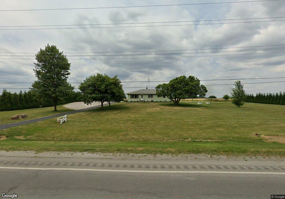
1119 S State Road 13 Pierceton, IN 46562
Estimated Value: $221,000 - $342,000
4
Beds
2
Baths
1,716
Sq Ft
$172/Sq Ft
Est. Value
About This Home
This home is located at 1119 S State Road 13, Pierceton, IN 46562 and is currently estimated at $294,723, approximately $171 per square foot. 1119 S State Road 13 is a home located in Kosciusko County with nearby schools including Whitko High School and Pierceton Woods Academy.
Ownership History
Date
Name
Owned For
Owner Type
Purchase Details
Closed on
Aug 27, 2008
Sold by
Caudill Michael D
Bought by
Pletcher Chad L and Pletcher Ashley N
Current Estimated Value
Home Financials for this Owner
Home Financials are based on the most recent Mortgage that was taken out on this home.
Original Mortgage
$100,000
Outstanding Balance
$24,030
Interest Rate
6.31%
Mortgage Type
New Conventional
Estimated Equity
$270,693
Create a Home Valuation Report for This Property
The Home Valuation Report is an in-depth analysis detailing your home's value as well as a comparison with similar homes in the area
Home Values in the Area
Average Home Value in this Area
Purchase History
| Date | Buyer | Sale Price | Title Company |
|---|---|---|---|
| Pletcher Chad L | -- | None Available |
Source: Public Records
Mortgage History
| Date | Status | Borrower | Loan Amount |
|---|---|---|---|
| Open | Pletcher Chad L | $100,000 |
Source: Public Records
Tax History Compared to Growth
Tax History
| Year | Tax Paid | Tax Assessment Tax Assessment Total Assessment is a certain percentage of the fair market value that is determined by local assessors to be the total taxable value of land and additions on the property. | Land | Improvement |
|---|---|---|---|---|
| 2024 | $1,965 | $274,300 | $25,500 | $248,800 |
| 2023 | $2,272 | $267,700 | $25,500 | $242,200 |
| 2022 | $2,078 | $249,900 | $25,500 | $224,400 |
| 2021 | $1,952 | $218,200 | $25,500 | $192,700 |
| 2020 | $1,929 | $213,100 | $23,000 | $190,100 |
| 2019 | $1,282 | $164,300 | $23,000 | $141,300 |
| 2018 | $1,247 | $157,000 | $23,000 | $134,000 |
| 2017 | $1,199 | $153,400 | $23,000 | $130,400 |
| 2016 | $1,163 | $150,600 | $22,500 | $128,100 |
| 2014 | $1,179 | $148,200 | $22,500 | $125,700 |
| 2013 | $1,179 | $148,200 | $22,500 | $125,700 |
Source: Public Records
Map
Nearby Homes
- 20 R2a Ln
- 310 N Eighth St
- 9283 E 250 S
- 102 S Seventh St
- 418 S Washington St
- 8013 E 250 S
- 0 Ash St Unit 202542596
- 0 Ash St Unit 202542666
- 1175 S 450 E
- 4406 E Wooster Rd
- 9283 E 250 S
- TBD E Adams Rd
- 481 County Line Rd
- 8 EMS Ems R2b Ln
- 11 Ems R4c Ln
- 273 Ems R4 Ln
- 0 County Road 325 N
- 2890 S 400 E
- 60 Ems B24 Ln
- 3393 E Old Road 30
- 1190 S State Road 13
- 1048 S State Road 13
- 1233 S State Road 13
- 1236 S State Road 13
- 1263 S State Road 13
- 1268 S State Road 13
- 7232 E Heritage Dr
- 952 S State Road 13
- 7085 E 125 S
- 0 N 950 W-92 Unit 201715912
- 450 E Center Street (Sidney) Unit East edge of Sidney
- TBD Lakeridge Dr Unit 2
- 2614 N Sr 13
- 9450 N 150 S
- TBD Ems B29 Unit 1
- 0 0 S Washington Street Lot 9 Unit 8
- 0 0 S Washington Street Lot 8 Unit 8
- 0 0 S Washington Street Lot 7 Unit 7
- 0 0 Cr 125 S
- 0 Ems B24 Ln Unit 512783