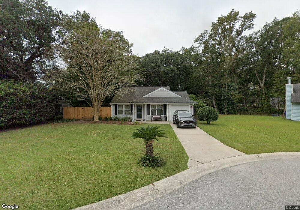
1119 Sexton Dr Charleston, SC 29412
James Island NeighborhoodEstimated Value: $445,000 - $528,000
2
Beds
2
Baths
1,018
Sq Ft
$474/Sq Ft
Est. Value
About This Home
This home is located at 1119 Sexton Dr, Charleston, SC 29412 and is currently estimated at $482,301, approximately $473 per square foot. 1119 Sexton Dr is a home located in Charleston County with nearby schools including James Island Elementary School, Camp Road Middle, and Septima P Clark Corporate Academy.
Ownership History
Date
Name
Owned For
Owner Type
Purchase Details
Closed on
Nov 20, 2020
Sold by
Jewett Jeffrey M and Jewett Catherine F
Bought by
Jewett Catherine F
Current Estimated Value
Purchase Details
Closed on
Oct 23, 2020
Sold by
Jewett Catherine F
Bought by
Jewett Christopher Scoff and Jewett Christopher Scoff
Purchase Details
Closed on
Oct 11, 2018
Sold by
Slagel Matthew S and Slagel Laura T
Bought by
Jewett Jeffrey M and Jewett Catherine F
Purchase Details
Closed on
Sep 25, 2007
Sold by
Flanagan Janine M
Bought by
Slagel Matthew J and Slagel Laura T
Home Financials for this Owner
Home Financials are based on the most recent Mortgage that was taken out on this home.
Original Mortgage
$190,023
Interest Rate
6.41%
Mortgage Type
Purchase Money Mortgage
Purchase Details
Closed on
Dec 30, 1999
Sold by
Bonner Frank L
Bought by
Flanagan Janine M
Create a Home Valuation Report for This Property
The Home Valuation Report is an in-depth analysis detailing your home's value as well as a comparison with similar homes in the area
Home Values in the Area
Average Home Value in this Area
Purchase History
| Date | Buyer | Sale Price | Title Company |
|---|---|---|---|
| Jewett Catherine F | -- | None Available | |
| Jewett Christopher Scoff | -- | None Available | |
| Jewett Jeffrey M | $250,000 | None Available | |
| Slagel Matthew J | $195,900 | Attorney | |
| Flanagan Janine M | $99,900 | -- |
Source: Public Records
Mortgage History
| Date | Status | Borrower | Loan Amount |
|---|---|---|---|
| Previous Owner | Slagel Matthew J | $190,023 |
Source: Public Records
Tax History Compared to Growth
Tax History
| Year | Tax Paid | Tax Assessment Tax Assessment Total Assessment is a certain percentage of the fair market value that is determined by local assessors to be the total taxable value of land and additions on the property. | Land | Improvement |
|---|---|---|---|---|
| 2024 | $1,384 | $10,000 | $0 | $0 |
| 2023 | $1,384 | $10,000 | $0 | $0 |
| 2022 | $1,271 | $10,000 | $0 | $0 |
| 2021 | $1,331 | $10,000 | $0 | $0 |
| 2020 | $3,982 | $15,000 | $0 | $0 |
| 2019 | $4,173 | $15,000 | $0 | $0 |
| 2017 | $2,666 | $9,900 | $0 | $0 |
| 2016 | $2,581 | $9,900 | $0 | $0 |
| 2015 | $918 | $9,900 | $0 | $0 |
| 2014 | $870 | $0 | $0 | $0 |
| 2011 | -- | $0 | $0 | $0 |
Source: Public Records
Map
Nearby Homes
- 1153 Pauline Ave
- 1135 Bellwood Rd
- 1152 Bradford Ave
- 1030 Pauline Ave
- 1182 Folly Rd Unit A,B,C,D
- 1014 Arborwood Dr
- 1047 Bradford Ave
- 1206 Folly Rd
- 1530 Fort Johnson Rd Unit 1E
- 1530 Fort Johnson Rd Unit 1L
- 1107 Secessionville Rd
- 1232 Silverleaf Cir
- 1056 Yorktown Dr
- 1418 Kentwood Cir
- 1815 Walsingham Way
- 1453 Camp Rd
- 1540 Fort Johnson Rd
- 1764 Ashworth Ln
- 1039 Yorktown Dr
- 1 S Anderson Ave
- 1091 Oakcrest Dr
- 1115 Sexton Dr
- 1087 Oakcrest Dr
- 1122 Sexton Dr
- 1126 Pauline Ave
- 1120 Pauline Ave
- 1083 Oakcrest Dr
- 1110 Sexton Dr
- 1114 Sexton Dr
- 1118 Sexton Dr
- 1130 Pauline Ave
- 1114 Pauline Ave
- 1094 Oakcrest Dr
- 1084 Oakcrest Dr
- 1079 Oakcrest Dr
- 1136 Pauline Ave
- 1097 Oakcrest Dr
- 1515 Kentwood Cir
- 1108 Pauline Ave
- 1510 Kentwood Cir