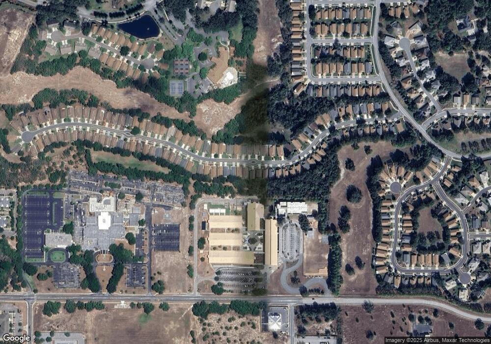
11190 Heathrow Ave Spring Hill, FL 34609
Estimated Value: $233,000 - $251,000
2
Beds
2
Baths
1,878
Sq Ft
$129/Sq Ft
Est. Value
About This Home
This home is located at 11190 Heathrow Ave, Spring Hill, FL 34609 and is currently estimated at $241,681, approximately $128 per square foot. 11190 Heathrow Ave is a home located in Hernando County with nearby schools including Suncoast Elementary School, Powell Middle School, and Frank W. Springstead High School.
Ownership History
Date
Name
Owned For
Owner Type
Purchase Details
Closed on
Mar 31, 2009
Sold by
Denapoli Albert J and Denapoli Josephine
Bought by
Figueroa Frank J and Figueroa Arlene
Current Estimated Value
Home Financials for this Owner
Home Financials are based on the most recent Mortgage that was taken out on this home.
Original Mortgage
$112,917
Outstanding Balance
$71,067
Interest Rate
5.1%
Mortgage Type
FHA
Estimated Equity
$170,614
Create a Home Valuation Report for This Property
The Home Valuation Report is an in-depth analysis detailing your home's value as well as a comparison with similar homes in the area
Home Values in the Area
Average Home Value in this Area
Purchase History
| Date | Buyer | Sale Price | Title Company |
|---|---|---|---|
| Figueroa Frank J | $115,000 | Clear Title Of Hernando Inc |
Source: Public Records
Mortgage History
| Date | Status | Borrower | Loan Amount |
|---|---|---|---|
| Open | Figueroa Frank J | $112,917 |
Source: Public Records
Tax History Compared to Growth
Tax History
| Year | Tax Paid | Tax Assessment Tax Assessment Total Assessment is a certain percentage of the fair market value that is determined by local assessors to be the total taxable value of land and additions on the property. | Land | Improvement |
|---|---|---|---|---|
| 2025 | $1,574 | $102,232 | -- | -- |
| 2024 | $1,475 | $99,351 | -- | -- |
| 2023 | $1,475 | $96,457 | $0 | $0 |
| 2022 | $1,381 | $93,648 | $0 | $0 |
| 2021 | $841 | $90,920 | $0 | $0 |
| 2020 | $1,268 | $89,665 | $0 | $0 |
| 2019 | $1,258 | $87,649 | $0 | $0 |
| 2018 | $712 | $86,015 | $0 | $0 |
| 2017 | $969 | $84,246 | $0 | $0 |
| 2016 | $934 | $82,513 | $0 | $0 |
| 2015 | $935 | $81,939 | $0 | $0 |
| 2014 | $901 | $81,289 | $0 | $0 |
Source: Public Records
Map
Nearby Homes
- 11158 Heathrow Ave
- 283 Quane Ave
- 189 Center Oak Cir
- 371 Quane Ave
- 232 Center Oak Cir
- 11261 McRacken Dr
- 265 Center Oak Cir
- 0 Centerwood Ave Unit MFRTB8450965
- 11330 Leeds Dr
- 11121 Cherrywood Ct
- 11078 Heathrow Ave
- 114 Center Oak Cir
- 412 Mistwood Ct
- 11343 Leeds Dr
- 453 Candlestone Ct
- 402 & 406 Candlestone Ct
- 401 & 405 Candlestone Ct
- 449 Candlestone Ct
- 416 Mistwood Ct
- 432 Mistwood Ct
- 11186 Heathrow Ave
- 11194 Heathrow Ave
- 11182 Heathrow Ave
- 11198 Heathrow Ave
- 11178 Heathrow Ave
- 11202 Heathrow Ave
- 11189 Heathrow Ave
- 11193 Heathrow Ave
- 11174 Heathrow Ave
- 11206 Heathrow Ave
- 11197 Heathrow Ave
- 11179 Heathrow Ave
- 11201 Heathrow Ave
- 11170 Heathrow Ave
- 11210 Heathrow Ave
- 11175 Heathrow Ave
- 11207 Heathrow Ave
- 11166 Heathrow Ave
- 11171 Heathrow Ave
- 11214 Heathrow Ave
