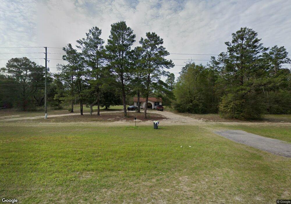
11190 Us Highway 90 W Defuniak Springs, FL 32433
Estimated Value: $111,551 - $426,000
2
Beds
1
Bath
640
Sq Ft
$346/Sq Ft
Est. Value
About This Home
This home is located at 11190 Us Highway 90 W, Defuniak Springs, FL 32433 and is currently estimated at $221,638, approximately $346 per square foot. 11190 Us Highway 90 W is a home with nearby schools including Mossy Head School, Walton Middle School, and Walton High School.
Ownership History
Date
Name
Owned For
Owner Type
Purchase Details
Closed on
Feb 2, 2006
Sold by
Rodwell John R
Bought by
Rodwell Catherine
Current Estimated Value
Purchase Details
Closed on
Jan 30, 2006
Sold by
Rodwell Catherine
Bought by
Porter Gordon and Porter Michael Eldon
Purchase Details
Closed on
Jan 23, 2006
Sold by
Mcneill Donald Britton
Bought by
Porter Gordon and Porter Michael Eldon
Purchase Details
Closed on
Jan 18, 2006
Sold by
Johnson Donna Lee Mcneill and Mcneill Donna Lee
Bought by
Porter Gordon and Porter Michael Eldon
Purchase Details
Closed on
Jan 17, 2006
Sold by
Richbourg Margaret Jean Britton and Richbourg Margaret B
Bought by
Porter Gordon and Porter Michael Eldon
Purchase Details
Closed on
Jan 11, 2006
Sold by
Britton Thomas Feagan and Britton Thomas F
Bought by
Porter Gordon and Porter Michael Eldon
Purchase Details
Closed on
Sep 16, 2005
Sold by
The Internal Improvement Trust Fund Of T
Bought by
Britton Hazel S and Britton Rodwell E
Create a Home Valuation Report for This Property
The Home Valuation Report is an in-depth analysis detailing your home's value as well as a comparison with similar homes in the area
Home Values in the Area
Average Home Value in this Area
Purchase History
| Date | Buyer | Sale Price | Title Company |
|---|---|---|---|
| Rodwell Catherine | -- | First Natl Land Title Co Inc | |
| Rodwell Catherine | -- | First Natl Land Title Co Inc | |
| Porter Gordon | $6,800 | First Natl Land Title Co Inc | |
| Rodwell Catherine | -- | First Natl Land Title Co Inc | |
| Porter Gordon | $1,300 | First Natl Land Title Co Inc | |
| Porter Gordon | $1,300 | First Natl Land Title Co Inc | |
| Porter Gordon | $7,800 | First Natl Land Title Co Inc | |
| Porter Gordon | $7,800 | First Natl Land Title Co Inc | |
| Porter Gordon | $2,600 | First Natl Land Title Co Inc | |
| Porter Gordon | $2,600 | First Natl Land Title Co Inc | |
| Britton Hazel S | -- | None Available |
Source: Public Records
Tax History Compared to Growth
Tax History
| Year | Tax Paid | Tax Assessment Tax Assessment Total Assessment is a certain percentage of the fair market value that is determined by local assessors to be the total taxable value of land and additions on the property. | Land | Improvement |
|---|---|---|---|---|
| 2024 | $575 | $62,814 | $12,000 | $50,814 |
| 2023 | $575 | $54,605 | $0 | $0 |
| 2022 | $551 | $61,561 | $16,266 | $45,295 |
| 2021 | $486 | $46,728 | $13,421 | $33,307 |
| 2020 | $454 | $41,025 | $11,247 | $29,778 |
| 2019 | $441 | $39,811 | $10,920 | $28,891 |
| 2018 | $433 | $38,776 | $0 | $0 |
| 2017 | $430 | $38,320 | $10,500 | $27,820 |
| 2016 | $432 | $38,118 | $0 | $0 |
| 2015 | $433 | $37,589 | $0 | $0 |
| 2014 | $442 | $37,975 | $0 | $0 |
Source: Public Records
Map
Nearby Homes
- 5 Acres Carol Ln
- 267 Donna Ln
- 172 Frazier Rd
- 7700 US Hwy 90w
- 134 Post Oak Rd
- 125 Roberts Rd W
- LOT 21 Us Hwy 90 W & Lancelot Rd
- 538 Majestic Blvd
- TBD Camelot Ave
- 394 Majestic Blvd
- 1700 County Highway 1087
- 484 Hamlet Dr
- 0 Round Table Rd Unit 986133
- 675 Spring Hill Rd
- Lot 5 Round Table Rd
- Lot 2 Round Table Rd
- Lot 1 Round Table Rd
- 00 Round Table Rd
- .9 Ac Round Table Rd
- 799 O'Sage Dr
- 000 Abt Martin Ave
- 281 Abt Martin Ave
- 178 Abt Martin Ave
- 11986 Us Highway 90 W
- 166 Michaelmas Cir
- 241 Abt Martin Ave
- 193 Michaelmas Cir
- 194 Michaelmas Cir
- 70 Michaelmas Cir
- Lot 8 Michaelmas Cir
- 97 Michaelmas Cir
- 50 Michaelmas Cir
- 75 Michaelmas Cir
- 240 Michaelmas Cir
- 8.3 Acres Cr 1883
- 218 County Highway 1087
- 49 Michaelmas Cir
- 337 Michaelmas Cir
- 57 Michaelmas Cir
- 55 Oakridge Way