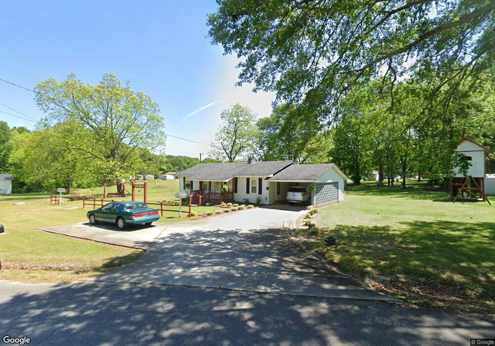
112 Adams Cir Bowman, GA 30624
Estimated Value: $110,106 - $173,000
Studio
1
Bath
1,008
Sq Ft
$137/Sq Ft
Est. Value
About This Home
This home is located at 112 Adams Cir, Bowman, GA 30624 and is currently estimated at $137,777, approximately $136 per square foot. 112 Adams Cir is a home located in Elbert County with nearby schools including Elbert County Elementary School, Elbert County Primary School, and Elbert County Middle School.
Ownership History
Date
Name
Owned For
Owner Type
Purchase Details
Closed on
Jun 6, 2011
Sold by
Teasley Alfred
Bought by
Teasley Larry D
Current Estimated Value
Purchase Details
Closed on
Jul 25, 2007
Sold by
Teasley Reginald
Bought by
Teasley Larry D
Purchase Details
Closed on
Feb 7, 2007
Sold by
Teasley Willie Ruth
Bought by
Teasley Larry D
Purchase Details
Closed on
Feb 6, 2007
Sold by
Teasley Cynthia
Bought by
Teasley Larry D
Purchase Details
Closed on
Apr 1, 1991
Purchase Details
Closed on
Feb 1, 1991
Purchase Details
Closed on
Feb 1, 1981
Purchase Details
Closed on
Nov 1, 1965
Create a Home Valuation Report for This Property
The Home Valuation Report is an in-depth analysis detailing your home's value as well as a comparison with similar homes in the area
Purchase History
| Date | Buyer | Sale Price | Title Company |
|---|---|---|---|
| Teasley Larry D | -- | -- | |
| Teasley Larry D | -- | -- | |
| Teasley Larry D | -- | -- | |
| Teasley Larry D | -- | -- | |
| -- | -- | -- | |
| -- | -- | -- | |
| -- | -- | -- | |
| -- | -- | -- |
Source: Public Records
Tax History
| Year | Tax Paid | Tax Assessment Tax Assessment Total Assessment is a certain percentage of the fair market value that is determined by local assessors to be the total taxable value of land and additions on the property. | Land | Improvement |
|---|---|---|---|---|
| 2025 | $471 | $41,452 | $2,760 | $38,692 |
| 2024 | $694 | $38,226 | $2,400 | $35,826 |
| 2023 | $694 | $38,226 | $2,400 | $35,826 |
| 2022 | $377 | $25,330 | $2,040 | $23,290 |
| 2021 | $380 | $25,330 | $2,040 | $23,290 |
| 2020 | $364 | $23,193 | $2,400 | $20,793 |
| 2019 | $376 | $23,193 | $2,400 | $20,793 |
| 2018 | $384 | $23,193 | $2,400 | $20,793 |
| 2017 | $307 | $19,786 | $2,400 | $17,386 |
| 2016 | $287 | $19,786 | $2,400 | $17,386 |
| 2015 | -- | $19,786 | $2,400 | $17,386 |
| 2014 | -- | $19,786 | $2,400 | $17,386 |
| 2013 | -- | $18,946 | $2,400 | $16,546 |
Source: Public Records
Map
Nearby Homes
- 231 Roosevelt Cir
- 260 Roosevelt Cir
- 0 Bowers St Unit LOT 1-8 10576344
- 0 Bowers St Unit LOT 1-8
- 494 S Broad St
- 0 Five Forks Rd Unit 10619685
- 0 Jess Guest Rd Unit CL336922
- 0 Jess Guest Rd Unit 10713982
- 0 Jess Guest Rd Unit 10586921
- 0 Jess Guest Rd Unit CL351681
- 2661 Brickyard Rd
- 8714 Georgia 172
- 0 Fork Creek Rd Unit CL350628
- 0 Fork Creek Rd Unit 7728987
- 0 Fork Creek Rd Unit 10702901
- 2115 Dusty Rd
- 0 Dusty Rd Unit 10569563
- 0 Dusty Rd Unit 7619983
- 825 Robert Reid Rd
- 00 Bowman Hwy
- 84 Jackson St
- 100 Jackson St
- 134 Adams Cir
- 127 Adams Cir
- 91 Adams Cir
- 112 Roosevelt Cir
- 0 Adams Cir
- 136 Adams Cir
- 117 Jackson St
- 139 Roosevelt Cir
- 79 Adams Cir
- 125 Jackson St
- 151 Adams Cir
- 158 Adams Cir
- 131 Jackson St
- 142 Jackson St
- 139 Jackson St
- 0 Roosevelt Cir Unit B05 008 7024694
- 0 Roosevelt Cir Unit CM921287
- 0 Roosevelt Cir Unit CM909890
Your Personal Tour Guide
Ask me questions while you tour the home.