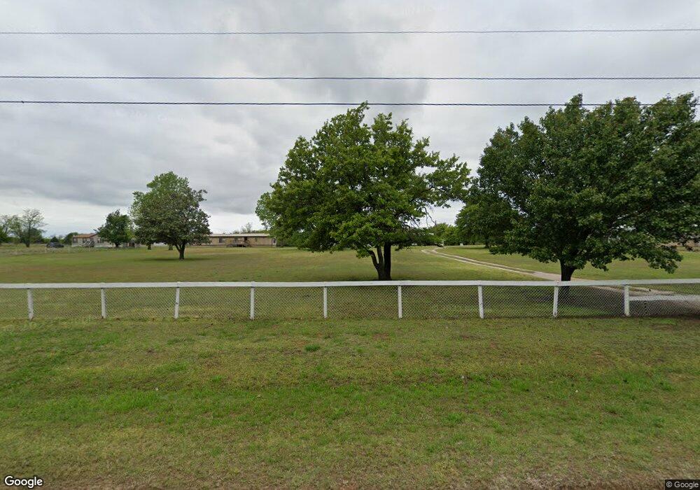
112 Amber Ridge Shawnee, OK 74801
Estimated Value: $162,094 - $196,000
3
Beds
1
Bath
1,040
Sq Ft
$174/Sq Ft
Est. Value
About This Home
This home is located at 112 Amber Ridge, Shawnee, OK 74801 and is currently estimated at $181,365, approximately $174 per square foot. 112 Amber Ridge is a home located in Pottawatomie County with nearby schools including Bethel Elementary School, Bethel Middle School, and Bethel High School.
Ownership History
Date
Name
Owned For
Owner Type
Purchase Details
Closed on
Aug 8, 2014
Sold by
Stiles Darrell G and Stiles Shirle
Bought by
Stiles Darrell G and Stiles Shirle
Current Estimated Value
Purchase Details
Closed on
Jan 11, 2010
Sold by
Stiles Darrell G
Bought by
Stiles Darrell G and Robison Shirley A
Purchase Details
Closed on
Sep 8, 2004
Sold by
Moody Shirley A
Bought by
Stiles Darrell G and Stiles Keli M
Create a Home Valuation Report for This Property
The Home Valuation Report is an in-depth analysis detailing your home's value as well as a comparison with similar homes in the area
Home Values in the Area
Average Home Value in this Area
Purchase History
| Date | Buyer | Sale Price | Title Company |
|---|---|---|---|
| Stiles Darrell G | -- | -- | |
| Stiles Darrell G | -- | None Available | |
| Stiles Darrell G | -- | None Available |
Source: Public Records
Tax History
| Year | Tax Paid | Tax Assessment Tax Assessment Total Assessment is a certain percentage of the fair market value that is determined by local assessors to be the total taxable value of land and additions on the property. | Land | Improvement |
|---|---|---|---|---|
| 2025 | $282 | $4,674 | $2,417 | $2,257 |
| 2024 | $286 | $4,673 | $2,605 | $2,068 |
| 2023 | $286 | $4,673 | $2,449 | $2,224 |
| 2022 | $281 | $4,673 | $2,449 | $2,224 |
| 2021 | $291 | $4,673 | $2,449 | $2,224 |
| 2020 | $289 | $4,673 | $2,449 | $2,224 |
| 2019 | $290 | $4,673 | $2,449 | $2,224 |
| 2018 | $286 | $4,673 | $2,449 | $2,224 |
| 2017 | $258 | $4,673 | $2,449 | $2,224 |
| 2016 | $260 | $4,673 | $2,449 | $2,224 |
| 2015 | $415 | $4,263 | $1,330 | $2,933 |
| 2014 | -- | $4,060 | $1,280 | $2,780 |
Source: Public Records
Map
Nearby Homes
- 31609 Clearpond Rd
- 31706 Hardesty Rd
- 30404 Lake Rd
- 31509 Homer Lane #B Ln
- 31509 Homer Lane Rd
- 36 Limberlost
- 33109 Hardesty Rd
- 0 NE Rd Unit 1207810
- 16244 Patterson Rd
- 11 Tonya Rd
- 33600 Post Office Neck Rd
- 0 Tract 4 Waco Rd Unit 1207822
- 0 Tract 7 Waco Rd Unit 1207834
- 189 Terry Ln
- 16103 Highway 102
- 30002 Homer Lane Rd
- 15969 Pecan Rd
- 29192 Osage Hills Dr
- 167 Betty Dr
- 15957 Pecan Rd
- 110 Amber Ridge
- 210 Amber Ridge
- 118 Amber Ridge
- 102 Amber Ridge
- 130 Amber Ridge
- 122 Amber Ridge
- 103 Amber Ridge
- 31804 Clear Pond Rd
- 31606 Clearpond Rd
- 26 Amber Ridge
- 209 Amber Ridge
- 16606 Patterson Rd
- 127 Amber Ridge
- 16602 Patterson Rd
- 16810 Patterson Rd
- 31 Amber Ridge
- 31504 Clearpond Rd
- 208 Amber Ridge
- 16510 Patterson Rd
- 128 Amber Ridge
