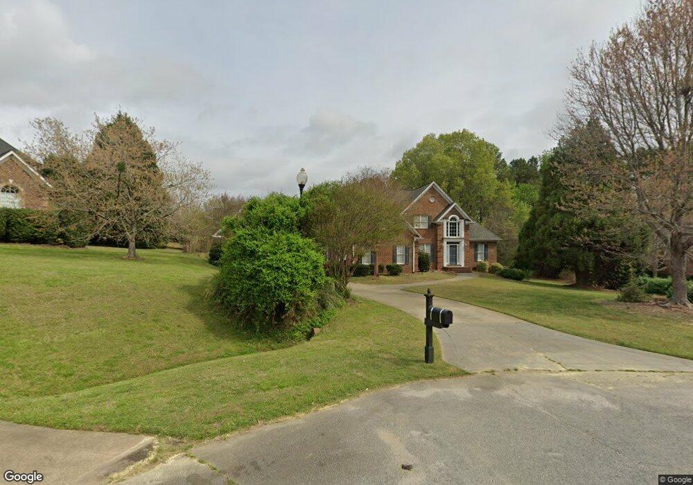
112 Amberley Ct Garner, NC 27529
Estimated Value: $628,586 - $733,000
3
Beds
3
Baths
2,688
Sq Ft
$251/Sq Ft
Est. Value
About This Home
This home is located at 112 Amberley Ct, Garner, NC 27529 and is currently estimated at $674,147, approximately $250 per square foot. 112 Amberley Ct is a home located in Johnston County with nearby schools including West View Elementary School, Cleveland Middle School, and West Johnston High School.
Ownership History
Date
Name
Owned For
Owner Type
Purchase Details
Closed on
Jul 12, 2012
Sold by
Marcom Jeffrey W
Bought by
Marcom Allison
Current Estimated Value
Purchase Details
Closed on
Apr 18, 2011
Sold by
Citimortgage Inc
Bought by
Marcom Jeffrey W and Marcom Allison T
Home Financials for this Owner
Home Financials are based on the most recent Mortgage that was taken out on this home.
Original Mortgage
$236,000
Outstanding Balance
$163,047
Interest Rate
4.83%
Mortgage Type
New Conventional
Estimated Equity
$511,100
Purchase Details
Closed on
Feb 15, 2011
Sold by
Dutton John E and Dutton Karen R
Bought by
Citimortgage Inc
Purchase Details
Closed on
Oct 13, 2003
Sold by
Dutton John
Bought by
Pomarico Construction Corp
Purchase Details
Closed on
Aug 13, 2002
Sold by
Pomarico Construction Corp
Bought by
S & S Land Development, Llc
Create a Home Valuation Report for This Property
The Home Valuation Report is an in-depth analysis detailing your home's value as well as a comparison with similar homes in the area
Home Values in the Area
Average Home Value in this Area
Purchase History
| Date | Buyer | Sale Price | Title Company |
|---|---|---|---|
| Marcom Allison | -- | None Available | |
| Marcom Jeffrey W | $295,000 | Chicago Title Insurance Co | |
| Citimortgage Inc | $327,600 | None Available | |
| Pomarico Construction Corp | $399,000 | -- | |
| S & S Land Development, Llc | $42,000 | -- |
Source: Public Records
Mortgage History
| Date | Status | Borrower | Loan Amount |
|---|---|---|---|
| Open | Marcom Jeffrey W | $236,000 |
Source: Public Records
Tax History
| Year | Tax Paid | Tax Assessment Tax Assessment Total Assessment is a certain percentage of the fair market value that is determined by local assessors to be the total taxable value of land and additions on the property. | Land | Improvement |
|---|---|---|---|---|
| 2025 | $4,117 | $648,390 | $125,000 | $523,390 |
| 2024 | $3,205 | $395,710 | $65,000 | $330,710 |
| 2023 | $3,106 | $395,710 | $65,000 | $330,710 |
| 2022 | $3,205 | $395,710 | $65,000 | $330,710 |
| 2021 | $3,205 | $395,710 | $65,000 | $330,710 |
| 2020 | $3,324 | $395,710 | $65,000 | $330,710 |
| 2019 | $3,245 | $395,710 | $65,000 | $330,710 |
| 2018 | $3,110 | $370,230 | $55,000 | $315,230 |
| 2017 | $3,110 | $370,230 | $55,000 | $315,230 |
| 2016 | $3,110 | $370,230 | $55,000 | $315,230 |
| 2015 | $3,110 | $370,230 | $55,000 | $315,230 |
| 2014 | $3,110 | $370,230 | $55,000 | $315,230 |
Source: Public Records
Map
Nearby Homes
- 648 Fieldtrial Cir
- 232 Fawn Hill Ct
- 181 Fawn Hill Ct
- 50 Linden Ct
- 356 Fieldtrial Cir
- 236 Fieldtrial Cir
- 403 Airedale Trail
- 222 Susan Dr
- 111 Artic Cir
- 200 Reese Dr
- 131 Artic Cir
- 58 Trailblazer Ln
- 55 Dolores Ct
- 304 Artic Cir
- 368 Artic Cir
- 595 Durwood Dr
- 10609 Orchid Ln
- 113 Hogan Dr
- 866 Black Angus Dr
- 248 Old Hickory Dr
- 115 Amberley Ct
- 108 Amberley Ct
- 110 Wyndham Dr
- 114 Wyndham Dr
- 106 Wyndham Dr
- 111 Amberley Ct
- 118 Wyndham Dr
- 0 Wyndham Dr Unit 1673665
- 0 Wyndham Dr Unit 5 TR1673665
- 118 Wyndham Dr Unit 5
- 133 Breckenridge Dr
- 133 Breckenridge Dr Unit 23
- 104 Amberley Ct
- 137 Breckenridge Dr
- 107 Amberley Ct
- 102 Wyndham Dr
- 129 Breckenridge Dr
- 109 Wyndham Dr
- 123 Breckenridge Dr Unit 21
- 123 Breckenridge Dr
Your Personal Tour Guide
Ask me questions while you tour the home.