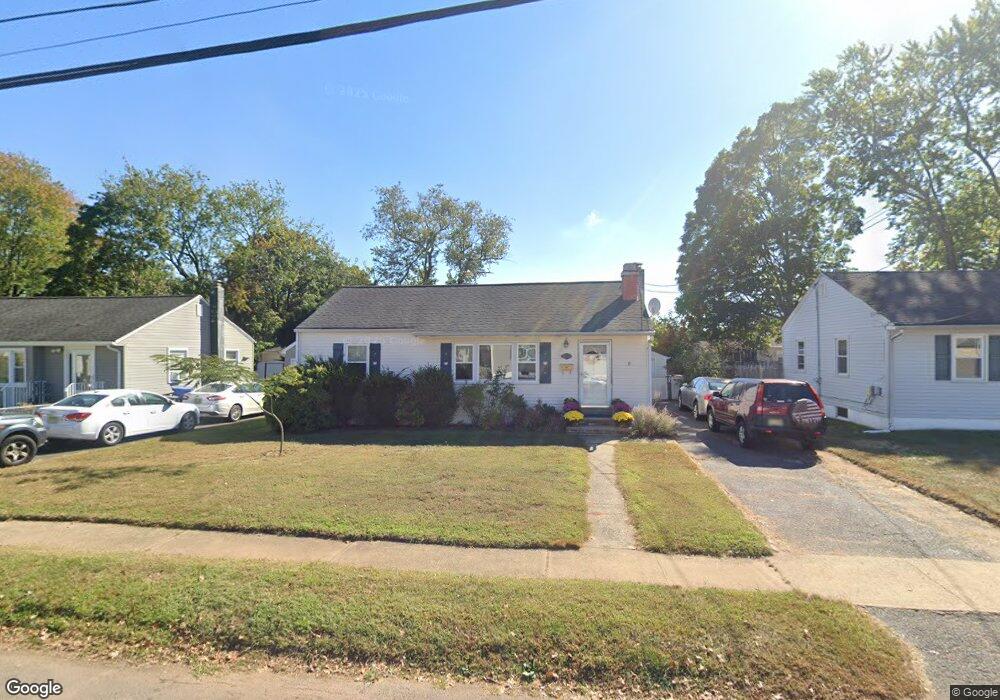
112 Atlantic St South Plainfield, NJ 07080
Estimated Value: $382,123 - $579,000
--
Bed
--
Bath
1,083
Sq Ft
$470/Sq Ft
Est. Value
About This Home
This home is located at 112 Atlantic St, South Plainfield, NJ 07080 and is currently estimated at $509,531, approximately $470 per square foot. 112 Atlantic St is a home located in Middlesex County with nearby schools including South Plainfield High School and The Queen City Academy Charter School.
Ownership History
Date
Name
Owned For
Owner Type
Purchase Details
Closed on
Nov 13, 2001
Sold by
Soper Keith
Bought by
Lee Richard and Lee Christine
Current Estimated Value
Home Financials for this Owner
Home Financials are based on the most recent Mortgage that was taken out on this home.
Original Mortgage
$132,000
Outstanding Balance
$50,907
Interest Rate
6.54%
Estimated Equity
$458,624
Purchase Details
Closed on
Mar 30, 1999
Sold by
Kennedy Richard
Bought by
Soper Keith and Soper Bobbi Jo
Home Financials for this Owner
Home Financials are based on the most recent Mortgage that was taken out on this home.
Original Mortgage
$105,000
Interest Rate
6.95%
Create a Home Valuation Report for This Property
The Home Valuation Report is an in-depth analysis detailing your home's value as well as a comparison with similar homes in the area
Home Values in the Area
Average Home Value in this Area
Purchase History
| Date | Buyer | Sale Price | Title Company |
|---|---|---|---|
| Lee Richard | $183,000 | -- | |
| Soper Keith | $122,000 | -- |
Source: Public Records
Mortgage History
| Date | Status | Borrower | Loan Amount |
|---|---|---|---|
| Open | Lee Richard | $132,000 | |
| Previous Owner | Soper Keith | $105,000 |
Source: Public Records
Tax History Compared to Growth
Tax History
| Year | Tax Paid | Tax Assessment Tax Assessment Total Assessment is a certain percentage of the fair market value that is determined by local assessors to be the total taxable value of land and additions on the property. | Land | Improvement |
|---|---|---|---|---|
| 2025 | $6,116 | $87,600 | $26,200 | $61,400 |
| 2024 | $5,850 | $87,600 | $26,200 | $61,400 |
| 2023 | $5,850 | $87,600 | $26,200 | $61,400 |
| 2022 | $5,777 | $87,600 | $26,200 | $61,400 |
| 2021 | $5,641 | $87,600 | $26,200 | $61,400 |
| 2020 | $5,559 | $87,600 | $26,200 | $61,400 |
| 2019 | $5,334 | $87,600 | $26,200 | $61,400 |
| 2018 | $5,196 | $87,600 | $26,200 | $61,400 |
| 2017 | $5,130 | $87,600 | $26,200 | $61,400 |
| 2016 | $5,078 | $87,600 | $26,200 | $61,400 |
| 2015 | $4,991 | $87,600 | $26,200 | $61,400 |
| 2014 | $4,847 | $87,600 | $26,200 | $61,400 |
Source: Public Records
Map
Nearby Homes
- 1631 Brunella Ave
- 1502 Chestnut St
- 1621 Albert St
- 1212 Mcdonough St
- 1534 Chestnut St
- 1205 S 10th St
- 1211 S 9th St
- 1620 Quincy St
- 1724 Quincy St
- 1401 Cherry St
- 1548 Dumont Ave
- 1433 Dogwood Dr
- 1119 S 9th St
- 1565 W 6th St
- 1825 Brunella Ave
- 1533 Clinton Ave
- 1515 Dogwood Dr
- 1115 Cherry St
- 525 Pleasant Ave
- 118 Atlantic St
- 108 Atlantic St
- 111 Sussex St
- 115 Sussex St
- 100 Atlantic St
- 107 Sussex St
- 101 Cumberland St
- 101 Sussex St
- 139 Hudson St
- 145 Hudson St
- 135 Hudson St
- 105 Cumberland St
- 106 Cumberland St
- 1325 New Brunswick Ave
- 1352 New Brunswick Ave
- 111 Cumberland St
- 108 Sussex St
- 106 Sussex St
- 110 Cumberland St
- 1340 New Brunswick Ave