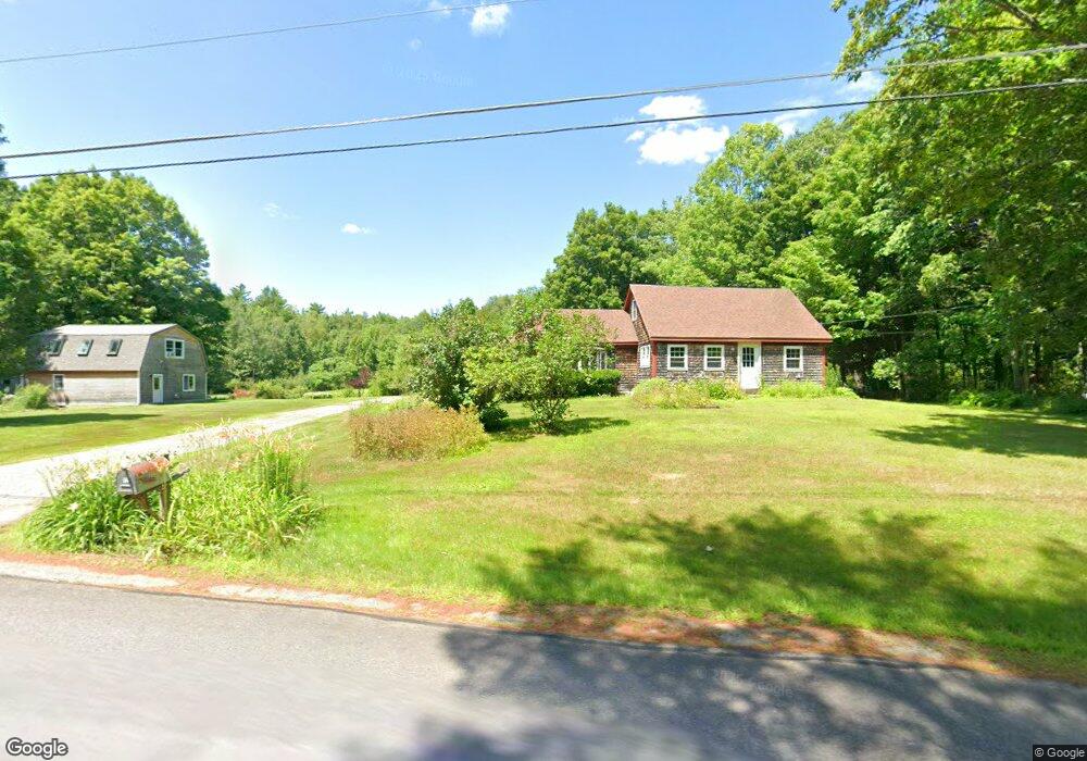
112 Barton Rd Windsor, ME 04363
Estimated Value: $352,000 - $423,000
Studio
--
Bath
--
Sq Ft
8.7
Acres
About This Home
This home is located at 112 Barton Rd, Windsor, ME 04363 and is currently estimated at $387,431. 112 Barton Rd is a home with nearby schools including Windsor Elementary School.
Ownership History
Date
Name
Owned For
Owner Type
Purchase Details
Closed on
Apr 23, 2013
Sold by
Bellemare Adam J and Cox Megan E
Bought by
Bellemare Adam J and Doak Melissa A
Current Estimated Value
Home Financials for this Owner
Home Financials are based on the most recent Mortgage that was taken out on this home.
Original Mortgage
$113,000
Interest Rate
3.52%
Mortgage Type
Commercial
Purchase Details
Closed on
Oct 31, 2006
Sold by
Cox Megan E and Cox David R
Bought by
Bellemare Adam and Cox Megan E
Home Financials for this Owner
Home Financials are based on the most recent Mortgage that was taken out on this home.
Original Mortgage
$113,250
Interest Rate
6.48%
Mortgage Type
Commercial
Create a Home Valuation Report for This Property
The Home Valuation Report is an in-depth analysis detailing your home's value as well as a comparison with similar homes in the area
Home Values in the Area
Average Home Value in this Area
Purchase History
| Date | Buyer | Sale Price | Title Company |
|---|---|---|---|
| Bellemare Adam J | -- | -- | |
| Bellemare Adam | -- | -- |
Source: Public Records
Mortgage History
| Date | Status | Borrower | Loan Amount |
|---|---|---|---|
| Closed | Bellemare Adam J | $113,000 | |
| Closed | Bellemare Adam | $113,250 |
Source: Public Records
Tax History
| Year | Tax Paid | Tax Assessment Tax Assessment Total Assessment is a certain percentage of the fair market value that is determined by local assessors to be the total taxable value of land and additions on the property. | Land | Improvement |
|---|---|---|---|---|
| 2024 | $3,509 | $381,400 | $53,000 | $328,400 |
| 2023 | $2,949 | $203,400 | $31,400 | $172,000 |
| 2022 | $2,787 | $203,400 | $31,400 | $172,000 |
| 2021 | $2,644 | $203,400 | $31,400 | $172,000 |
| 2020 | $2,604 | $203,400 | $31,400 | $172,000 |
| 2019 | $2,583 | $203,400 | $31,400 | $172,000 |
| 2018 | $2,624 | $203,400 | $31,400 | $172,000 |
| 2017 | $2,604 | $203,400 | $31,400 | $172,000 |
| 2016 | $2,375 | $187,000 | $31,400 | $155,600 |
| 2015 | $2,225 | $187,000 | $31,400 | $155,600 |
| 2014 | $2,196 | $168,900 | $31,400 | $137,500 |
| 2013 | $2,229 | $168,900 | $31,400 | $137,500 |
Source: Public Records
Map
Nearby Homes
- 361 S Belfast Rd
- 3 Elmwood Ave
- 20 Pitt Rd
- Lot 4-A-11 Lone Indian Trail
- Lot 73A Lone Indian Trail
- M4A L71 Lone Indian Trail
- 89 Lone Indian Trail Lot 4-A111 Trail
- 34 Albee Rd
- 89 Lone Indian Trail
- 1105 S Belfast Ave
- 146 Lone Indian Trail
- 57 Elm Ln
- 824 Ridge Rd
- 11 Northeast Way
- 175 Buck N Doe Trail
- 7 Frog Holler Ln
- 214 Augusta Rockland Rd
- 10 Ridge Rd
- 31 Lees Ct
- Lot 3 Woody Ln
Your Personal Tour Guide
Ask me questions while you tour the home.