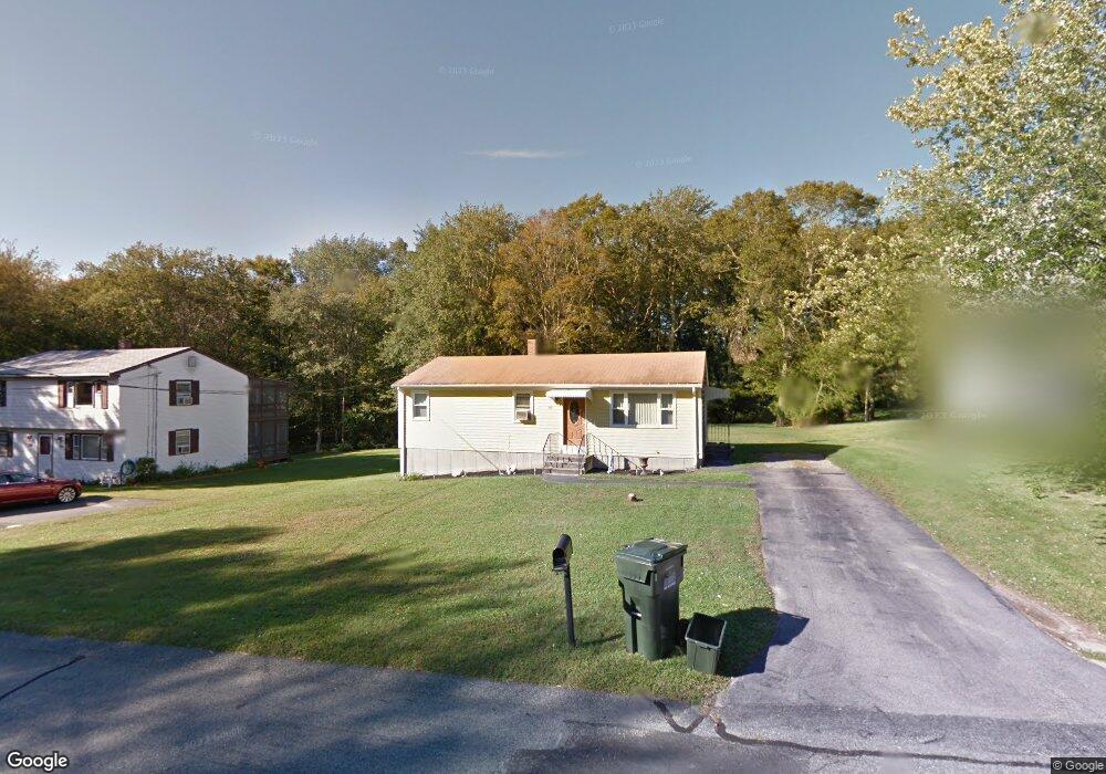
112 Benoit St Westport, MA 02790
North Westport NeighborhoodEstimated Value: $396,907 - $453,000
3
Beds
1
Bath
1,000
Sq Ft
$435/Sq Ft
Est. Value
About This Home
This home is located at 112 Benoit St, Westport, MA 02790 and is currently estimated at $434,977, approximately $434 per square foot. 112 Benoit St is a home located in Bristol County with nearby schools including Alice A. Macomber Primary School, Westport Elementary School, and Westport Middle-High School.
Ownership History
Date
Name
Owned For
Owner Type
Purchase Details
Closed on
Jul 10, 2017
Sold by
Reitano Victor and Reitano Pauline
Bought by
Calnan Ian
Current Estimated Value
Home Financials for this Owner
Home Financials are based on the most recent Mortgage that was taken out on this home.
Original Mortgage
$196,000
Outstanding Balance
$163,111
Interest Rate
3.95%
Mortgage Type
New Conventional
Estimated Equity
$271,866
Purchase Details
Closed on
Oct 3, 2014
Sold by
Carvalho Carmella Est
Bought by
Reitano Victor and Reitano Pauline
Purchase Details
Closed on
Oct 31, 1972
Bought by
Reitano Victor and Reitano Pauline
Create a Home Valuation Report for This Property
The Home Valuation Report is an in-depth analysis detailing your home's value as well as a comparison with similar homes in the area
Home Values in the Area
Average Home Value in this Area
Purchase History
| Date | Buyer | Sale Price | Title Company |
|---|---|---|---|
| Calnan Ian | $245,000 | -- | |
| Reitano Victor | -- | -- | |
| Reitano Victor | -- | -- |
Source: Public Records
Mortgage History
| Date | Status | Borrower | Loan Amount |
|---|---|---|---|
| Open | Calnan Ian | $196,000 |
Source: Public Records
Tax History
| Year | Tax Paid | Tax Assessment Tax Assessment Total Assessment is a certain percentage of the fair market value that is determined by local assessors to be the total taxable value of land and additions on the property. | Land | Improvement |
|---|---|---|---|---|
| 2025 | $2,514 | $337,500 | $156,800 | $180,700 |
| 2024 | $2,501 | $323,600 | $145,300 | $178,300 |
| 2023 | $2,403 | $294,500 | $138,400 | $156,100 |
| 2022 | $2,300 | $271,200 | $138,400 | $132,800 |
| 2021 | $2,229 | $258,600 | $125,800 | $132,800 |
| 2020 | $1,995 | $236,600 | $120,800 | $115,800 |
| 2019 | $1,848 | $223,500 | $109,800 | $113,700 |
| 2018 | $1,596 | $195,300 | $110,800 | $84,500 |
| 2017 | $1,515 | $190,100 | $107,300 | $82,800 |
| 2016 | $1,441 | $182,200 | $103,800 | $78,400 |
| 2015 | $1,396 | $176,100 | $106,100 | $70,000 |
Source: Public Records
Map
Nearby Homes
- 104 Benoit St Unit 106
- 116 Benoit St
- 120 Benoit St
- 113 Benoit St
- 117 Benoit St
- 10 Estrella Ln Unit lane
- 10 Estrella Ln
- 37 E Morency Ave
- 109 Thomas St
- 35 Thomas St
- 33 Thomas St
- 32 Thomas St
- 23 Thomas St
- 91 Benoit St Unit 93
- 16 Estrella Ln
- 35 E Morency Ave
- 88 Benoit St
- 87 Benoit St Unit 89
- 407 Sanford Rd
- 15 Estrella Ln
Your Personal Tour Guide
Ask me questions while you tour the home.