Estimated Value: $156,948 - $212,000
3
Beds
1
Bath
1,120
Sq Ft
$159/Sq Ft
Est. Value
About This Home
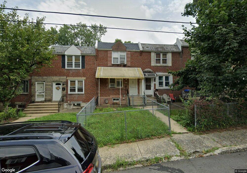
This home is located at 112 Branford Rd, Darby, PA 19023 and is currently estimated at $178,487, approximately $159 per square foot. 112 Branford Rd is a home located in Delaware County with nearby schools including Park Lane Elementary School, Penn Wood Middle School, and Penn Wood High School - Cypress Street Campus.
Ownership History
Date
Name
Owned For
Owner Type
Purchase Details
Closed on
Apr 24, 2008
Sold by
Baer Geraldine T and Baer Marian E
Bought by
Poden Tuahpue N
Current Estimated Value
Home Financials for this Owner
Home Financials are based on the most recent Mortgage that was taken out on this home.
Original Mortgage
$105,169
Outstanding Balance
$66,690
Interest Rate
5.99%
Mortgage Type
FHA
Estimated Equity
$111,797
Purchase Details
Closed on
Sep 5, 1997
Sold by
Baer Geraldine and Baer Marian
Bought by
Baer Geraldine T and Baer Marian E
Purchase Details
Closed on
Aug 20, 1997
Sold by
Baer Geraldine
Bought by
Baer Geraldine and Baer Marion
Create a Home Valuation Report for This Property
The Home Valuation Report is an in-depth analysis detailing your home's value as well as a comparison with similar homes in the area
Home Values in the Area
Average Home Value in this Area
Purchase History
| Date | Buyer | Sale Price | Title Company |
|---|---|---|---|
| Poden Tuahpue N | $106,000 | None Available | |
| Baer Geraldine T | -- | -- | |
| Baer Geraldine | -- | -- |
Source: Public Records
Mortgage History
| Date | Status | Borrower | Loan Amount |
|---|---|---|---|
| Open | Poden Tuahpue N | $105,169 |
Source: Public Records
Tax History Compared to Growth
Tax History
| Year | Tax Paid | Tax Assessment Tax Assessment Total Assessment is a certain percentage of the fair market value that is determined by local assessors to be the total taxable value of land and additions on the property. | Land | Improvement |
|---|---|---|---|---|
| 2025 | $3,093 | $62,470 | $19,040 | $43,430 |
| 2024 | $3,093 | $62,470 | $19,040 | $43,430 |
| 2023 | $2,910 | $62,470 | $19,040 | $43,430 |
| 2022 | $2,831 | $62,470 | $19,040 | $43,430 |
| 2021 | $3,951 | $62,470 | $19,040 | $43,430 |
| 2020 | $3,753 | $51,370 | $15,440 | $35,930 |
| 2019 | $3,593 | $51,370 | $15,440 | $35,930 |
| 2018 | $3,550 | $51,370 | $0 | $0 |
| 2017 | $3,485 | $51,370 | $0 | $0 |
| 2016 | $282 | $51,370 | $0 | $0 |
| 2015 | $288 | $51,370 | $0 | $0 |
| 2014 | $282 | $51,370 | $0 | $0 |
Source: Public Records
Map
Nearby Homes
- 33 Mermont Cir
- 129 Branford Rd
- 29 Concord Rd
- 27 Concord Rd
- 1345 Park Ln
- 1210 Berkley Rd
- 306 Golf Rd
- 209 Weymouth Rd
- 1232 Edgehill Rd
- 1237 Edgehill Rd
- 1246 Wycombe Ave
- 1125 Main St
- 1203 Edgehill Rd
- 28 S 12th St
- 1143 Chestnut St
- 14 N Macdade Blvd
- 1115 Chestnut St
- 32 Elder Ave
- 30 E Providence Rd
- 14 W Providence Rd
- 114 Branford Rd
- 110 Branford Rd
- 116 Branford Rd
- 118 Branford Rd
- 108 Branford Rd
- 74 Mermont Cir
- 120 Branford Rd
- 106 Branford Rd
- 104 Branford Rd
- 122 Branford Rd
- 102 Branford Rd
- 72 Mermont Cir
- 124 Branford Rd
- 100 Branford Rd
- 70 Mermont Cir
- 68 Mermont Cir
- 126 Branford Rd
- 66 Mermont Cir
- 64 Mermont Cir
- 53 Mermont Cir