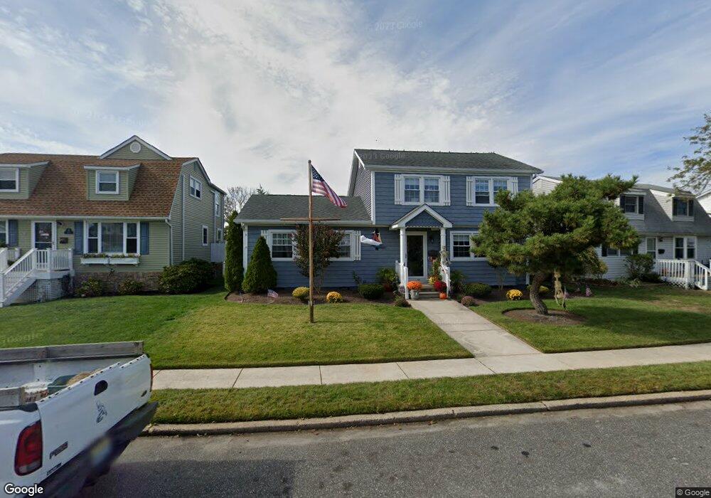
112 Brigantine Dr Ocean City, NJ 08226
Estimated Value: $1,015,980 - $1,196,000
4
Beds
2
Baths
1,691
Sq Ft
$677/Sq Ft
Est. Value
About This Home
This home is located at 112 Brigantine Dr, Ocean City, NJ 08226 and is currently estimated at $1,144,745, approximately $676 per square foot. 112 Brigantine Dr is a home located in Cape May County with nearby schools including Ocean City Primary School, Ocean City Intermediate School, and Ocean City High School.
Ownership History
Date
Name
Owned For
Owner Type
Purchase Details
Closed on
Jun 28, 2023
Sold by
Selby Joyce A and Selby James Richard
Bought by
Selby Family Trust
Current Estimated Value
Purchase Details
Closed on
Jan 20, 2011
Sold by
Mcdonald Paul and Mcdonald Sandra
Bought by
Selby John and Selby Joyce
Purchase Details
Closed on
Jul 31, 2007
Sold by
The Estate Of Rita M Fitzgibbon and Fitzgibbon Charles J
Bought by
Mcdonald Paul and Mcdonald Sandra
Home Financials for this Owner
Home Financials are based on the most recent Mortgage that was taken out on this home.
Original Mortgage
$357,040
Interest Rate
6.78%
Mortgage Type
Purchase Money Mortgage
Create a Home Valuation Report for This Property
The Home Valuation Report is an in-depth analysis detailing your home's value as well as a comparison with similar homes in the area
Home Values in the Area
Average Home Value in this Area
Purchase History
| Date | Buyer | Sale Price | Title Company |
|---|---|---|---|
| Selby Family Trust | -- | None Listed On Document | |
| Selby John | $477,500 | North American Title Agency | |
| Mcdonald Paul | $446,300 | Freedom Title & Abstract Com |
Source: Public Records
Mortgage History
| Date | Status | Borrower | Loan Amount |
|---|---|---|---|
| Previous Owner | Mcdonald Paul | $357,040 |
Source: Public Records
Tax History Compared to Growth
Tax History
| Year | Tax Paid | Tax Assessment Tax Assessment Total Assessment is a certain percentage of the fair market value that is determined by local assessors to be the total taxable value of land and additions on the property. | Land | Improvement |
|---|---|---|---|---|
| 2025 | $5,080 | $452,800 | $308,100 | $144,700 |
| 2024 | $5,080 | $452,800 | $308,100 | $144,700 |
| 2023 | $4,849 | $452,800 | $308,100 | $144,700 |
| 2022 | $4,659 | $452,800 | $308,100 | $144,700 |
| 2021 | $4,427 | $452,800 | $308,100 | $144,700 |
| 2020 | $4,428 | $452,800 | $308,100 | $144,700 |
| 2019 | $4,379 | $452,800 | $308,100 | $144,700 |
| 2018 | $4,338 | $452,800 | $308,100 | $144,700 |
| 2017 | $4,270 | $452,800 | $308,100 | $144,700 |
| 2016 | $4,107 | $452,800 | $308,100 | $144,700 |
| 2015 | $4,053 | $452,800 | $308,100 | $144,700 |
| 2014 | $3,994 | $452,800 | $308,100 | $144,700 |
Source: Public Records
Map
Nearby Homes
- 209 Bark Dr
- 13 53rd St
- 5404 Bay Ave
- 5242 West Ave Unit 2
- 5315 West Ave
- 5225 Asbury Ave Unit 1
- 400 E 55th St Unit D
- 400 E 55th St Unit E
- 400 E 55th St Unit F
- 5235 Central Ave
- 5512 Asbury Ave
- 5441 Central Ave
- 305 57th St Unit 305
- 4933 Central Ave Unit 4933
- 4828 West Ave Unit first floor
- 4919 Central Ave
- 4923 Central Ave Unit 2
- 4818-20 Asbury Ave
- 4818 Asbury Ave Unit 1
- 4641 West Ave Unit 1
- 108 Brigantine Dr
- 116 Brigantine Dr
- 104 Brigantine Dr
- 120 Brigantine Dr
- 124 Brigantine Dr
- 38 W 52nd St
- 115 Clipper Dr
- 109 Clipper Dr
- 100 Brigantine Dr
- 117 Clipper Dr
- 42 W 52nd St
- 117 Brigantine Dr
- 115 Brigantine Dr
- 121 Brigantine Dr
- 121 Clipper Dr
- 109 Brigantine Dr
- 125 Brigantine Dr
- 105 Clipper Dr
- 128 Brigantine Dr
- 105 Brigantine Dr