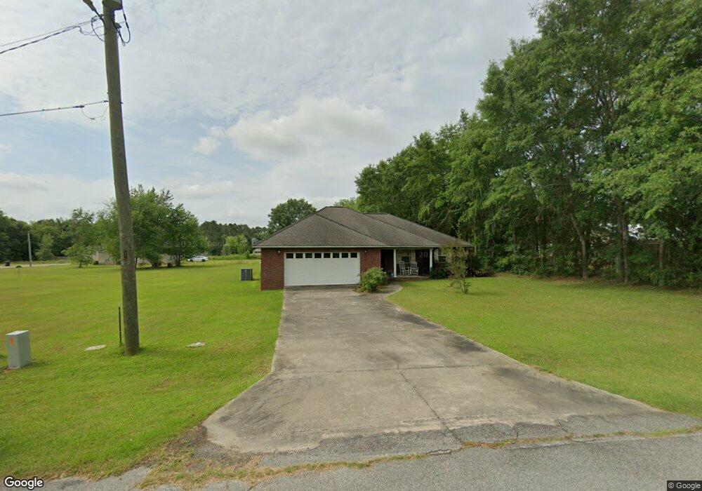
112 Brittany Ln Fitzgerald, GA 31750
Estimated Value: $171,000 - $260,000
4
Beds
3
Baths
2,011
Sq Ft
$111/Sq Ft
Est. Value
About This Home
This home is located at 112 Brittany Ln, Fitzgerald, GA 31750 and is currently estimated at $222,332, approximately $110 per square foot. 112 Brittany Ln is a home located in Ben Hill County with nearby schools including Ben Hill County Primary School, Ben Hill Elementary School, and Ben Hill County Middle School.
Ownership History
Date
Name
Owned For
Owner Type
Purchase Details
Closed on
Dec 10, 2010
Sold by
Hampton Wade
Bought by
Bullock Stephanie Jo
Current Estimated Value
Home Financials for this Owner
Home Financials are based on the most recent Mortgage that was taken out on this home.
Original Mortgage
$141,855
Outstanding Balance
$94,576
Interest Rate
4.4%
Mortgage Type
FHA
Estimated Equity
$127,756
Purchase Details
Closed on
Mar 17, 2006
Sold by
Conger Allen A
Bought by
Hampton Wade and Hampton Cynthia Carleen
Purchase Details
Closed on
Dec 12, 2001
Bought by
Conger Allen
Create a Home Valuation Report for This Property
The Home Valuation Report is an in-depth analysis detailing your home's value as well as a comparison with similar homes in the area
Home Values in the Area
Average Home Value in this Area
Purchase History
| Date | Buyer | Sale Price | Title Company |
|---|---|---|---|
| Bullock Stephanie Jo | $147,000 | -- | |
| Hampton Wade | $15,000 | -- | |
| Conger Allen | -- | -- |
Source: Public Records
Mortgage History
| Date | Status | Borrower | Loan Amount |
|---|---|---|---|
| Open | Bullock Stephanie Jo | $141,855 |
Source: Public Records
Tax History Compared to Growth
Tax History
| Year | Tax Paid | Tax Assessment Tax Assessment Total Assessment is a certain percentage of the fair market value that is determined by local assessors to be the total taxable value of land and additions on the property. | Land | Improvement |
|---|---|---|---|---|
| 2024 | $3,377 | $79,155 | $2,400 | $76,755 |
| 2023 | $2,327 | $75,895 | $2,400 | $73,495 |
| 2022 | $2,073 | $62,684 | $2,400 | $60,284 |
| 2021 | $2,071 | $60,282 | $2,400 | $57,882 |
| 2020 | $1,920 | $55,229 | $2,400 | $52,829 |
| 2019 | $1,912 | $55,229 | $2,400 | $52,829 |
| 2018 | $2,365 | $54,886 | $2,400 | $52,486 |
| 2017 | $1,892 | $54,371 | $2,400 | $51,971 |
| 2016 | $1,807 | $54,371 | $2,400 | $51,971 |
| 2015 | -- | $55,171 | $3,200 | $51,971 |
| 2014 | -- | $55,171 | $3,200 | $51,971 |
Source: Public Records
Map
Nearby Homes
- TBD Amber St
- 114 Taylor Cir
- 117 Royal Cir
- 155 Grove Ave
- 000 Evergreen Rd
- 130 Arnold Dr
- 701 S Monitor Dr
- 815 E Jessamine St
- 709 E Orange St
- 411 S Meade St
- 00 East Rd
- 512 E Lemon St
- 0 E Magnolia St
- 407 E Lemon St
- 510 S Grant St
- 515 S Grant St
- 0 Union Cemetery Rd Unit 20524152
- 106 Van Deman Dr
- 573 Frank Rd
- 510 S Main St
- 121 Taylor Cir
- 150 Amber St
- 142 Amber St
- 124 Taylor Cir
- 117 Taylor Cir
- 138 Royal Ct
- 138 Royal Ct Unit 11
- 138 Royal Ct Unit 11
- 138 Royal Ct
- 103 Brittany Ln
- 116 Taylor Cir
- 140 Royal Ct
- 139 Amber St
- 134 Royal Ct
- 134 Royal Cir
- 181 Grove Ave
- TBD Amber St
- 0 Amber St Unit 39 13648
- 0 Amber St Unit 41 13650
- 0 Amber St Unit 40 14396