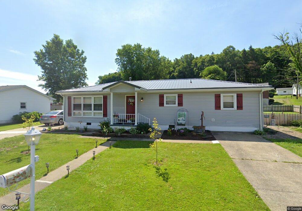
112 Brownlow Ave Grafton, WV 26354
Estimated Value: $158,388 - $517,000
3
Beds
1
Bath
1,591
Sq Ft
$163/Sq Ft
Est. Value
About This Home
This home is located at 112 Brownlow Ave, Grafton, WV 26354 and is currently estimated at $259,847, approximately $163 per square foot. 112 Brownlow Ave is a home with nearby schools including Grafton High School and Fellowship Christian Academy.
Ownership History
Date
Name
Owned For
Owner Type
Purchase Details
Closed on
May 16, 2014
Sold by
Forrest Forrest and Toth Stephanie
Bought by
Novisky Sabrina Kay
Current Estimated Value
Home Financials for this Owner
Home Financials are based on the most recent Mortgage that was taken out on this home.
Original Mortgage
$75,000
Outstanding Balance
$57,030
Interest Rate
4.27%
Mortgage Type
Stand Alone First
Estimated Equity
$202,817
Purchase Details
Closed on
Jan 12, 2007
Sold by
Ohagan Forrest
Bought by
Toth Stephanie
Create a Home Valuation Report for This Property
The Home Valuation Report is an in-depth analysis detailing your home's value as well as a comparison with similar homes in the area
Home Values in the Area
Average Home Value in this Area
Purchase History
| Date | Buyer | Sale Price | Title Company |
|---|---|---|---|
| Novisky Sabrina Kay | $95,000 | -- | |
| Toth Stephanie | -- | -- |
Source: Public Records
Mortgage History
| Date | Status | Borrower | Loan Amount |
|---|---|---|---|
| Open | Novisky Sabrina Kay | $75,000 |
Source: Public Records
Tax History Compared to Growth
Tax History
| Year | Tax Paid | Tax Assessment Tax Assessment Total Assessment is a certain percentage of the fair market value that is determined by local assessors to be the total taxable value of land and additions on the property. | Land | Improvement |
|---|---|---|---|---|
| 2024 | $909 | $65,280 | $9,720 | $55,560 |
| 2023 | $902 | $64,740 | $9,720 | $55,020 |
| 2022 | $782 | $60,660 | $9,720 | $50,940 |
| 2021 | $771 | $59,760 | $8,820 | $50,940 |
| 2020 | $762 | $59,040 | $8,160 | $50,880 |
| 2019 | $741 | $57,420 | $6,300 | $51,120 |
| 2018 | $762 | $56,280 | $5,640 | $50,640 |
| 2017 | $776 | $56,700 | $5,640 | $51,060 |
| 2016 | $893 | $65,880 | $5,460 | $60,420 |
| 2015 | $614 | $65,100 | $6,720 | $58,380 |
| 2014 | $608 | $64,440 | $8,400 | $56,040 |
Source: Public Records
Map
Nearby Homes
- 377 Haymond Rd
- Lot 109 Richmond Ave
- Lot 108 Richmond Ave
- 53 Kersting Ave
- 58 Clay St
- 301 Virginia St
- 113 W Knotts Ave
- 45 Springdale St
- 0 Knottsville Rd
- 1258 Knottsville Rd
- Lot 2 Shaw St
- Lot 1 Shaw St
- 306 Beech St
- 0 Phillips Pike Unit 10158035
- 1 4th St
- 330 Walnut St
- 307 Mackin St
- 408 Dewey Ave
- 244 Jayla Dr
- 436 Walnut St
- 124 Brownlow Ave
- 315 Haymond Rd
- 295 Haymond Rd
- 99 Brownlow Ave
- 117 Brownlow Ave
- 281 Haymond Rd
- 131 Brownlow Ave
- 14 Meadowbrook Ave
- 267 Haymond Rd
- 69 Brownlow Ave
- 298 Haymond Rd
- 282 Haymond Rd
- 322 Haymond Rd
- 30 Meadowbrook Ave
- 239 Haymond Rd
- 255 Haymond Rd
- 349 Haymond Rd
- 266 Haymond Rd
- 110 Hickory St
- 19 Brownlow Ave