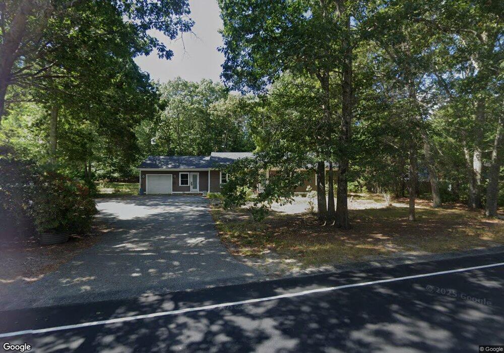
112 Bullock Rd East Freetown, MA 02717
Estimated Value: $528,291 - $616,000
3
Beds
2
Baths
1,552
Sq Ft
$371/Sq Ft
Est. Value
About This Home
This home is located at 112 Bullock Rd, East Freetown, MA 02717 and is currently estimated at $576,323, approximately $371 per square foot. 112 Bullock Rd is a home located in Bristol County with nearby schools including Freetown Elementary School, George R Austin Intermediate School, and Freetown-Lakeville Middle School.
Ownership History
Date
Name
Owned For
Owner Type
Purchase Details
Closed on
May 31, 2016
Sold by
Rezendes Daniel N
Bought by
Rezendes Daniel N and Grace Kathleen R
Current Estimated Value
Home Financials for this Owner
Home Financials are based on the most recent Mortgage that was taken out on this home.
Original Mortgage
$200,000
Outstanding Balance
$159,230
Interest Rate
3.58%
Mortgage Type
New Conventional
Estimated Equity
$417,093
Purchase Details
Closed on
Sep 19, 1988
Sold by
Omalley Dona Jean
Bought by
Rezendes Marianno
Home Financials for this Owner
Home Financials are based on the most recent Mortgage that was taken out on this home.
Original Mortgage
$40,000
Interest Rate
10.43%
Mortgage Type
Purchase Money Mortgage
Create a Home Valuation Report for This Property
The Home Valuation Report is an in-depth analysis detailing your home's value as well as a comparison with similar homes in the area
Home Values in the Area
Average Home Value in this Area
Purchase History
| Date | Buyer | Sale Price | Title Company |
|---|---|---|---|
| Rezendes Daniel N | -- | -- | |
| Rezendes Marianno | $141,000 | -- |
Source: Public Records
Mortgage History
| Date | Status | Borrower | Loan Amount |
|---|---|---|---|
| Open | Rezendes Daniel N | $200,000 | |
| Previous Owner | Rezendes Marianno | $10,000 | |
| Previous Owner | Rezendes Marianno | $60,000 | |
| Previous Owner | Rezendes Marianno | $40,000 |
Source: Public Records
Tax History Compared to Growth
Tax History
| Year | Tax Paid | Tax Assessment Tax Assessment Total Assessment is a certain percentage of the fair market value that is determined by local assessors to be the total taxable value of land and additions on the property. | Land | Improvement |
|---|---|---|---|---|
| 2025 | $4,300 | $433,900 | $159,000 | $274,900 |
| 2024 | $4,270 | $409,400 | $149,900 | $259,500 |
| 2023 | $4,183 | $390,600 | $135,000 | $255,600 |
| 2022 | $3,985 | $330,400 | $114,400 | $216,000 |
| 2021 | $3,774 | $297,200 | $104,000 | $193,200 |
| 2020 | $3,719 | $285,600 | $100,100 | $185,500 |
| 2019 | $3,511 | $267,000 | $95,300 | $171,700 |
| 2018 | $3,341 | $251,000 | $95,300 | $155,700 |
| 2017 | $3,247 | $243,800 | $95,300 | $148,500 |
| 2016 | $3,100 | $236,800 | $92,600 | $144,200 |
| 2015 | $3,043 | $235,900 | $92,600 | $143,300 |
| 2014 | $2,890 | $229,200 | $90,600 | $138,600 |
Source: Public Records
Map
Nearby Homes
- 144 Chace Rd
- 150 Quanapoag Rd
- 195 Slab Bridge Rd
- Lot 2/3 Quanapoag Rd
- 0 Costa Dr
- 599 Quanapoag Rd
- 264 Collins Corner Rd
- 1475 Braley Rd Unit 17
- 13 Luscomb Ln
- 111 High St
- 16 Swallow St
- 4597 Acushnet Ave
- 24 Bells Brook Rd
- 1069 Cherokee St
- 353 Upland St
- 300 High Hill Rd
- 64 Blaze Rd
- 20 Slab Bridge Rd
- 42 High St
- 319 Northwest St
- 110 Bullock Rd
- 4 Winslow Way
- 114 Bullock Rd
- 3 Winslow Way
- 113 Bullock Rd
- 109 Bullock Rd
- 108 Bullock Rd
- 111 Bullock Rd
- 6 Winslow Way
- 107 Bullock Rd
- 5 Winslow Way
- 116 Bullock Rd
- Lot 15 Winslow Way
- Lot 25 Winslow Way
- Lot 4 Winslow Way
- Lot 1 Winslow Way
- Lot 31 Winslow Way
- 4 Pierce Way
- 106 Bullock Rd
- 3 Pierce Way