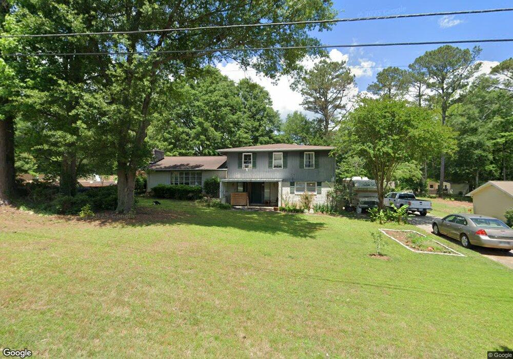
112 Candy Cir Carrollton, GA 30117
Estimated Value: $176,000 - $254,000
2
Beds
1
Bath
1,566
Sq Ft
$137/Sq Ft
Est. Value
About This Home
This home is located at 112 Candy Cir, Carrollton, GA 30117 and is currently estimated at $214,630, approximately $137 per square foot. 112 Candy Cir is a home located in Carroll County with nearby schools including Carrollton Elementary School, Carrollton Upper Elementary School, and Carrollton Middle School.
Ownership History
Date
Name
Owned For
Owner Type
Purchase Details
Closed on
Mar 9, 2020
Sold by
Henry Abbigail
Bought by
Bennett Serah
Current Estimated Value
Home Financials for this Owner
Home Financials are based on the most recent Mortgage that was taken out on this home.
Original Mortgage
$108,478
Outstanding Balance
$97,565
Interest Rate
3.25%
Mortgage Type
FHA
Purchase Details
Closed on
Feb 28, 2019
Sold by
Veal-Vazquez Jeremy H
Bought by
Henry Abbigail
Home Financials for this Owner
Home Financials are based on the most recent Mortgage that was taken out on this home.
Original Mortgage
$97,000
Interest Rate
4.4%
Mortgage Type
New Conventional
Purchase Details
Closed on
Jun 5, 2017
Sold by
Andrews Grace Mooney
Bought by
Veal-Vazquez Jeremy H
Home Financials for this Owner
Home Financials are based on the most recent Mortgage that was taken out on this home.
Original Mortgage
$80,514
Interest Rate
4.87%
Mortgage Type
FHA
Purchase Details
Closed on
Jun 14, 2016
Sold by
Caitlyn Marie Weathers
Bought by
Andrews Grace
Home Financials for this Owner
Home Financials are based on the most recent Mortgage that was taken out on this home.
Original Mortgage
$64,705
Interest Rate
3.6%
Purchase Details
Closed on
May 17, 2013
Sold by
Casa Holdings Llc
Bought by
Weathes Jordan Alexander and Weathers Caitlyn Marie
Home Financials for this Owner
Home Financials are based on the most recent Mortgage that was taken out on this home.
Original Mortgage
$46,148
Interest Rate
4.4%
Mortgage Type
FHA
Purchase Details
Closed on
Jan 17, 2012
Purchase Details
Closed on
Oct 4, 2011
Sold by
Wells Fargo Bank
Bought by
Federal Home Loan
Purchase Details
Closed on
Dec 5, 2007
Sold by
Butler James R
Bought by
Alvarado Robin
Purchase Details
Closed on
Jul 12, 1996
Bought by
Butler James R and Butler Kay
Purchase Details
Closed on
May 31, 1994
Bought by
Johnson Aubrey
Create a Home Valuation Report for This Property
The Home Valuation Report is an in-depth analysis detailing your home's value as well as a comparison with similar homes in the area
Home Values in the Area
Average Home Value in this Area
Purchase History
| Date | Buyer | Sale Price | Title Company |
|---|---|---|---|
| Bennett Serah | $110,480 | -- | |
| Henry Abbigail | $100,000 | -- | |
| Veal-Vazquez Jeremy H | $82,000 | -- | |
| Andrews Grace | -- | -- | |
| Weathes Jordan Alexander | $47,000 | -- | |
| -- | $16,500 | -- | |
| Federal Home Loan | $40,395 | -- | |
| Wells Fargo Bank | $40,395 | -- | |
| Alvarado Robin | $270,000 | -- | |
| Butler James R | $20,000 | -- | |
| Johnson Aubrey | -- | -- |
Source: Public Records
Mortgage History
| Date | Status | Borrower | Loan Amount |
|---|---|---|---|
| Open | Bennett Serah | $108,478 | |
| Previous Owner | Henry Abbigail | $97,000 | |
| Previous Owner | Veal-Vazquez Jeremy H | $80,514 | |
| Previous Owner | Wells Fargo Bank | $64,705 | |
| Previous Owner | Wells Fargo Bank | -- | |
| Previous Owner | Weathes Jordan Alexander | $46,148 |
Source: Public Records
Tax History Compared to Growth
Tax History
| Year | Tax Paid | Tax Assessment Tax Assessment Total Assessment is a certain percentage of the fair market value that is determined by local assessors to be the total taxable value of land and additions on the property. | Land | Improvement |
|---|---|---|---|---|
| 2024 | $1,733 | $63,422 | $7,516 | $55,906 |
| 2023 | $1,733 | $58,396 | $7,517 | $50,879 |
| 2022 | $1,339 | $45,866 | $5,011 | $40,855 |
| 2021 | $1,134 | $38,858 | $3,712 | $35,146 |
| 2020 | $1,026 | $35,100 | $3,712 | $31,388 |
| 2019 | $949 | $32,166 | $3,712 | $28,454 |
| 2018 | $848 | $28,356 | $3,712 | $24,644 |
| 2017 | $665 | $22,097 | $3,712 | $18,385 |
| 2016 | $668 | $22,097 | $3,712 | $18,385 |
| 2015 | $449 | $14,529 | $4,000 | $10,530 |
| 2014 | $451 | $14,530 | $4,000 | $10,530 |
Source: Public Records
Map
Nearby Homes
- 121 Wilson Cir
- 536 N Lakeshore Dr
- 115 N Lake Dr
- 2580 Shady Grove Rd
- 221 Turtle Cove
- 105 Providence Ct
- 231 N Lakeshore Dr
- 110 Stoney Brook Dr
- 325 Almon Rd
- 101 Grove Park Dr
- 110 Green Point Way
- 114 Green Point Way
- 255 Morgan Rd
- The Ellison II Plan at Jameson Towns
- The Norwood II Plan at Jameson Towns
- The Maddux II Plan at Jameson Towns
- 206 Asher Dr
- 123 Cedar Park Way
- 3 Burns Rd
- 2 Burns Rd
- 112 Candy Cir
- 112 Candy Cir
- 112 Candy Cir
- 112 Candy Cir
- 112 Candy Cir
- 114 Candy Cir
- 110 Candy Cir
- 111 Lisa Ln
- 109 Lisa Ln
- 111 Candy Cir
- 0 Candy Cir Unit 7119432
- 0 Candy Cir Unit 8700081
- 0 Candy Cir Unit 8683669
- 0 Candy Cir Unit 8572941
- 0 Candy Cir Unit 8096256
- 0 Candy Cir Unit 8092021
- 0 Candy Cir Unit 8003857
- 0 Candy Cir
- 108 Candy Cir
- 113 Candy Cir