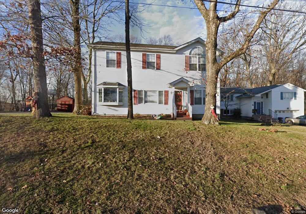
112 Cayuga Ave Rockaway, NJ 07866
Estimated Value: $535,000 - $632,470
5
Beds
3
Baths
2,240
Sq Ft
$266/Sq Ft
Est. Value
About This Home
This home is located at 112 Cayuga Ave, Rockaway, NJ 07866 and is currently estimated at $596,368, approximately $266 per square foot. 112 Cayuga Ave is a home located in Morris County with nearby schools including Catherine A. Dwyer Elementary School and Copeland Middle School.
Ownership History
Date
Name
Owned For
Owner Type
Purchase Details
Closed on
Dec 21, 2004
Sold by
Lummie Terri
Bought by
Pirro Ralph
Current Estimated Value
Purchase Details
Closed on
Nov 15, 1995
Sold by
Lummie Frank D
Bought by
Lummie Frank D and Lummie Terri R
Purchase Details
Closed on
Sep 8, 1994
Sold by
Duggan Teresa
Bought by
Lummie Frank
Home Financials for this Owner
Home Financials are based on the most recent Mortgage that was taken out on this home.
Original Mortgage
$131,000
Interest Rate
8.56%
Mortgage Type
FHA
Create a Home Valuation Report for This Property
The Home Valuation Report is an in-depth analysis detailing your home's value as well as a comparison with similar homes in the area
Home Values in the Area
Average Home Value in this Area
Purchase History
| Date | Buyer | Sale Price | Title Company |
|---|---|---|---|
| Pirro Ralph | $378,000 | -- | |
| Lummie Frank D | -- | -- | |
| Lummie Frank | $135,000 | -- |
Source: Public Records
Mortgage History
| Date | Status | Borrower | Loan Amount |
|---|---|---|---|
| Previous Owner | Lummie Frank | $131,000 |
Source: Public Records
Tax History
| Year | Tax Paid | Tax Assessment Tax Assessment Total Assessment is a certain percentage of the fair market value that is determined by local assessors to be the total taxable value of land and additions on the property. | Land | Improvement |
|---|---|---|---|---|
| 2025 | $10,689 | $460,800 | $236,400 | $224,400 |
| 2024 | $10,228 | $416,900 | $204,900 | $212,000 |
Source: Public Records
Map
Nearby Homes
- 13 Apache Trail
- 48 Algonquin Ave
- 216 Jackson Ave
- 23 W Lake Shore Dr
- 47 Cherokee Ave
- 2 W Lake Shore Dr
- 51 Sioux Ave
- 40 White Meadow Rd
- 53 White Meadow Rd
- 51 Mountain Ave
- 36 Mountain Ave
- 8214 Polk Dr
- 7311 Polk Dr
- 7113 Polk Dr Unit 13
- 21 Reservoir Rd
- 208 Fischer Ct
- 1202 Hale Dr
- 301 Fischer Ct Unit 301
- 1213 Hale Dr
- 16 White Meadow Rd
Your Personal Tour Guide
Ask me questions while you tour the home.