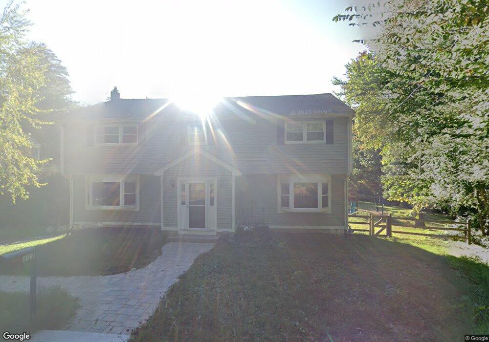
112 Central St Byfield, MA 01922
Estimated Value: $789,010 - $909,000
3
Beds
3
Baths
2,876
Sq Ft
$289/Sq Ft
Est. Value
About This Home
This home is located at 112 Central St, Byfield, MA 01922 and is currently estimated at $832,003, approximately $289 per square foot. 112 Central St is a home located in Essex County with nearby schools including Triton Regional High School, North Shore Montessori School, and The Governors Academy.
Ownership History
Date
Name
Owned For
Owner Type
Purchase Details
Closed on
Aug 30, 2004
Sold by
Granlund Catherine and Granlund Kenneth
Bought by
Dynok Michael and Archibald Heather J
Current Estimated Value
Create a Home Valuation Report for This Property
The Home Valuation Report is an in-depth analysis detailing your home's value as well as a comparison with similar homes in the area
Home Values in the Area
Average Home Value in this Area
Purchase History
| Date | Buyer | Sale Price | Title Company |
|---|---|---|---|
| Dynok Michael | $365,000 | -- | |
| Dynok Michael | $365,000 | -- |
Source: Public Records
Mortgage History
| Date | Status | Borrower | Loan Amount |
|---|---|---|---|
| Open | Dynok Michael | $304,000 | |
| Closed | Dynok Michael | $50,000 |
Source: Public Records
Tax History Compared to Growth
Tax History
| Year | Tax Paid | Tax Assessment Tax Assessment Total Assessment is a certain percentage of the fair market value that is determined by local assessors to be the total taxable value of land and additions on the property. | Land | Improvement |
|---|---|---|---|---|
| 2025 | $4,590 | $616,100 | $301,300 | $314,800 |
| 2024 | $4,631 | $603,000 | $301,300 | $301,700 |
| 2023 | $5,076 | $585,500 | $281,200 | $304,300 |
| 2022 | $4,934 | $507,100 | $241,000 | $266,100 |
| 2021 | $4,803 | $450,600 | $200,900 | $249,700 |
| 2020 | $4,843 | $440,700 | $200,900 | $239,800 |
| 2019 | $4,764 | $440,700 | $200,900 | $239,800 |
| 2018 | $4,565 | $418,800 | $194,800 | $224,000 |
| 2017 | $4,359 | $410,800 | $194,800 | $216,000 |
| 2016 | $4,410 | $386,800 | $180,800 | $206,000 |
| 2015 | $3,993 | $346,600 | $140,600 | $206,000 |
| 2014 | $3,810 | $336,600 | $130,600 | $206,000 |
Source: Public Records
Map
Nearby Homes
- 103 Central St
- 15 School St
- 66 3 Parish Rd
- 66 2 Parish Rd
- 4 Coleman Rd
- 36 Caldwell Farm Rd
- 64 Caldwell Farm Rd Unit 64
- 66 Parish Rd Unit 4
- 34 Central St
- 78 Elm St
- 6 Parker River Dr
- 10 Noyes Rd
- 55 Pearson Dr Unit 9 - ALDER
- 55 Pearson Dr Unit 6-Dogwood
- 55 Pearson Dr Unit 3 - ALDER
- 55 Pearson Dr Unit 8-Dogwood
- 21 Main St
- 15 Central St
- 2 & 4 Tenney Ct
- 30 Christa Dr
- 2 Silvermine Ln
- 111 Central St
- 113 Central St
- 110 Central St
- 118 Central St
- 109 Central St
- 4 Silvermine Ln
- 115 Central St
- 120 Central St
- 107 Central St
- 117 Central St
- 50 Fatherland Dr
- 105 Central St
- 106 Central St
- 48 Fatherland Dr
- 2 Birch Ln
- 119 Central St
- 108 Central St
- 104 Central St
- 46 Fatherland Dr