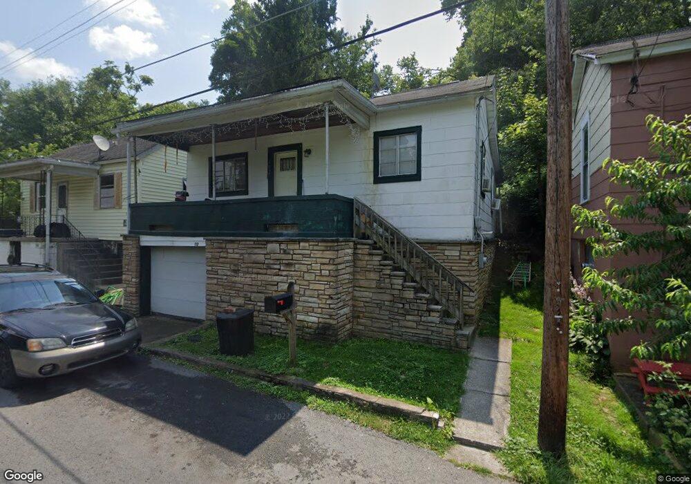
112 Chew St Fairmont, WV 26554
Estimated Value: $60,000 - $166,000
2
Beds
1
Bath
882
Sq Ft
$106/Sq Ft
Est. Value
About This Home
This home is located at 112 Chew St, Fairmont, WV 26554 and is currently estimated at $93,128, approximately $105 per square foot. 112 Chew St is a home located in Marion County with nearby schools including Jayenne Elementary School, West Fairmont Middle School, and Fairmont Senior High School.
Ownership History
Date
Name
Owned For
Owner Type
Purchase Details
Closed on
Oct 27, 2023
Sold by
Stemple Ben
Bought by
Stemple Chanda
Current Estimated Value
Purchase Details
Closed on
Sep 20, 2019
Sold by
By Properties Llc
Bought by
Stemple Ben E and Stemple Chanda M
Purchase Details
Closed on
Nov 9, 2009
Sold by
Sedera Virginia Decarlo
Bought by
B Y Properties Llc
Home Financials for this Owner
Home Financials are based on the most recent Mortgage that was taken out on this home.
Original Mortgage
$32,868
Interest Rate
4.92%
Mortgage Type
Future Advance Clause Open End Mortgage
Create a Home Valuation Report for This Property
The Home Valuation Report is an in-depth analysis detailing your home's value as well as a comparison with similar homes in the area
Home Values in the Area
Average Home Value in this Area
Purchase History
| Date | Buyer | Sale Price | Title Company |
|---|---|---|---|
| Stemple Chanda | -- | None Listed On Document | |
| Stemple Ben E | $14,000 | None Available | |
| B Y Properties Llc | $32,000 | -- |
Source: Public Records
Mortgage History
| Date | Status | Borrower | Loan Amount |
|---|---|---|---|
| Previous Owner | B Y Properties Llc | $32,868 |
Source: Public Records
Tax History Compared to Growth
Tax History
| Year | Tax Paid | Tax Assessment Tax Assessment Total Assessment is a certain percentage of the fair market value that is determined by local assessors to be the total taxable value of land and additions on the property. | Land | Improvement |
|---|---|---|---|---|
| 2024 | $634 | $21,720 | $4,020 | $17,700 |
| 2023 | $643 | $21,000 | $4,020 | $16,980 |
| 2022 | $602 | $20,220 | $4,020 | $16,200 |
| 2021 | $597 | $20,280 | $4,860 | $15,420 |
| 2020 | $577 | $19,500 | $4,860 | $14,640 |
| 2019 | $573 | $19,080 | $5,280 | $13,800 |
| 2018 | $771 | $25,860 | $10,200 | $15,660 |
| 2017 | $694 | $23,460 | $8,100 | $15,360 |
| 2016 | $612 | $20,760 | $5,940 | $14,820 |
| 2015 | $592 | $20,100 | $5,940 | $14,160 |
| 2014 | $592 | $19,920 | $5,940 | $13,980 |
Source: Public Records
Map
Nearby Homes
- 208 Maple Ave
- 336 Maple Ave
- 140 Chestnut St
- 0 Montgomery Ave
- 107 Hess Ave
- TBD Maple Run
- 44 Holbert Ave
- 0 Monroe St
- 116 Russell St
- 402 Lehman Ave
- TBD Cleveland Ave
- 109 & 109.5 Highland Ave
- 0 Holbert Ave
- 1914 Carpenter Dr
- 449 Hampton Rd
- 0 Garrett Ave
- 213 Watson Ave
- 217 Watson Ave
- 140 Locust Ave
- 317 Quarry Ave