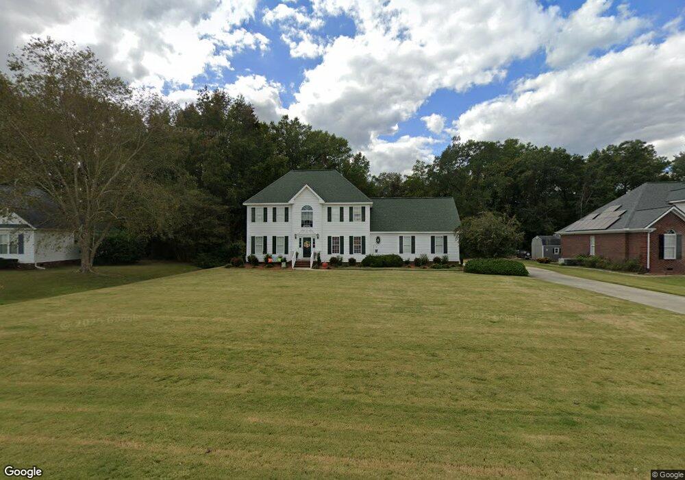
112 Clay Brook Dr Goldsboro, NC 27530
Estimated Value: $327,000 - $369,000
3
Beds
3
Baths
2,046
Sq Ft
$165/Sq Ft
Est. Value
About This Home
This home is located at 112 Clay Brook Dr, Goldsboro, NC 27530 and is currently estimated at $338,458, approximately $165 per square foot. 112 Clay Brook Dr is a home located in Wayne County with nearby schools including Northwest Elementary School, Norwayne Middle School, and Charles B. Aycock High School.
Ownership History
Date
Name
Owned For
Owner Type
Purchase Details
Closed on
Jan 6, 2021
Sold by
Shackelford Bradford E and Shackelford Melanie
Bought by
Shackelford Bradford E and Shackelford Melanie
Current Estimated Value
Purchase Details
Closed on
Jun 18, 2020
Sold by
Herring Lori
Bought by
Shackelford Bradford E
Home Financials for this Owner
Home Financials are based on the most recent Mortgage that was taken out on this home.
Original Mortgage
$214,051
Interest Rate
3.2%
Mortgage Type
FHA
Purchase Details
Closed on
Dec 9, 2014
Sold by
Herring William D
Bought by
Herring Loris S
Purchase Details
Closed on
Mar 14, 2005
Sold by
Melvin Ada K
Bought by
Herring William D and Herring Lori S
Home Financials for this Owner
Home Financials are based on the most recent Mortgage that was taken out on this home.
Original Mortgage
$28,000
Interest Rate
5.54%
Mortgage Type
Purchase Money Mortgage
Purchase Details
Closed on
Sep 1, 2003
Purchase Details
Closed on
Jul 1, 1998
Purchase Details
Closed on
Feb 1, 1998
Purchase Details
Closed on
May 1, 1997
Create a Home Valuation Report for This Property
The Home Valuation Report is an in-depth analysis detailing your home's value as well as a comparison with similar homes in the area
Home Values in the Area
Average Home Value in this Area
Purchase History
| Date | Buyer | Sale Price | Title Company |
|---|---|---|---|
| Shackelford Bradford E | -- | None Available | |
| Shackelford Bradford E | -- | None Listed On Document | |
| Shackelford Bradford E | $218,000 | None Available | |
| Herring Loris S | -- | None Available | |
| Herring William D | $22,000 | None Available | |
| -- | $199,000 | -- | |
| -- | $151,000 | -- | |
| -- | $13,500 | -- | |
| -- | $20,500 | -- |
Source: Public Records
Mortgage History
| Date | Status | Borrower | Loan Amount |
|---|---|---|---|
| Previous Owner | Shackelford Bradford E | $214,051 | |
| Previous Owner | Herring William D | $28,000 |
Source: Public Records
Tax History Compared to Growth
Tax History
| Year | Tax Paid | Tax Assessment Tax Assessment Total Assessment is a certain percentage of the fair market value that is determined by local assessors to be the total taxable value of land and additions on the property. | Land | Improvement |
|---|---|---|---|---|
| 2025 | $1,651 | $302,430 | $35,000 | $267,430 |
| 2024 | $1,651 | $194,670 | $28,000 | $166,670 |
| 2023 | $1,602 | $194,670 | $28,000 | $166,670 |
| 2022 | $1,602 | $194,670 | $28,000 | $166,670 |
| 2021 | $1,534 | $194,670 | $28,000 | $166,670 |
| 2020 | $1,448 | $194,670 | $28,000 | $166,670 |
| 2018 | $1,470 | $197,730 | $23,000 | $174,730 |
| 2017 | $1,470 | $197,730 | $23,000 | $174,730 |
| 2016 | $1,470 | $197,730 | $23,000 | $174,730 |
| 2015 | $1,473 | $197,730 | $23,000 | $174,730 |
| 2014 | $1,476 | $197,730 | $23,000 | $174,730 |
Source: Public Records
Map
Nearby Homes
- 302 N Pointe Dr
- 109 Ashworth Dr
- 220 Creek Ridge Dr
- 608 Adler Ln
- 203 Lane Tree Dr
- 101 Mcwood Place
- 479 Perkins Rd
- 626 Adler Ln
- 408 Perkins Rd
- 102 Olde Mill Creek Dr
- 404 Lane Tree Dr
- 461 Perkins
- 100 W Berkshire Ct
- 103 Poplar Knoll Rd
- 302 Morgan Trace Ln
- 176 Perkins Rd
- 205 Carlyle Cir
- 106 Pony Cir NW
- 600 Morgan Trace Ln
- 585 Buck Swamp Rd
- 110 Clay Brook Dr
- 114 Clay Brook Dr
- 116 Clay Brook Dr
- 108 Clay Brook Dr
- 113 Clay Brook Dr
- 111 Clay Brook Dr
- 504 N Pointe Dr
- 115 Clay Brook Dr
- 109 Clay Brook Dr
- 118 Clay Brook Dr
- 106 Clay Brook Dr
- 502 N Pointe Dr
- 506 N Pointe Dr
- 117 Clay Brook Dr
- 105 Lane Ridge Dr
- 103 Lane Ridge Dr
- 120 Clay Brook Dr
- 500 N Pointe Dr
- 107 Lane Ridge Dr
- 107 Clay Brook Dr