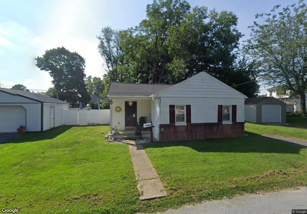
112 Colgate Ave Lancaster, PA 17603
Wheatland NeighborhoodEstimated Value: $214,253 - $300,000
3
Beds
1
Bath
1,220
Sq Ft
$219/Sq Ft
Est. Value
About This Home
This home is located at 112 Colgate Ave, Lancaster, PA 17603 and is currently estimated at $266,813, approximately $218 per square foot. 112 Colgate Ave is a home located in Lancaster County with nearby schools including Hambright Elementary School, Manor Middle School, and Penn Manor High School.
Ownership History
Date
Name
Owned For
Owner Type
Purchase Details
Closed on
Nov 30, 2021
Sold by
Zimmerman Ashley L
Bought by
Zimmerman Wilmer and Zimmerman Laurie
Current Estimated Value
Purchase Details
Closed on
Nov 13, 2009
Sold by
Albright Robert L and Albright Carla M
Bought by
Zimmerman Ashley L and Silva Leonard
Home Financials for this Owner
Home Financials are based on the most recent Mortgage that was taken out on this home.
Original Mortgage
$143,355
Interest Rate
4.86%
Mortgage Type
FHA
Purchase Details
Closed on
Jan 7, 2002
Sold by
Splain David P
Bought by
Splain David P and Reaney Melanie D
Purchase Details
Closed on
Aug 21, 2000
Sold by
Herr Dennis D
Bought by
Splain David P
Home Financials for this Owner
Home Financials are based on the most recent Mortgage that was taken out on this home.
Original Mortgage
$97,650
Interest Rate
8.13%
Mortgage Type
FHA
Create a Home Valuation Report for This Property
The Home Valuation Report is an in-depth analysis detailing your home's value as well as a comparison with similar homes in the area
Home Values in the Area
Average Home Value in this Area
Purchase History
| Date | Buyer | Sale Price | Title Company |
|---|---|---|---|
| Zimmerman Wilmer | $120,000 | None Available | |
| Zimmerman Ashley L | $146,000 | None Available | |
| Splain David P | -- | -- | |
| Splain David P | $97,750 | -- |
Source: Public Records
Mortgage History
| Date | Status | Borrower | Loan Amount |
|---|---|---|---|
| Previous Owner | Zimmerman Ashley L | $143,355 | |
| Previous Owner | Splain David P | $97,650 |
Source: Public Records
Tax History Compared to Growth
Tax History
| Year | Tax Paid | Tax Assessment Tax Assessment Total Assessment is a certain percentage of the fair market value that is determined by local assessors to be the total taxable value of land and additions on the property. | Land | Improvement |
|---|---|---|---|---|
| 2025 | $2,924 | $133,900 | $51,200 | $82,700 |
| 2024 | $2,924 | $133,900 | $51,200 | $82,700 |
| 2023 | $2,924 | $133,900 | $51,200 | $82,700 |
| 2022 | $2,869 | $133,900 | $51,200 | $82,700 |
| 2021 | $2,796 | $133,900 | $51,200 | $82,700 |
| 2020 | $2,796 | $133,900 | $51,200 | $82,700 |
| 2019 | $2,718 | $133,900 | $51,200 | $82,700 |
| 2018 | $2,076 | $133,900 | $51,200 | $82,700 |
| 2017 | $2,424 | $99,900 | $43,000 | $56,900 |
| 2016 | $2,424 | $99,900 | $43,000 | $56,900 |
| 2015 | $499 | $99,900 | $43,000 | $56,900 |
| 2014 | $1,641 | $99,900 | $43,000 | $56,900 |
Source: Public Records
Map
Nearby Homes
- 1799 Heritage Ave
- 1761 Wilson Ave
- 220 Harvard Ave
- 2008 Manor Ridge Dr
- 105 Silverwind Ct S
- 34 Girard Ave
- 108 Wildbriar Ct S
- 171 Harvard Ave
- 109 Falcon Ct
- 114 Pheasant Ridge Cir
- 111 Pheasant Ridge Cir
- 203 Oakfield Ct W
- 1809 Brubaker Run Rd
- 102 Arrowwood Ct
- 106 Longwood Ct E
- 115 Nursery Ln
- 494 Northlawn Dr
- 619 + 621 Millersville Rd
- 62 Oak Ln
- 1262 Wilson Ave
- 1775 Hemlock Rd
- 1771 Hemlock Rd
- 1779 Hemlock Rd
- 1780 Temple Ave
- 1762 Temple Ave
- 1786 Temple Ave
- 1783 Hemlock Rd
- 1787 Hemlock Rd
- 111 Dickinson Ave
- 115 Colgate Ave
- 1765 Hemlock Rd
- 1791 Hemlock Rd
- 1760 Temple Ave
- 103 Dickinson Ave
- 1761 Hemlock Rd
- 1795 Hemlock Rd
- 1757 Hemlock Rd
- 1769 Temple Ave
- 1765 Temple Ave
- 1773 Temple Ave