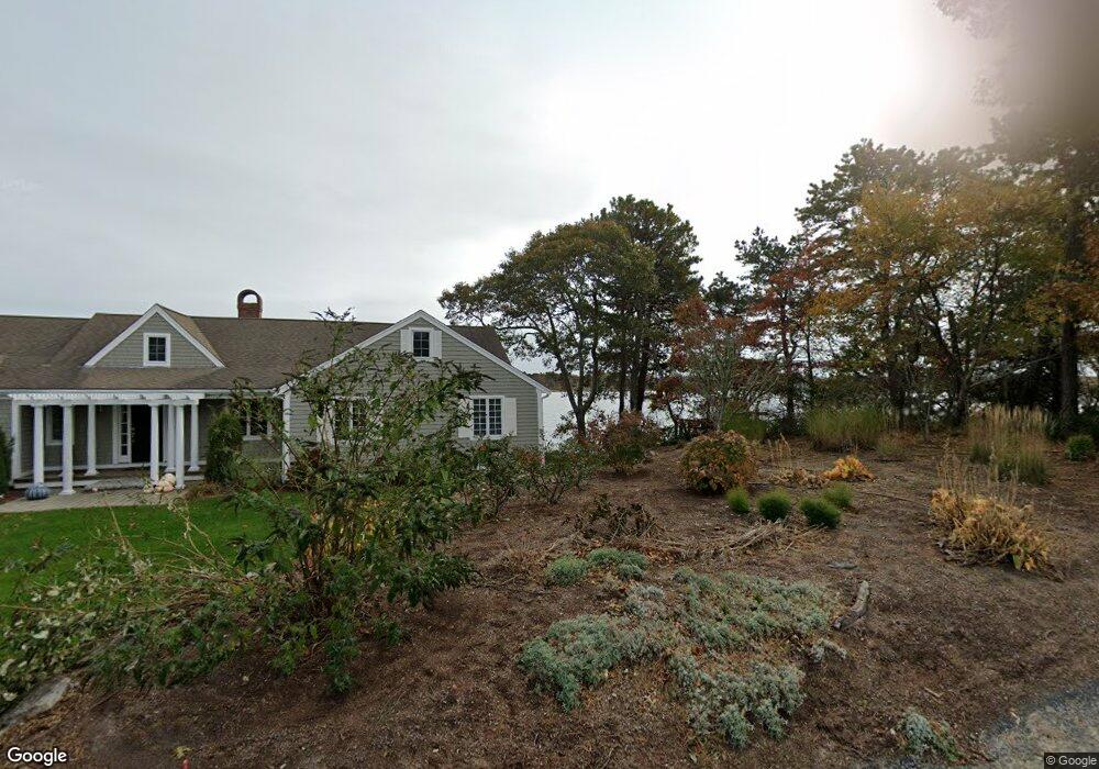
112 Cove Rd South Dennis, MA 02660
West Dennis NeighborhoodEstimated Value: $648,000 - $942,000
4
Beds
1
Bath
1,336
Sq Ft
$554/Sq Ft
Est. Value
About This Home
This home is located at 112 Cove Rd, South Dennis, MA 02660 and is currently estimated at $739,518, approximately $553 per square foot. 112 Cove Rd is a home located in Barnstable County with nearby schools including Dennis-Yarmouth Regional High School and St. Pius X. School.
Ownership History
Date
Name
Owned For
Owner Type
Purchase Details
Closed on
Jul 9, 2018
Sold by
K2m Llc
Bought by
Graham Austin P
Current Estimated Value
Home Financials for this Owner
Home Financials are based on the most recent Mortgage that was taken out on this home.
Original Mortgage
$298,000
Outstanding Balance
$257,759
Interest Rate
4.6%
Mortgage Type
New Conventional
Estimated Equity
$481,759
Purchase Details
Closed on
Dec 29, 2016
Sold by
Wartz Mary J Est and Arroyo
Bought by
K2m Llc
Home Financials for this Owner
Home Financials are based on the most recent Mortgage that was taken out on this home.
Original Mortgage
$209,000
Interest Rate
3.94%
Mortgage Type
New Conventional
Purchase Details
Closed on
Jan 28, 1974
Bought by
Halwartz Mary Jane
Create a Home Valuation Report for This Property
The Home Valuation Report is an in-depth analysis detailing your home's value as well as a comparison with similar homes in the area
Home Values in the Area
Average Home Value in this Area
Purchase History
| Date | Buyer | Sale Price | Title Company |
|---|---|---|---|
| Graham Austin P | $390,000 | -- | |
| K2m Llc | $261,200 | -- | |
| Halwartz Mary Jane | -- | -- |
Source: Public Records
Mortgage History
| Date | Status | Borrower | Loan Amount |
|---|---|---|---|
| Open | Graham Austin P | $298,000 | |
| Closed | Halwartz Mary Jane | $298,000 | |
| Previous Owner | K2m Llc | $209,000 |
Source: Public Records
Tax History Compared to Growth
Tax History
| Year | Tax Paid | Tax Assessment Tax Assessment Total Assessment is a certain percentage of the fair market value that is determined by local assessors to be the total taxable value of land and additions on the property. | Land | Improvement |
|---|---|---|---|---|
| 2025 | $2,957 | $682,800 | $273,400 | $409,400 |
| 2024 | $2,818 | $641,900 | $262,900 | $379,000 |
| 2023 | $2,695 | $577,100 | $232,400 | $344,700 |
| 2022 | $2,602 | $464,600 | $209,300 | $255,300 |
| 2021 | $2,282 | $378,400 | $175,900 | $202,500 |
| 2020 | $2,237 | $366,800 | $175,900 | $190,900 |
| 2019 | $1,831 | $296,700 | $126,500 | $170,200 |
| 2018 | $1,669 | $263,200 | $98,500 | $164,700 |
| 2017 | $1,550 | $252,100 | $98,500 | $153,600 |
| 2016 | $1,623 | $248,500 | $120,400 | $128,100 |
| 2015 | $1,590 | $248,500 | $120,400 | $128,100 |
| 2014 | $1,552 | $244,400 | $120,400 | $124,000 |
Source: Public Records
Map
Nearby Homes
- 428 Main St Unit 1-11
- 467 Main St
- 401 Main St Unit 201
- 401 Main St Unit 101
- 23 Doric Ave
- 209 Main St Unit 3
- 209 Main St Unit 6
- 209 Main St Unit 1
- 209 Main St Unit 2
- 209 Main St Unit 4
- 209 Main St Unit 5
- 14 Schoolhouse Ln
- 45 Seth Ln
- 29 Bass River Rd
- 18 Turner Ln
- 178 School St
- 40 Kelley Rd
- 3 Pinefield Ln
- 61 Trotters Ln
- 116 N Main St
- 112 Cove Rd
- 3 Stephen Ln
- 114 Cove Rd
- 104 Cove Rd
- 104 Cove Rd
- 114 Cove Rd
- 117 Cove Rd
- 15 Captain Donald Path
- 8 Capt Donalds
- 8 Captain Donald Path
- 4 Stephen Ln
- 98 Cove Rd
- 123 Cove Rd
- 11 Captain Donald Path
- 11 Capt Donald Point
- 105 Cove Rd
- 12 Captain Donald Path
- 3 Captain Donald Path
- 9 Captain Donald Path
- 16 Aunt Julia Ann Rd