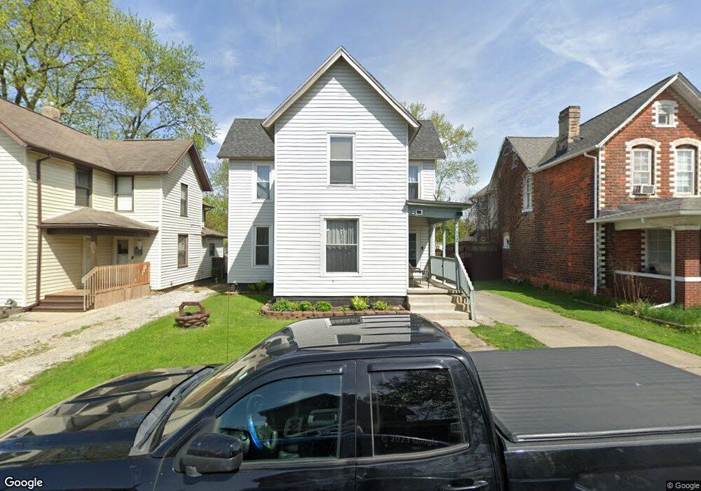
112 Dewey Ave Newark, OH 43055
Estimated Value: $184,000 - $191,000
3
Beds
1
Bath
1,580
Sq Ft
$118/Sq Ft
Est. Value
About This Home
This home is located at 112 Dewey Ave, Newark, OH 43055 and is currently estimated at $186,885, approximately $118 per square foot. 112 Dewey Ave is a home located in Licking County with nearby schools including Carson Elementary School, Heritage Middle School, and Newark High School.
Ownership History
Date
Name
Owned For
Owner Type
Purchase Details
Closed on
Jan 8, 1998
Sold by
Associates Financial Ser
Bought by
Myers Joseph S and Myers Luann K
Current Estimated Value
Home Financials for this Owner
Home Financials are based on the most recent Mortgage that was taken out on this home.
Original Mortgage
$59,052
Outstanding Balance
$10,357
Interest Rate
7.26%
Mortgage Type
New Conventional
Estimated Equity
$176,528
Purchase Details
Closed on
Oct 3, 1994
Sold by
Locke L Alan
Bought by
Tigner Tammy S
Home Financials for this Owner
Home Financials are based on the most recent Mortgage that was taken out on this home.
Original Mortgage
$45,900
Interest Rate
8.6%
Mortgage Type
Purchase Money Mortgage
Create a Home Valuation Report for This Property
The Home Valuation Report is an in-depth analysis detailing your home's value as well as a comparison with similar homes in the area
Home Values in the Area
Average Home Value in this Area
Purchase History
| Date | Buyer | Sale Price | Title Company |
|---|---|---|---|
| Myers Joseph S | $57,000 | -- | |
| Tigner Tammy S | $45,900 | -- |
Source: Public Records
Mortgage History
| Date | Status | Borrower | Loan Amount |
|---|---|---|---|
| Open | Myers Joseph S | $59,052 | |
| Previous Owner | Tigner Tammy S | $45,900 |
Source: Public Records
Tax History Compared to Growth
Tax History
| Year | Tax Paid | Tax Assessment Tax Assessment Total Assessment is a certain percentage of the fair market value that is determined by local assessors to be the total taxable value of land and additions on the property. | Land | Improvement |
|---|---|---|---|---|
| 2024 | $1,915 | $53,550 | $8,680 | $44,870 |
| 2023 | $2,007 | $53,550 | $8,680 | $44,870 |
| 2022 | $1,284 | $31,960 | $5,220 | $26,740 |
| 2021 | $1,346 | $31,960 | $5,220 | $26,740 |
| 2020 | $1,377 | $31,960 | $5,220 | $26,740 |
| 2019 | $1,152 | $25,730 | $4,340 | $21,390 |
| 2018 | $1,153 | $0 | $0 | $0 |
| 2017 | $1,180 | $0 | $0 | $0 |
| 2016 | $1,230 | $0 | $0 | $0 |
| 2015 | $1,257 | $0 | $0 | $0 |
| 2014 | $808 | $0 | $0 | $0 |
| 2013 | $2,852 | $0 | $0 | $0 |
Source: Public Records
Map
Nearby Homes
- 76 Oakwood Ave
- 60 Dewey Ave
- 167 Essex St
- 81 Madison Ave
- 430 E Main St
- 160 N Cedar St
- 240 N Wing St
- 51 Mill St
- 452 Walnut Ln
- 232 Rosehill Ave
- 491 Garfield Ave
- 284 Everett Ave
- 136 Hunter St
- 61 Rosebud Ave
- 424 Ridge Ave
- 554 Garfield Ave
- 408 Cedarcrest Ave
- 688 Russell Ave
- 203 Lawrence St
- 483 Allston Ave