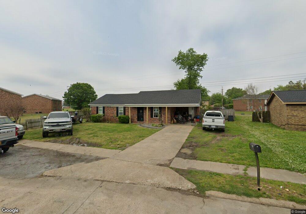
112 Douglas Dr Osceola, AR 72370
Estimated Value: $98,947 - $110,000
--
Bed
1
Bath
1,189
Sq Ft
$88/Sq Ft
Est. Value
About This Home
This home is located at 112 Douglas Dr, Osceola, AR 72370 and is currently estimated at $104,987, approximately $88 per square foot. 112 Douglas Dr is a home located in Mississippi County with nearby schools including North Elementary School, Carroll Smith Elementary School, and Osceola High School.
Ownership History
Date
Name
Owned For
Owner Type
Purchase Details
Closed on
Jan 2, 2006
Sold by
Langston Larry J
Bought by
Langston Larry J
Current Estimated Value
Purchase Details
Closed on
Jan 1, 2006
Sold by
Langston Larry J
Bought by
Langston Larry J
Purchase Details
Closed on
Jan 2, 1979
Sold by
Mockingbird Devel Corp
Bought by
Langston Larry J
Purchase Details
Closed on
Jan 1, 1979
Sold by
Mockingbird Devel Corp
Bought by
Langston Larry J
Purchase Details
Closed on
Jan 2, 1978
Bought by
Mockingbird Devel Corp
Purchase Details
Closed on
Jan 1, 1978
Bought by
Mockingbird Devel Corp
Create a Home Valuation Report for This Property
The Home Valuation Report is an in-depth analysis detailing your home's value as well as a comparison with similar homes in the area
Home Values in the Area
Average Home Value in this Area
Purchase History
| Date | Buyer | Sale Price | Title Company |
|---|---|---|---|
| Langston Larry J | -- | -- | |
| Langston Larry J | -- | -- | |
| Langston Larry J | -- | -- | |
| Langston Larry J | -- | -- | |
| Mockingbird Devel Corp | -- | -- | |
| Mockingbird Devel Corp | -- | -- |
Source: Public Records
Tax History Compared to Growth
Tax History
| Year | Tax Paid | Tax Assessment Tax Assessment Total Assessment is a certain percentage of the fair market value that is determined by local assessors to be the total taxable value of land and additions on the property. | Land | Improvement |
|---|---|---|---|---|
| 2024 | $696 | $15,386 | $3,000 | $12,386 |
| 2023 | $696 | $15,386 | $3,000 | $12,386 |
| 2022 | $664 | $15,386 | $3,000 | $12,386 |
| 2021 | $324 | $11,520 | $2,300 | $9,220 |
| 2020 | -- | $11,520 | $2,300 | $9,220 |
| 2019 | -- | -- | $2,300 | $9,220 |
| 2018 | -- | -- | $2,300 | $9,220 |
| 2017 | -- | -- | $2,000 | $10,289 |
| 2015 | -- | -- | $2,000 | $10,289 |
| 2013 | -- | -- | $2,000 | $10,289 |
Source: Public Records
Map
Nearby Homes
- 130 Diane Dr
- 110 Carriage Dr
- 132 Ken Dr
- 106 W Cheryl St
- 109 Newport Dr
- 101 Carriage Dr
- 123 Kristi Dr
- 111 Colonial Rd
- 116 Cherry Dr
- 1169 S State Highway 119
- 113 Franklin St
- 205 S Brickey St
- 391 N Ermen Ln
- 910 W Semmes Ave
- 704 W Ford Ave
- 709 W Hale Ave
- 816 W Johnson Ave
- 608 W Ford Ave
- 0 E Johnson Ave
- 0 Shippen Ave Unit 22016399
- 110 Douglas Dr
- 0 Douglas Dr
- 108 Douglas Dr
- 111 Douglas Dr
- 109 Douglas Dr
- 130 W Alicia St
- 106 Douglas Dr
- 125 W Shadow Ln
- W Shadow Ln
- 135A W Alicia St Unit 135B
- 3 Arrowhead Cove
- 104 Douglas Dr
- 128 W Alicia St
- 133 W Alicia St
- 125 W Greenbriar Dr
- 129 W Greenbriar Dr
- 123 W Shadow Ln
- 129 W Alicia St
- 117 Douglas Dr
- 126 W Alicia St