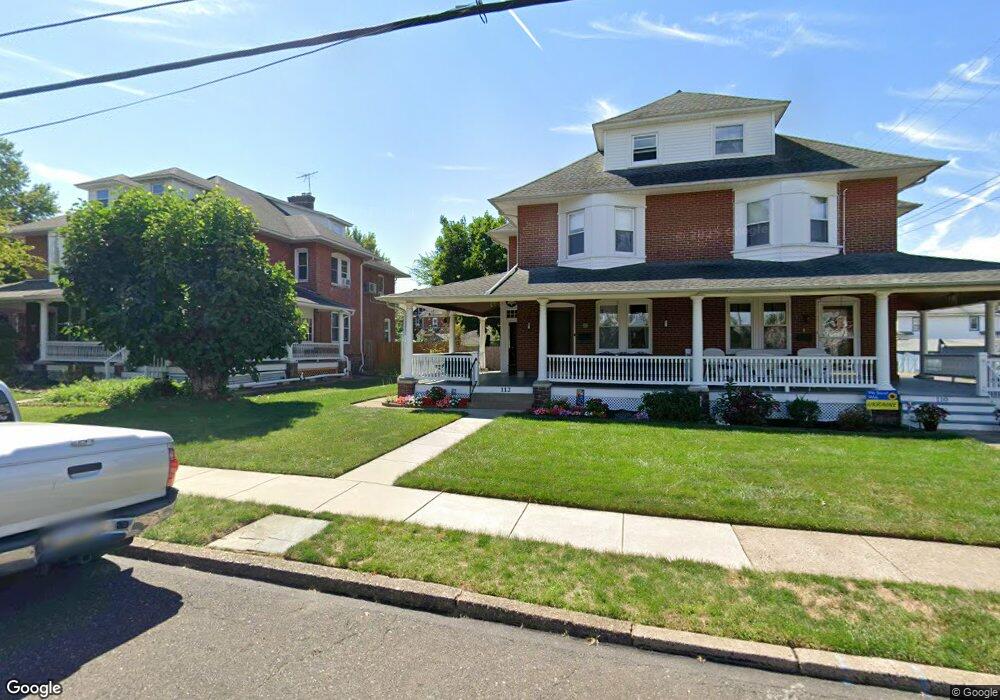
112 E 4th St Lansdale, PA 19446
Estimated Value: $339,000 - $421,000
3
Beds
1
Bath
2,298
Sq Ft
$166/Sq Ft
Est. Value
About This Home
This home is located at 112 E 4th St, Lansdale, PA 19446 and is currently estimated at $381,668, approximately $166 per square foot. 112 E 4th St is a home located in Montgomery County with nearby schools including Knapp Elementary School, Penndale Middle School, and North Penn Senior High School.
Ownership History
Date
Name
Owned For
Owner Type
Purchase Details
Closed on
Sep 25, 2003
Sold by
Moyer Roger C
Bought by
Szczepanski Keith W and Szczepanski Melinda S
Current Estimated Value
Home Financials for this Owner
Home Financials are based on the most recent Mortgage that was taken out on this home.
Original Mortgage
$135,900
Interest Rate
6.35%
Purchase Details
Closed on
Aug 22, 1995
Sold by
Moyer Ida E
Bought by
Moyer Ida E and Moyer Roger C
Create a Home Valuation Report for This Property
The Home Valuation Report is an in-depth analysis detailing your home's value as well as a comparison with similar homes in the area
Home Values in the Area
Average Home Value in this Area
Purchase History
| Date | Buyer | Sale Price | Title Company |
|---|---|---|---|
| Szczepanski Keith W | $169,900 | -- | |
| Moyer Ida E | -- | -- |
Source: Public Records
Mortgage History
| Date | Status | Borrower | Loan Amount |
|---|---|---|---|
| Previous Owner | Szczepanski Keith W | $135,900 |
Source: Public Records
Tax History
| Year | Tax Paid | Tax Assessment Tax Assessment Total Assessment is a certain percentage of the fair market value that is determined by local assessors to be the total taxable value of land and additions on the property. | Land | Improvement |
|---|---|---|---|---|
| 2025 | $4,940 | $117,440 | $42,330 | $75,110 |
| 2024 | $4,940 | $117,440 | $42,330 | $75,110 |
| 2023 | $4,622 | $117,440 | $42,330 | $75,110 |
| 2022 | $4,474 | $117,440 | $42,330 | $75,110 |
| 2021 | $4,292 | $117,440 | $42,330 | $75,110 |
| 2020 | $4,163 | $117,440 | $42,330 | $75,110 |
| 2019 | $4,094 | $117,440 | $42,330 | $75,110 |
Source: Public Records
Map
Nearby Homes
- 209 Ridge St
- 515 N Broad St
- 235 E 2nd St
- 174 E Main St
- 3 N Line St
- 30 W 6th St
- 135 Penn St
- 100 Penn St
- 737 Shaw Ave
- 102 Almond Dr
- 241 Susquehanna Ave
- 611 W Main St
- 816 Kenilworth Ave
- 380 E Hancock St Unit 100A
- 380 E Hancock St Unit 104A
- 380 E Hancock St Unit 103A
- 380 E Hancock St Unit 101A
- 380 E Hancock St Unit 103B
- 380 E Hancock St Unit 102B
- 380 E Hancock St Unit 101B
Your Personal Tour Guide
Ask me questions while you tour the home.